
USGS Real-time Groundwater-Level Data at Mashpee, Massachusetts (Site 413525070291904)

Detailed Description
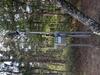
USGS monitors groundwater levels at sites around the Nation. The location and frequency of water-level measurements depends on the objectives of the project or program for which the data are being collected. This USGS well (Site 413525070291904) in Mashpee, Massachusetts, was updated in September 2022 with equipment to monitor the water level in the well in real time, and those data are publicly available online in near real time. This well is part of a groundwater network maintained by the USGS New England Water Science Center. Users can also view statistics on recent groundwater level conditions in the well relative to historical monthly conditions.
Sources/Usage
Public Domain.
Photographer: USGS/Sam Banas