
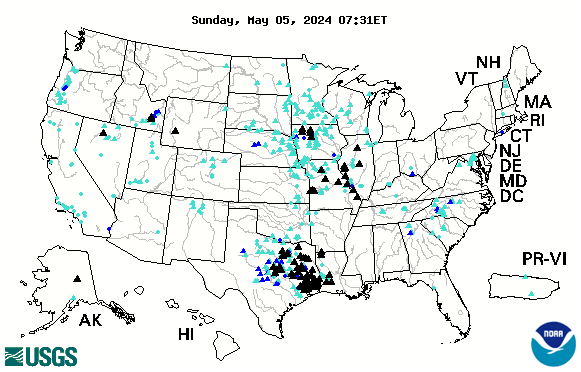
USGS streamgages currently experiencing flood and high-flow streamflow conditions
Detailed Description
Map of USGS streamgages currently experiencing flood and high-flow streamflow conditions. Image updated hourly by USGS WaterWatch.
WaterWatch will be decommissioned in Feb. 2026, and this image will break. We recommend using the National Water Dashboard and this static image as a replacement until a better option becomes available.
Sources/Usage
Public Domain.