
Variations of repeating earthquake activity through time
By Volcano Hazards Program
2013 (approx.)

Detailed Description
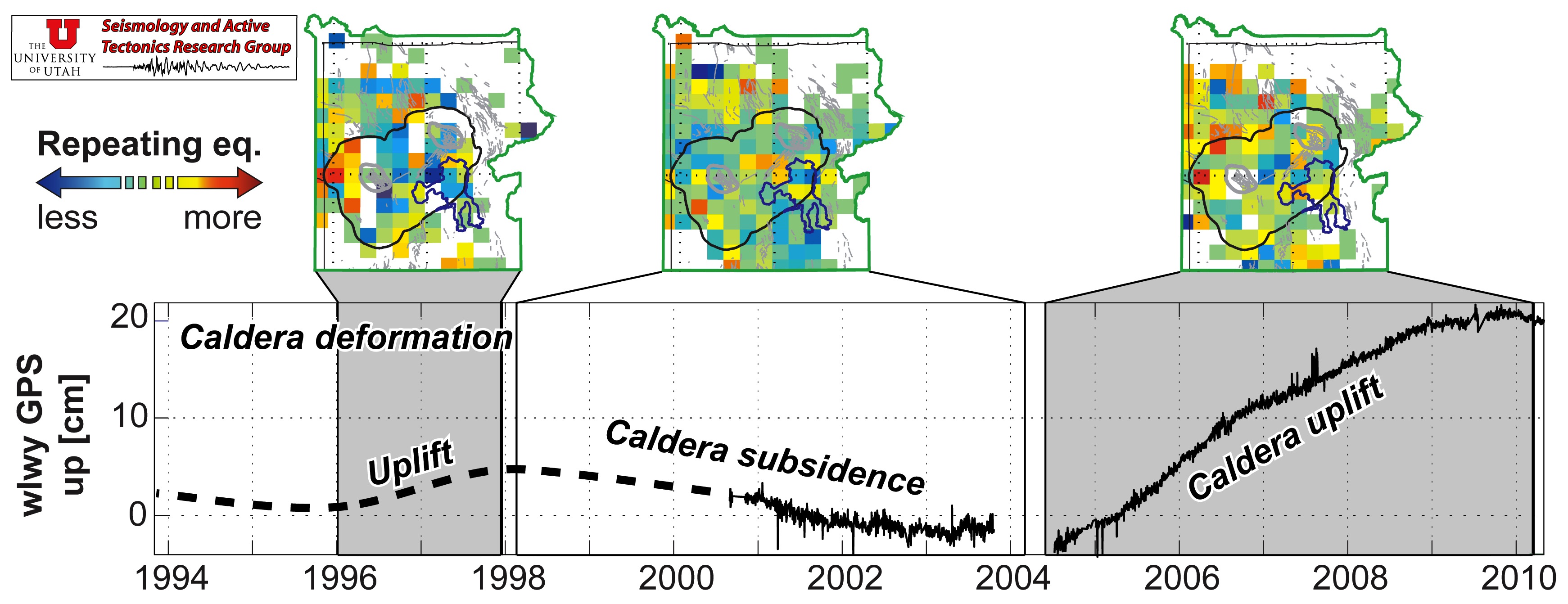
Top: Map of repeating earthquake areas corresponding to the deformation episodes, below. Bottom: Left 1996-1998 Yellowstone caldera uplift episode. Middle: 1998-2004 subsidence episode. Right: 2004-2010 uplift episode. Bottom: vertical ground deformation from GPS observations at station, WLWY, on the Sour Creek resurgent dome.
Sources/Usage
Public Domain.
Massin et al., 2013