
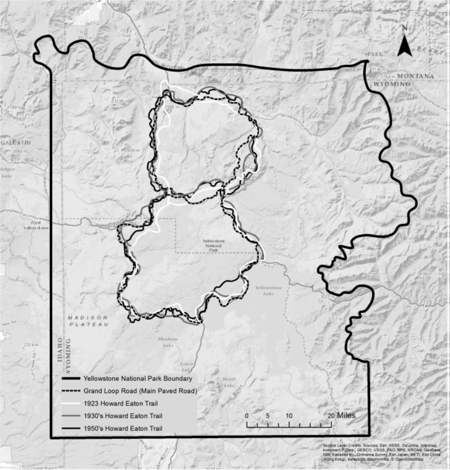
Various iterations of the Howard Eaton Trail, Yellowstone National Park
By Yellowstone Volcano Observatory
2017 (approx.)

Detailed Description
This map shows the Grand Loop Road along with different versions of the Howard Eaton Trail. Over the years, sections of the trail were rerouted to improve visitor safety, reduce maintenance costs, and protect sensitive natural areas. Using National Park Service and USGS sources from 1923, 1937, 1956, 1958, and 1959, students E. Alexander Beardall and Julia Kovacs from Missouri State University created this combined map. Source: Meyer, J. 2017. Yellowstone’s Howard Eaton Trail. Western Historical Quarterly 48 (2), https://www.jstor.org/stable/26782820.
Sources/Usage
Public Domain.