
Volcano monitoring map earthquake report
Detailed Description
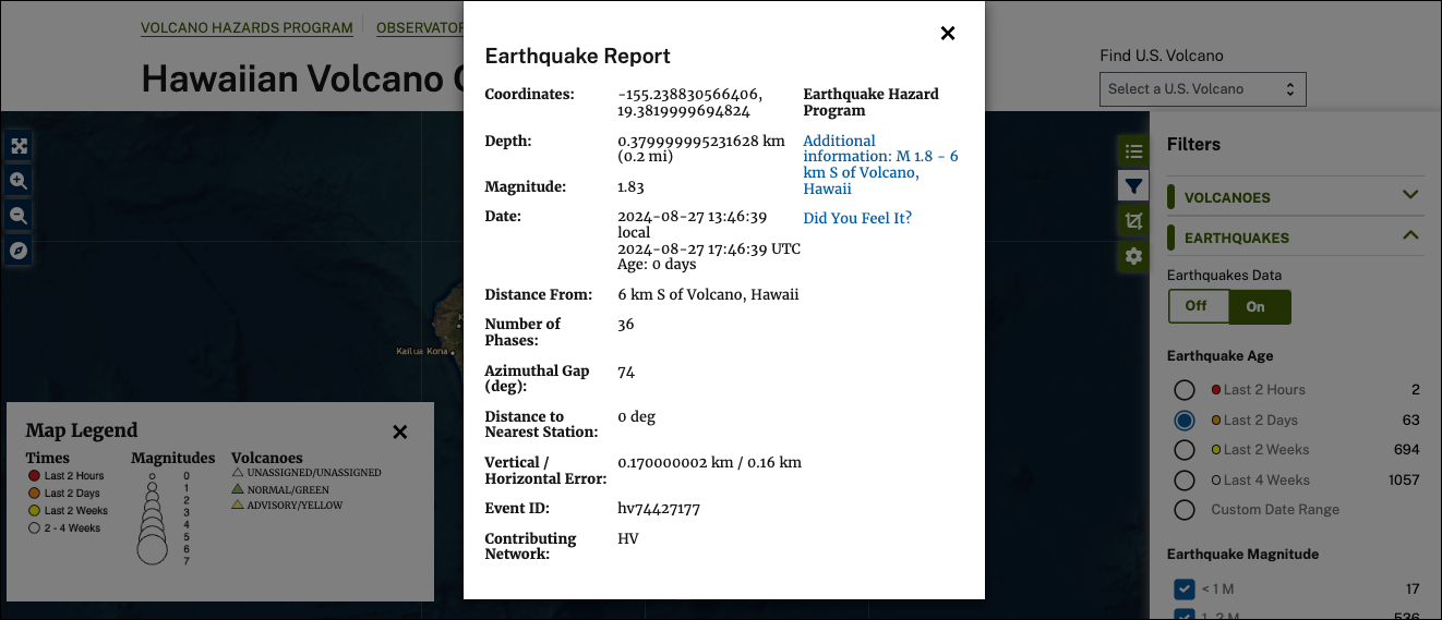
When you click on an earthquake icon on the volcano monitoring map, you can view the earthquake report. The report includes: earthquake location, depth, magnitude, date, number of phases, azimuthal gap, distance to nearest station, vertical/horizonal error, event ID, and contributing network.
Sources/Usage
Public Domain.