Adventure awaits: USGS releases detailed topographic maps designed for recreational use
New on-demand maps will enhance outdoor navigation for nature explorers
For outdoor enthusiasts, hikers, and adventurers, maps are more than just a tool – they are a gateway to exploration. The U.S. Geological Survey has released an innovative new series of topographic maps with a user-friendly design tailored specifically for recreational users, enhancing the outdoor experience.
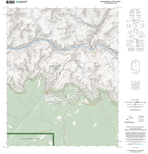
The maps are highly detailed, allowing users to see subtle changes in terrain and plan routes that match their skill level, time constraints and interests. They also have specialized symbols that denote key recreational features like trailheads, campsites, picnic areas, and other amenities, making it easier to locate resources for outdoor enthusiasts of all ages and abilities. Rivers, trails, forests, and structures are emphasized, providing a comprehensive view of the environment with a focus on recreational opportunities. The maps highlight protected areas, such as national parks, national forests and national wild and scenic rivers, encouraging responsible exploration.
“Whether you are a seasoned explorer or a casual hiker, the new USGS maps are a game-changer for recreational activities. If you’re looking for the shortest path to a summit or a leisurely trail along a river, these maps have you covered,” said Ariel Doumbouya, a USGS geographer and product lead.
These new maps are called 25K Recreational Topos because they have a 1:25,000 scale, which means one inch on the map represents 25,000 inches on the ground. This is about 2,083 feet or roughly 0.4 miles. This scale was used because it matches those used in Alaska, Canada, and by the U.S. Military, simplifying the user experience and aligning with scales used by national and international agencies and industries.
The level of detail these new maps bring to outdoor navigation make it easier to explore the natural wonders of the U.S. while supporting access to public lands for everyone. Designed with modern mapping technology, these maps offer precise coordinates and topographical details perfect for remote explorations.
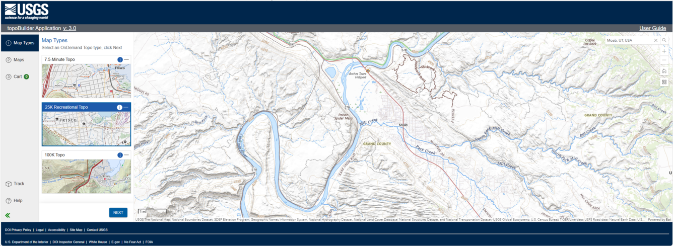
The new 25K Recreational Topo is available through the USGS topoBuilder application, where users can customize and download digital OnDemand Topo maps featuring the most up-to-date data from The National Map. These maps can be integrated with GPS devices or mobile apps, providing real-time navigation in the field. The maps are free for digital use, reinforcing the USGS commitment to making geographical data accessible to all, and enhancing public access to public lands for outdoor exploration.
“The 25K Recreational Topos mark a milestone in supporting recreation and reflect USGS’s commitment to innovative cartography that serves and supports the American public.” said Doumbouya. “They empower adventurers to explore the outdoors with greater confidence, insights, and awareness of their surroundings.”
Ready to hit the trails? Check out the new maps and start planning your next adventure. Let the 25K Recreational Topo guide you to places you’ve only dreamed of exploring!
Learn more about the variety of topographic maps from the U.S. Geological survey.