
New research shows prehistoric lake contributed to the birth of the Grand Canyon
Lake spillover events helped form today’s Colorado River system
RESTON, Va. — A new collaborative study led by the U.S. Geological Survey provides strong evidence that the Grand Canyon was carved out by spillover flooding from ancient Lake Bidahochi, a large lake fed by the ancestral Colorado River. The lake’s eventual spillover likely helped establish the course of the Colorado River.
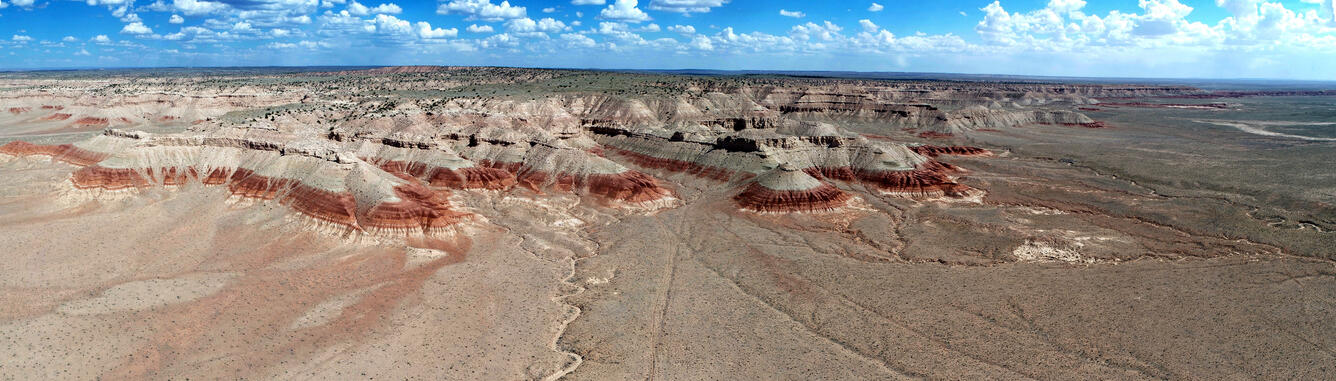
A team of scientists from the USGS, the Arizona Geological Survey, the University of California, Los Angeles, and the Paradise Valley Community College, Phoenix analyzed mineral grains preserved in ancient lake deposits east of the canyon to test a long-standing hypothesis: that a Colorado River–fed lake once existed in the region and played a direct role in shaping one of America’s most iconic landscapes. By comparing the ages of these grains to those in known early Colorado River sediments, researchers traced exactly when Colorado River material first reached the lake, which was in the present-day Bidahochi Basin east of Flagstaff, Arizona, primarily on Navajo land. The findings were published in Science.
“By tracing the mineral grains in these lake deposits, we can see exactly when the Colorado River reached this basin,” said Ryan Crow, USGS geologist and a lead author. “The evidence points clearly to a Colorado River–fed lake that could have spilled westward, establishing the river’s course through what is now the Grand Canyon. It’s a simple but powerful explanation for how the Colorado River system took shape.”
Scientific discussion about the formation of the Grand Canyon began in 1869, with the expedition led by John Wesley Powell, a pioneering geologist and future director of the U.S. Geological Survey. Powell navigated the Colorado River by boat, advanced early theories about the canyon’s origins and western drainage systems and demonstrated the national need for a dedicated science agency—work that ultimately contributed to the creation and mission of the USGS in 1879.
“On the eve of our nation’s 250th anniversary, we are proud to publish research that advances a geologic discussion begun by our second director, John Wesley Powell,” said Ned Mamula, USGS Director. “These findings about the Bidahochi Basin’s role in forming the Grand Canyon deepen our understanding of how the Colorado River system evolved and exemplify the geologic science Powell championed. Collaborating with our partners at the Arizona Geological Survey and at UCLA and Paradise Valley Community College produced these rich findings.”
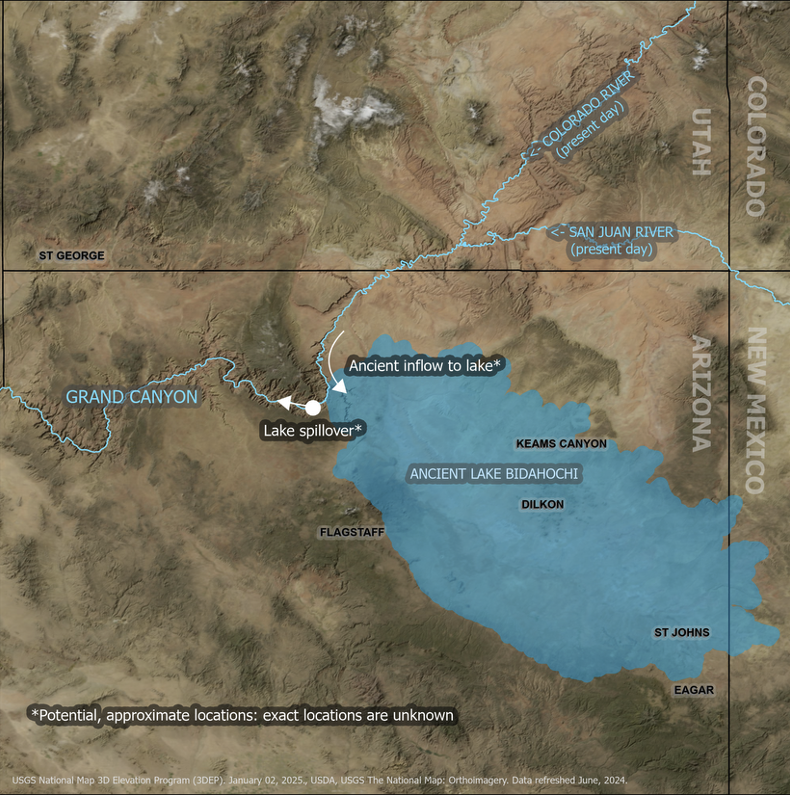
Beginning about 6.6 million years ago, the sand within these lake deposits shows a clear and distinct Colorado River signature. Two million or so years later, evidence indicates the river system had fully integrated, connecting headwaters in the Rockies all the way to the Pacific through the Gulf of California, thus carving what is now the Grand Canyon along the way.
The study also adds nuance to decades of scientific debate by showing that multiple natural processes—including lake spillover, river incision, and changes in regional topography—likely worked together to shape the Grand Canyon’s modern form.
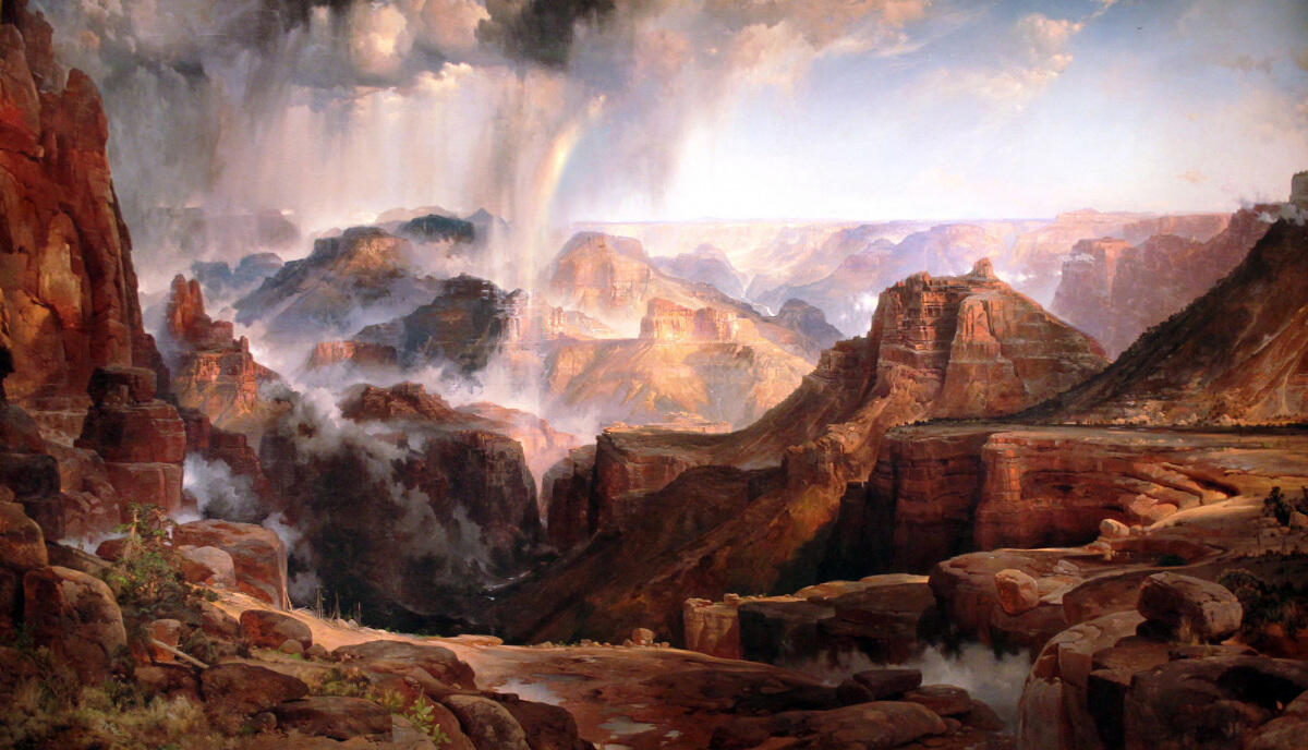
Painter Thomas Moran accompanied J.W. Powell on an 1873 expedition to the Grand Canyon. Courtesy of the U.S. Department of the Interior Museum, Washington, DC.