
USGS releases assessment of undiscovered oil and gas resources in Bossier Formation of Gulf Coast
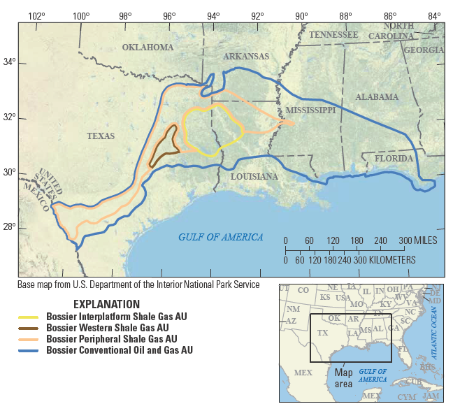
343.5 trillion cubic feet of gas estimated in Bossier, including high-pressure “Western Haynesville”
RESTON, Va. — The U.S. Geological Survey released its assessment of undiscovered gas and oil in the Bossier Formation along the Gulf Coast, assessing that there are technically recoverable resources of 343.5 trillion cubic feet of gas – enough to supply the United States for more than 10 years at the current rate of consumption -- as well as 3 million barrels of oil.
Since the last USGS assessment of undiscovered oil and gas resources in the Bossier Formation, exploration drilling by industry has revealed deep, highly overpressured shale formations, warranting a new assessment. Since production began, the Bossier Formation has produced 3.8 trillion cubic feet of gas, equal to nearly six weeks of U.S. consumption at the record-high 2025 level. The Gulf Coast has long been one of the most abundant sources of U.S. energy. The organic-rich shales of the Bossier Formation are produced from up to 18,000 feet below the surface, at greater depths than other resources in the Gulf Coast. New plays, such as the Bossier Western Shale Gas Assessment Unit, sometimes referred to by industry as “Western Haynesville”, or “Waynesville”, show that drilling into deeper, higher-pressured reservoirs can result in more resources than previously thought.
“The U.S. economy and our way of life depend on energy, and USGS oil and gas assessments point to resources that industry hasn’t discovered yet. In this case, we have assessed there are significant undiscovered resources in the Bossier Formation,” said USGS Director Ned Mamula.
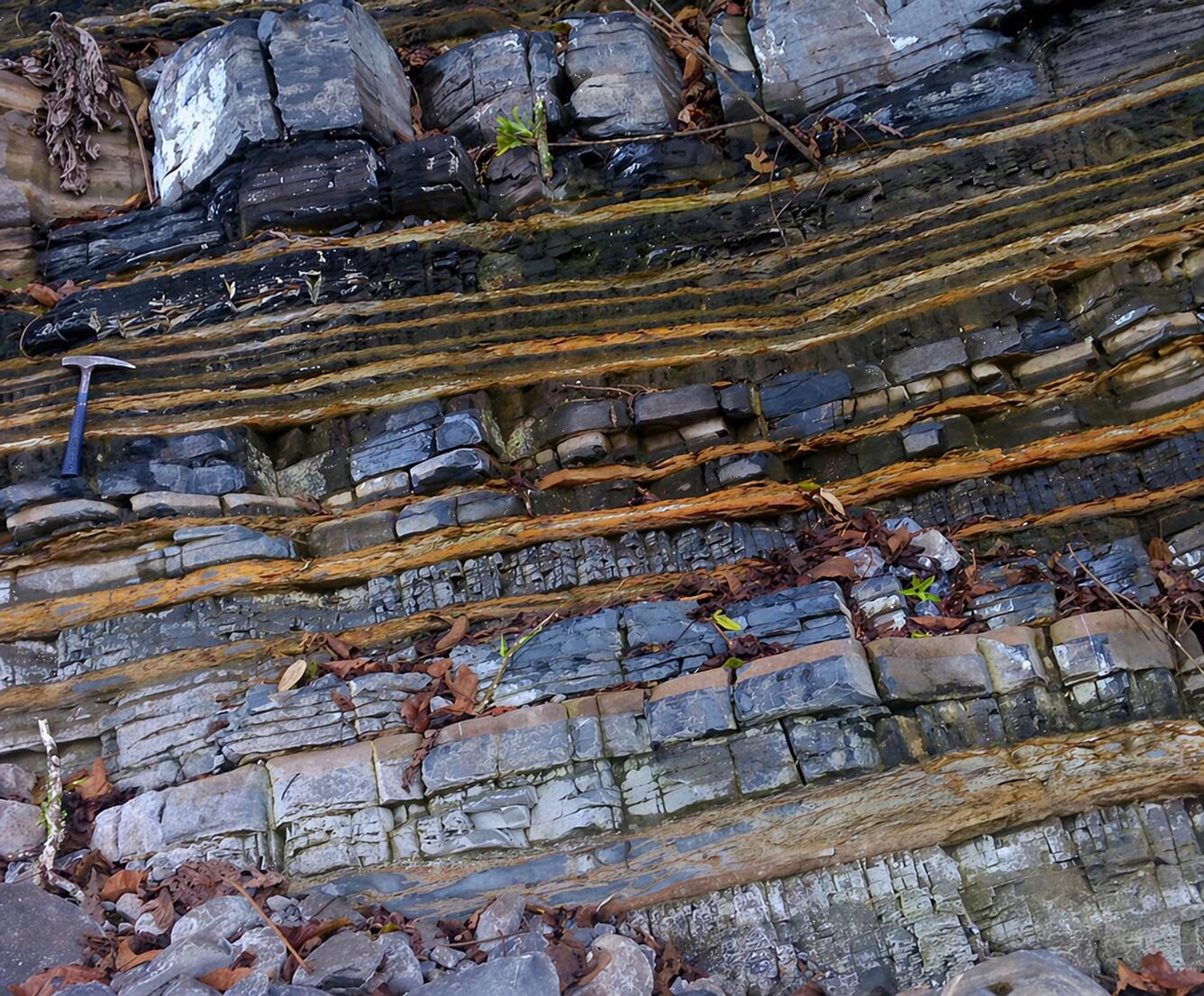
-- photo of a Bossier Formation outcrop by Mario Martínez-Yáñez.
USGS oil and gas assessments began 50 years ago following an oil embargo against the U.S. that signaled a need to understand the occurrence, distribution and potential volumes of undiscovered resources. The embargo led to a mandate for the USGS to use geologic science and data to assess undiscovered oil and gas resources to help meet the nation’s needs. The work continues today – identifying new resources for domestic production as well as international resources that affect market conditions -- an important part of the USGS mission to provide actionable insight to U.S. leaders, other Federal agencies, industry and the public.
USGS energy resource assessments provide information to policy makers on resource potential in areas of the United States and the world. For land-management agencies such as the Bureau of Land Management, the results of an energy resources assessment feed into land use and resource management plans. For the private sector, USGS assessments of undiscovered energy resources provide context for planning detailed exploration.
The range of assessments produced by the USGS has changed with the technology available to produce oil and gas. In 1995, the USGS began conducting assessments of unconventional, technically recoverable resources. “The shift to horizontal drilling with fracking has revolutionized energy production, and we’ve changed with it,” said Christopher Schenk, USGS geologist.
The USGS Energy Resources Program assesses the potential for undiscovered oil and gas resources in priority geologic provinces in the United States and around the world. Two methodologies are used by the USGS: one for assessing conventional oil and gas resources and one for assessing unconventional (continuous) oil and gas resources (such as shale gas and coalbed gas).