
NEW TNMCorps LIGHTNING Challenge for City / Town Halls in KS & OK!
Our last few city hall challenges have been rather large, so we thought we’d change things up with a Lightning Challenge for City / Town Halls in Kansas and Oklahoma!
What’s a Lightning Challenge?
A Lightning Challenge is similar our other challenges except the anticipated timeframe is a bit shorter. This is due to either fewer points needing review or the challenge covering a smaller geographic area.
In Kansas and Oklahoma, volunteers have already performed a significant amount of work on city/town halls, resulting in fewer points that need to be reviewed or collected. See our spatial overlay for tips on which communities still need a city hall point.
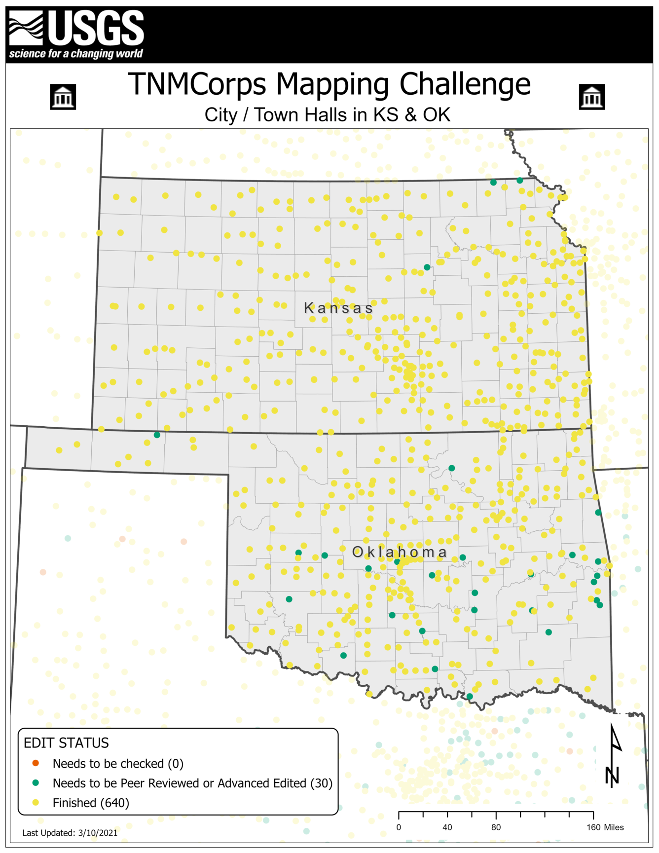
Not sure what each point color means?
These colors are part of our tiered editing process and signal to other editors that a point has passed through the upper tiers and does not need to be edited again.

Our November 2018 newsletter has an article titled Editor Roles and Point Colors that describes this process further.
Tips and tricks for this challenge:
Local Government: Incorporated vs. Unincorporated
- Municipalities in Oklahoma consist of cities and towns.
- The only municipalities in Kansas are cities.
- See the Cities vs. Towns vs. Villages article in our September 2019 newsletter for more information on the different types of governing bodies.
Possible Sources
- Remember to confirm each entry in a list with an authoritative source (e.g., the city or village’s website) before using it to update the map.
- See the How to Spot an Authoritative (Re)Source article in our November 2017 newsletter for why this is important.
- The United States Census Bureau maintains downloadable lists of all the incorporated places in each state by population
- The League of Kansas Municipalities also has a member directory that users can search and filter.
- Wikipedia maintains lists of cities for Kansas and Oklahoma.
- Smaller communities may also use Facebook or other social media platforms for their virtual communications. See the newsletter article titled Social Media as an Authoritative Source (July 2020) for tips on when it is acceptable to use social media to update points.
Proper Point Placement
Our November 2018 newsletter includes an article on aerial interpretation for city/town hall structures. This article walks you through how to identify which building to place a point on when examining aerial imagery.
Remaining Communities
Since so much work has already been done on these states, we went ahead and performed a spatial overlay between US Census's Incorporated Places dataset and all the city / town hall features collected to date. We then limited the results to communities with a population greater than 500 since larger communities are more likely to have their own designated city hall. The results reveal a few incorporated places that do not yet have a city/town hall point inside their boundaries but may be large enough to support such a structure; the map below highlights these communities.
NOTE that this does not mean every one of these communities is missing a point. It is possible that some of these communities do not have a building that fits our definition of a city / town hall while others may have already been collected but their city / town hall falls outside their corporate boundary.
Please help us research these communities and determine if a city / town hall exists!

Interested in collecting city/town halls elsewhere?
We’re collecting city/town halls nationally, so feel free to research these features throughout the U.S. Other states that still need to have city halls collected include: Indiana, Iowa, Kentucky, Minnesota, Tennessee, Texas, and Wisconsin. Note that only city/town halls in Kansas and Oklahoma will count towards this challenge.
If you have any questions during the mapping process, reach out to us at nationalmapcorps@usgs.gov and we’ll be happy to assist! Thank you for all that you do, and happy mapping!