New U.S. Geological Survey Report Assesses Risk of Once-Per-Century Geomagnetic Superstorm to the Northeastern United States
A new report and map published by the U.S. Geological Survey provides critical insight to electric power grid operators across the northeastern United States in the event of a once-per-century magnetic superstorm.
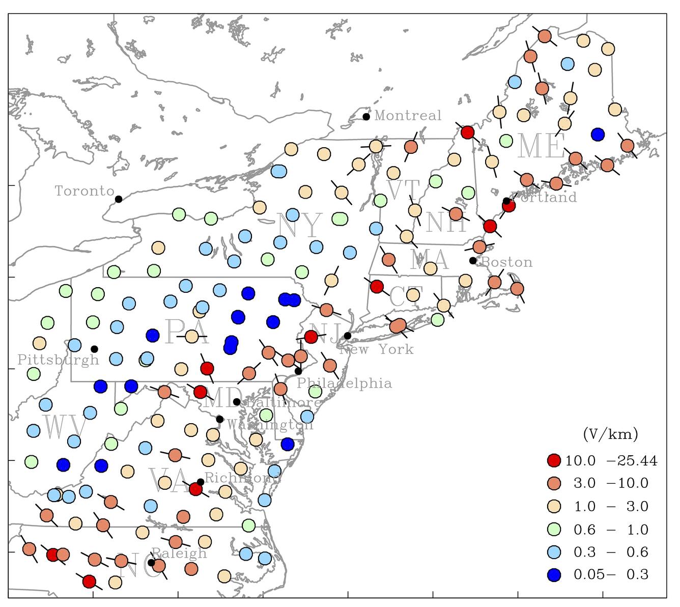
Major metropolitan areas along the I-95 corridor – including Boston, New York, Philadelphia, Baltimore, and Washington, DC – will benefit from the report’s geoelectrical hazard assessment, published in the journal Space Weather.
“These new maps will allow states and utilities to better anticipate the threat and response to future magnetic storms across the northeast,” said Jim Reilly, director of the USGS. “They will prove useful for planning for future power-grid installations and will help utility companies develop strategies to mitigate blackouts and power system damage.”
Geomagnetic storms occasionally occur in the space environment surrounding the Earth due to the dynamic influence of the sun and the solar wind on the Earth’s geomagnetic field. On the Earth’s surface, magnetic storms can produce blackouts – for example, a storm in March 1989 caused a blackout of Quebec, Canada, and the northeastern United States. Even more concerning are the rare magnetic superstorms comparable to the “Carrington” storm of 1859, which today could cause blackouts on a continental scale and damage infrastructure that would not only be costly and time consuming to repair, but could potentially pose a threat to human safety.
The new USGS research shows that geological structure impacts the strength and direction of storm-generated geoelectric fields. In particular, USGS models show high geoelectric risk potential across the igneous and metamorphic rock of the Appalachian Mountains. In contrast, the sedimentary rock of Appalachian Plateau and Mid-Atlantic Coastal Plain exhibits lower potential.
Next Steps
This work highlights the need for completing a national-scale magnetotelluric survey and for additional geomagnetic monitoring stations to complete and improve assessments of geoelectric hazards for the continental United States.
Watch our Video to Learn More
Watch a video with USGS scientists to learn more about solar storms and relevant research underway.