
EarthView–January Rain, Snow Refills California Reservoirs
USGS EarthView of the Week
See a decade of California drought ease in this EarthView from Landsat.
EarthViews is a continuing series in which we share a USGS Image of the Week featuring the USGS/NASA Landsat program. From the artistry of Earth imagery to natural and human-caused land change over time, check back every Friday to finish your week with a visual flourish!
The EarthView: January Rain, Snow Refills California Reservoirs
Description:
A decade of drought in California has eased after the first month of 2017 thanks to heavy rains and snow, a fact that Landsat images are helping to confirm.
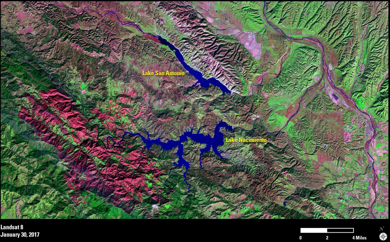
For the first time in three years, the U.S. Drought Monitor reported in late January 2017 that not a single area in California is considered in “exceptional drought,” the most severe category. A year ago, about 40 percent of the state was under the most severe designation. Landsat 8’s Operational Land Imager captures the dramatic reversal in these false-color views of Lake Nacimiento and Lake San Antonio along the coast in central California between Los Angeles and San Francisco.

Drought left Lake Nacimiento at only 22 percent full as of late 2016. Since 2014, Lake San Antonio had been emptied to critical levels to help recharge the groundwater in the Salinas Valley. At only 3 percent full, the lake was closed to public use on July 1, 2015. The red burn scar from the Chimney Fire in August 2016 is a vivid reminder of the drought’s impact on the area.
Today, however, the January 30, 2017, image shows how the recent precipitation has transformed the water levels in these two lakes. Lake Nacimiento is now at 81 percent full, while Lake San Antonio—virtually dry before—sits at 26 percent full.
All told, more than 48 percent of California was drought free as of February 1, 2017, compared to only 5 percent a year ago, according to the Drought Monitor.
Hungry for some science, but you don’t have time for a full-course research plate? Then check out USGS Science Snippets, our snack-sized science series that focuses on the fun, weird, and fascinating stories of USGS science.