
Low-level helicopter flights to image geology over Wyoming and Colorado
USGS surveys set to begin in February
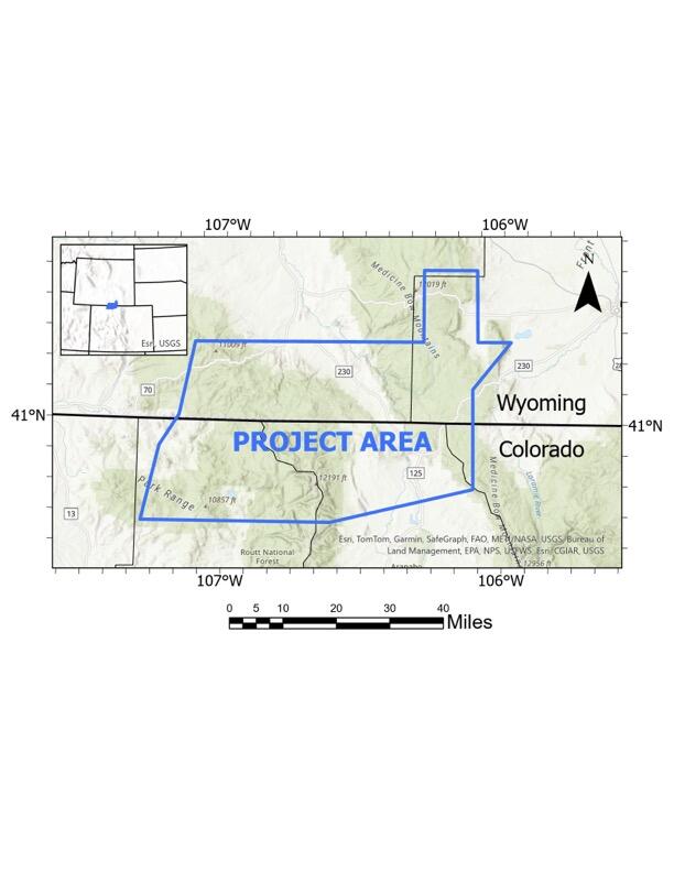
RESTON, Va. — Low-level helicopter flights are planned over areas of Wyoming and northern Colorado to image geology using airborne geophysical technology for up to one month.
The flights are a collaborative effort between the USGS Earth Mapping Resources Initiative and the geological surveys of Colorado and Wyoming, and are part of a national effort to map critical mineral resources and modernize mapping of the nation’s geology.
“Earth MRI is mapping the critical minerals needed to drive the U.S. economy and bolster national security. Partnering with the state geological surveys of Colorado and Wyoming helps with the work of the nation -- and adds to state knowledge crucial to the resource economy, as well as water resources, and natural hazards,” said Jamey Jones, science coordinator for the U.S. Geological Survey’s Earth MRI.
Flights will cover areas in Routt, Jackson and Larimer counties in Colorado, and Carbon and Albany counties, Wyoming.
The flights will be based out of various Wyoming airports. Flights and landing areas could shift with little to no warning to other parts of the survey area as necessary to minimize ferrying distances and avoid adverse flying conditions.
The purpose of the airborne electromagnetic survey is to provide images of the subsurface to expand the fundamental knowledge of geology underpinning an area from the Cheyenne Belt in Wyoming through to the Black Hills in South Dakota. These flights are a part of a two-year airborne data collection project, expected to finish in 2026.
The helicopter will fly along pre-planned flight paths relatively low to the ground at about 100 to 200 feet (30-60 meters) above the land surface. The ground clearance will be increased as needed and will comply with Federal Aviation Administration regulations. Flight lines will be flown along lines of variable orientation and spacing with a typical approximate spacing of 6,500 ft (2,000 m).
A sensor that resembles a large hula-hoop will be towed beneath the helicopter to measure small electromagnetic signals that can be used to map geologic features.
