FY19 U.S. Geological Survey Broad Agency Announcement for 3D Elevation Program Released
Partnership opportunities for the acquisition of lidar data issued.
On September 17, 2018, the USGS issued the FY18/FY19 Broad Agency Announcement (BAA) for 3D Elevation Program (3DEP). The BAA provides detailed information on how to partner with the USGS and other Federal agencies to acquire high-quality 3D Elevation data. Information and contacts are now available at Fed Biz Opps (Reference Number: 140G0118R0037) and Grants.gov (Funding Opportunity Number: G18AS00078).
Offerors may contribute funds toward a USGS lidar data acquisition activity via the Geospatial Products and Services Contracts or they may request 3DEP funds toward a lidar data acquisition activity where the requesting partner is the acquiring authority. Federal agencies, state and local governments, tribes, academic institutions and the private sector are eligible to submit proposals. Proposals are due by 5:00 PM ET, November 9, 2018.
A national public webinar designed to provide instructions on preparing BAA submissions was conducted on August 22, 2018. The webinar Presentation, a set of FAQs and other BAA Reference Materials are available for viewing and download. Questions on the BAA can be submitted to gs_baa@usgs.gov for resolution.
About the BAA and 3DEP
The BAA is a public process to develop partnerships for the collection of lidar and derived elevation data for 3DEP.
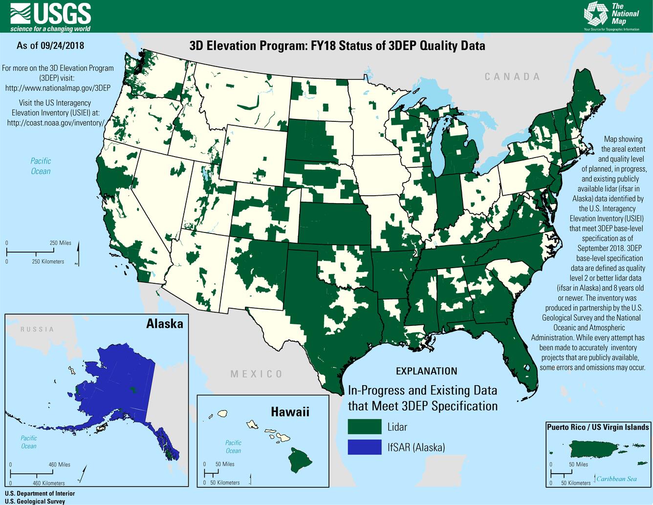
The primary goal of 3DEP is to systematically collect nationwide lidar coverage (ifsar in Alaska) over an 8-year period to provide more than \$690 million annually in new benefits to government entities, the private sector and citizens. 3DEP presents a unique opportunity for collaboration between all levels of government to leverage the services and expertise of private sector mapping firms that acquire the data, and to create jobs now and in the future.
USGS elevation data is available for download through The National Map. 3DEP represents the USGS’s latest iteration of national elevation coverage. Since 2015, over 200 federal, state, local and non-government partners have collaborated to support over 1.5 million square miles of 3DEP acquisition across the nation; 3DEP data is now available or in-work for nearly 50% of the nation. The 3DEP BAA provides an opportunity for continued collaboration across the nation so that all governments, the private sector and citizens may have access to and derive the benefits of 3D elevation data.