
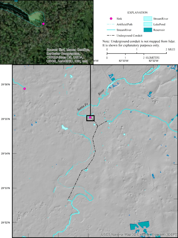
Elevation-Derived Hydrography READ Rules: Sink
The place at which a stream disappears into an underground conduit or an isolated depression where the network ends (Figure 66).
Delineation
The limit of Sink is the place at which a stream disappears underground.
Representation Rules
Delineate features as points, lines, or polygons based on their area or length along different axes (Table 31).
| Kind of feature object | Area | Shortest Axis | Longest Axis |
| 0-dimensional (point) | greater than 0 | -- | -- |
| 1-dimensional (line) | -- | -- | -- |
| 2-dimensional (polygon) | -- | -- | -- |
Special Conditions
None.
Data Extraction
Capture Conditions
If stream disappears,
then capture at the point of disappearance.
Attribute Information
FClass 1—Hydrography feature defined within the collection criteria of the elevation-derived hydrography specifications.
FCode 45000—Sink (the place at which a stream disappears into an under- ground conduit or reappears at the surface from an underground conduit, or an isolated depression where the network ends).
EClass 0— Not used to create elevation derivatives.
Source Interpretation Guidelines
A Sink feature shall be used at the lowest point of elevation in a Playa feature.