
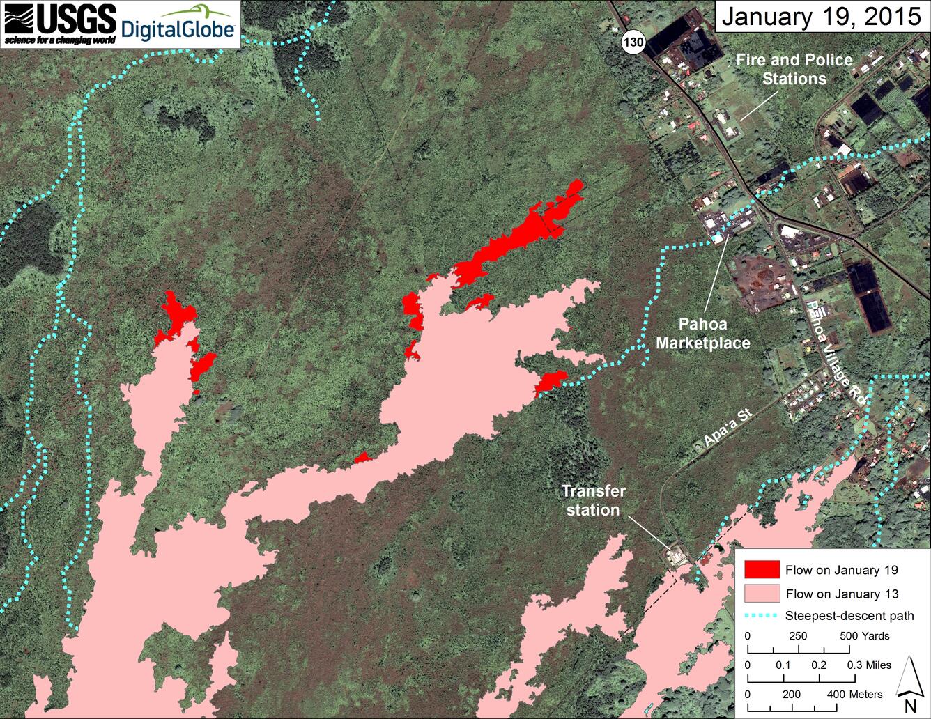
Map of area around front of Kīlauea’s East Rift Zone lava flow
January 19, 2015
Media
Sources/Usage: Public Domain. View Media Details