
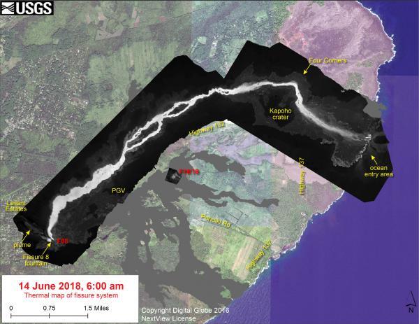
June 14—Thermal map of fissure system and lava flows
June 14, 2018
Media
Sources/Usage: Public Domain. View Media Details