
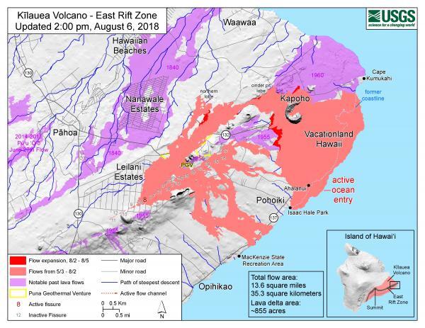
Kīlauea Lower East Rift Zone Fissures and Flows, August 6, 2018 2:00 p.m. HST
August 6, 2018
Media
Sources/Usage: Public Domain. View Media Details