
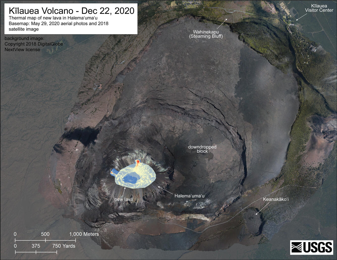
December 22, 2020—Kīlauea summit eruption thermal map
December 22, 2020
Media
Sources/Usage: Public Domain. View Media Details