
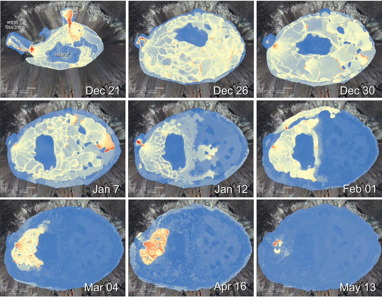
May 13, 2021—Kīlauea summit eruption thermal map compilation
May 14, 2021
Media
Sources/Usage: Public Domain. View Media Details