
By Hawaiian Volcano Observatory
April 9, 2026
Episode 44 of lava fountaining at the summit of Kīlauea took place on April 9, 2026. Southerly/southwesterly winds resulted in the plume being transported in the north/northeast direction, resulting in tephra falling in areas of Hawaiʻi Volcanoes National Park, on Highway 11 nearby, and on communities near the summit of Kīlauea.
Media
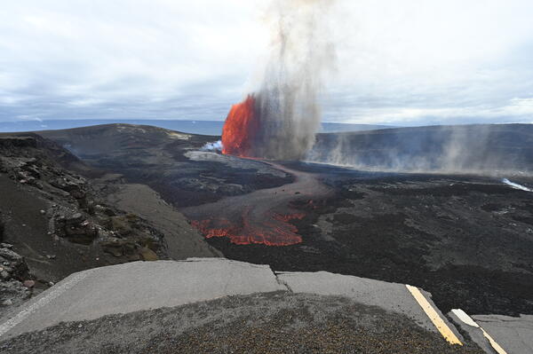
Episode 44 of lava fountaining in Halemaʻumaʻu began at the summit of Kīlauea began at 11:10 a.m. HST on April 9, 2026. Precursory lava flows began on April 3, primarily from the south vent, and continued intermittently until the episode began. The predominant lava fountain during episode 44, however, came from the north vent. This view, with a portion of Crater Rim Drive that was damaged during the 2018 collapse, was taken from the south rim of the crater. USGS photo by L. Gallant.
Sources/Usage: Public Domain. View Media Details
Media
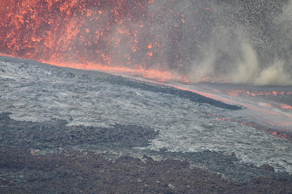
This telephoto view, taken from the south rim of Halemaʻumaʻu crater, shows the base of the north vent lava fountain, which feeds a lava flow on to the crater floor during episode 44 on April 9, 2026. USGS photo by L. Gallant
Sources/Usage: Public Domain. View Media Details
Media
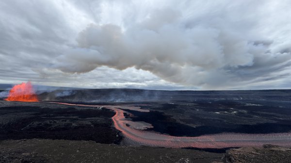
This photograph, taken from the north rim of Kaluapele (Kīlauea caldera) near Uēkahuna around 4 p.m. HST on April 9, 2026, shows the lava fountain from the north vent rising above the crater walls during episode 44. USGS photo by D. Downs.
Sources/Usage: Public Domain. View Media Details
Media
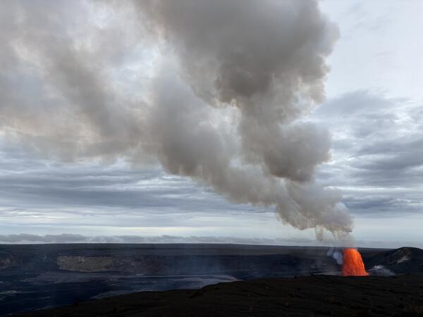
During episode 44, the north vent at the summit of Kīlauea erupted a lava fountain about 500 feet (150 meters) high at 4 p.m. HST, feeding a lava flow on the floor of Halemaʻumaʻu crater on April 9, 2026. This photograph shows the view from the south rim of the caldera. USGS photo by M. Patrick.
Sources/Usage: Public Domain. View Media Details
Media
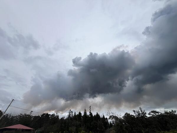
During episode 44 of lava fountaining at the summit of Kīlauea, the NOAA Washington Volcanic Ash Advisory Center reported the plume reached up to 16,000 feet (about 4,900 meters) above sea level. This photo shows the plume close the eruptive vents, and tephra is visibly falling through the air as the photo was taken. USGS photo by K. Mulliken.
Sources/Usage: Public Domain. View Media Details
Media
At the Kilauea Military Camp in Hawaiʻi Volcanoes National Park, tephra from episode 44 lava fountaining at the summit of Kīlauea on April 9, 2026, covers the ground surface as the eruptive plume traverses overhead. USGS photo by K. Mulliken.
Sources/Usage: Public Domain. View Media Details
Media
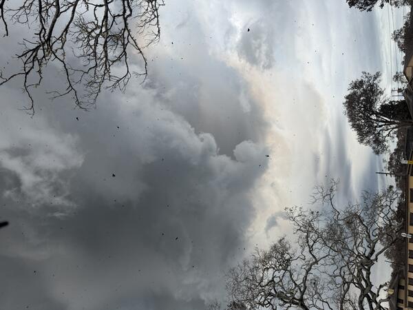
The eruptive plume associated with episode 44 of lava fountaining at the summit of Kīlauea was transported by wind in a northeast direction. This photo shows the plume from Volcano village, about 4 miles (6.5 km) northeast of the eruptive vents in Hawaiʻi Volcanoes National Park. USGS photo by P. Dotray.
Sources/Usage: Public Domain. View Media Details
Media
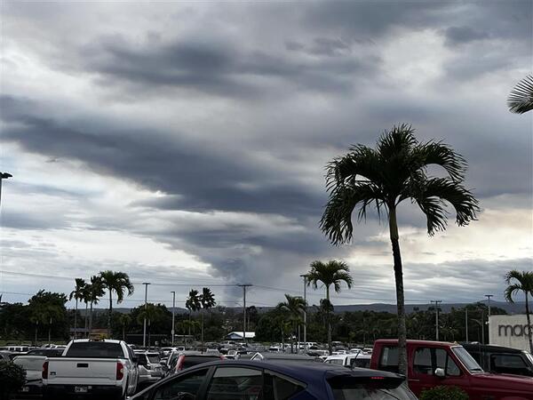
Episode 44 at the summit of Kīlauea generated a plume of ash and gas, which strong southerly winds transported in a narrow band to the north-northeast of Halemaʻumaʻu, where it widened over a large section of east Hawaiʻi. This photo shows the eruption plume from Hilo, about 25 miles (40 km) to the northeast of the eruptive vents. USGS photo by C. Gansecki.
Sources/Usage: Public Domain. View Media Details
Media
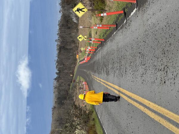
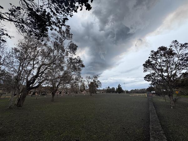
During lava fountaining episode 44 at the summit of Kīlauea, winds transported gas and tephra in a narrow band to the north-northeast of Halemaʻumaʻu. Tephra fallout was strongest in the direction of Kilauea Military Camp and the Volcano Golf Course subdivision, with pieces of lightweight reticulite up to 12 inches (30 centimeters) reported falling in these areas. Tephra fall was also reported as far east as Volcano House within Hawaiʻi Volcanoes National Park. This photo shows Crater Rim Drive near Steaming Bluff in Hawaiʻi Volcanoes National Park, with the increasing density of tephra on the road evident in the direction of the Kilauea Military Camp (not visible in the background of the photo). USGS photo by M. Patrick.
Sources/Usage: Public Domain. View Media Details
Media
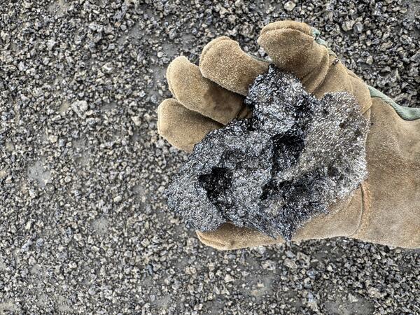
Tephra is anything erupted by a volcano that travels through the air before it is deposited on the ground. Lava fountaining episodes at the summit of Kīlauea since December 2024 have deposited glassy and lightweight tephra at various locations around Kīlauea summit and farther downwind, depending on the lava fountain heights and wind conditions. During episode 44, tephra landed to the north/northeast of the eruptive vents. This photo shows a fist-sized piece that landed near Kilauea Military Camp in Hawaiʻi Volcanoes National Park, where tephra fall was most dense and nearly continuously covered the ground surface. USGS photo by K. Mulliken.
Sources/Usage: Public Domain. View Media Details
Media
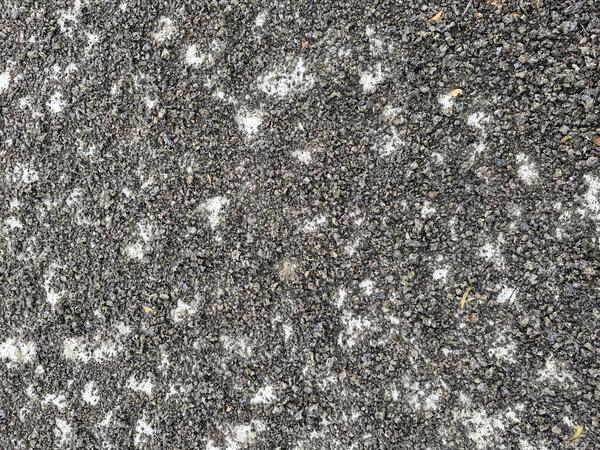
During episode 44 of lava fountaining at the summit of Kīlauea, tephra fallout was strongest in the direction of Kilauea Military Camp and the Volcano Golf Course subdivision, with pieces of lightweight reticulite up to 12 inches (30 centimeters) reported falling in these areas. This photo shows how a paved ground surface was nearly continuously covered with tephra ranging in size up to about a baseball. Other larger tephra fell in this area but often broke upon impact with the ground. USGS photo by K. Mulliken.
Sources/Usage: Public Domain. View Media Details
Media
Crater Rim Drive near Kilauea Military Camp in Hawaiʻi Volcanoes National Park was covered with tephra from episode 44 lava fountaining at the summit of Kīlauea on April 9, 2026. This photo shows recent tire tracks in the newly deposited tephra. USGS photo by K. Mulliken.
Sources/Usage: Public Domain. View Media Details