
Photo & Video Chronology — December 19, 2025 — New V3cam and overflight of Kīlauea summit
By Hawaiian Volcano Observatory
December 19, 2025
USGS scientists conducted a monitoring overflight of Halemaʻumaʻu crater, at the summit of Kīlauea volcano, on December 19, 2025, during which a new V3cam was deployed on the south rim of the crater.
Media
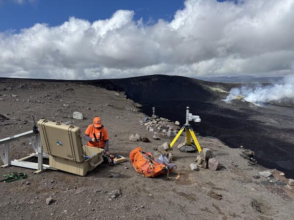
USGS staff deployed a new V3cam on the south rim of Halemaʻumaʻu crater at the summit of Kīlauea volcano, within Hawaiʻi Volcanoes National Park. The camera, a pan-tilt-zoom model, replaces the V3cam that was located to the west, which was destroyed during episode 38 lava fountaining on December 6, 2025. USGS photo by M. Patrick.
Sources/Usage: Public Domain. View Media Details
Media
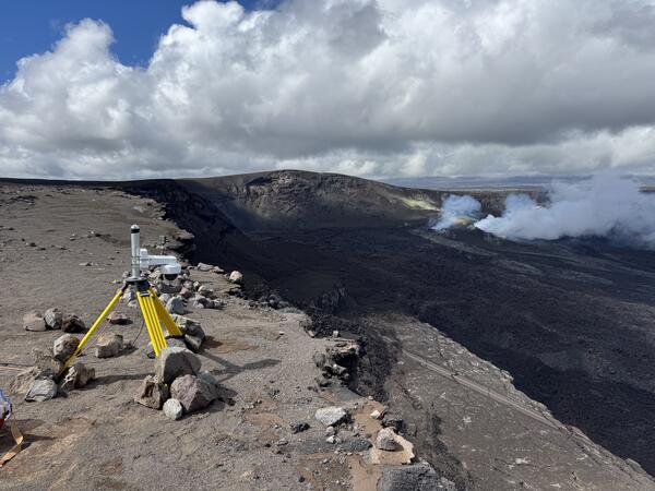
V3cam on the south rim of Halemaʻumaʻu crater, Kīlauea volcano. USGS Hawaiian Volcano Observatory staff deployed the new camera on December 19, 2025, with permission from Hawaiʻi Volcanoes National Park. USGS photo by M. Patrick.
Sources/Usage: Public Domain. View Media Details
Media

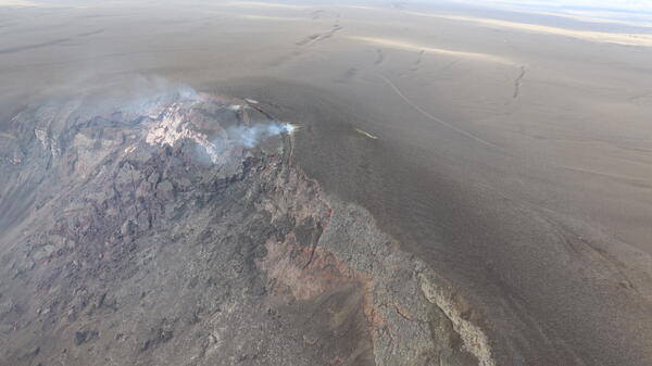
During a monitoring helicopter overflight on December 19, 2025, USGS geologists captured this southwest looking photo of the tephra hill that has grown over the past year of episodic lava fountaining at the summit of Kīlauea. In the foreground, the smaller tephra hill that formed during episode 38 on December 6 is visible; the V3 livestream camera is buried beneath this smaller hill. There is a sharp boundary visible in this photo, between the new tephra deposited during episode 38 (dark brown) and the older lava flows (light brown). USGS photo by D. Downs.
Sources/Usage: Public Domain. View Media Details
Media
Aerial photo showing the tephra hill on the western margin of Kaluapele (Kīlauea caldera), which has grown over the past year of 38 lava fountaining episodes within Halema‘uma‘u. The arcuate scarps are from landslides of tephra that have fallen back into the caldera near the north and south vents that have erupted all the material making up the tephra hill. This is another example of the many hazards that exist in the closed area of Hawaiʻi Volcanoes National Park. USGS photo by D. Downs.
Sources/Usage: Public Domain. View Media Details
Media
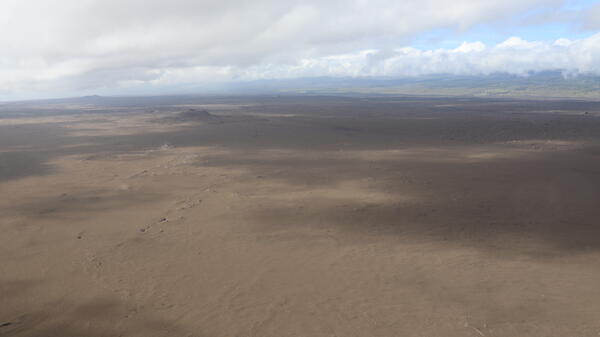
This aerial view, captured during a USGS Hawaiian Volcano Observatory monitoring overflight on December 19, 2025, shows the Southwest Rift Zone of Kīlauea between the summit caldera and the prominent scoria cones of Puʻukoaʻe. This region of the volcano is covered by a nearly continuous blanket of fresh tephra deposited since December 23, 2024, when the episodic lava fountaining began within Halema‘uma‘u crater. USGS photo by D. Downs.
Sources/Usage: Public Domain. View Media Details
Media
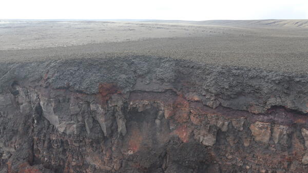
Aerial photograph looking at the southwestern rim of Kaluapele (Kīlauea caldera), where the original V3 livestream camera was located. This camera was buried under about 10 meters (32 feet) of molten spatter and tephra during inclined lava fountains of episode 38 on December 6, 2025. The upper third of the cliff face is this new spatter deposited during episode 38. USGS photo by D. Downs.
Sources/Usage: Public Domain. View Media Details