



Photo & Video Chronology — Episode 56 of lava fountaining at the summit of Kīlauea
By Hawaiian Volcano Observatory
November 5, 2026
On November 5, 2026, the summit of Kīlauea erupted lava fountains for six hours during the fifty-sixth episode of the eruption that began on December 23, 2024. A lava fountain from the north vent reached up to 660 feet (200 meters) above the ground.
Media
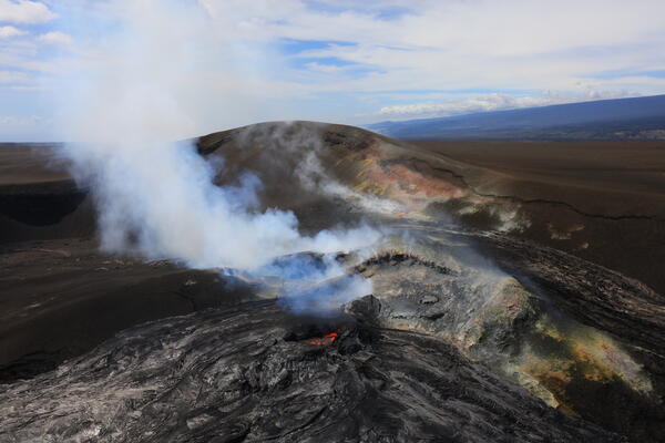
This overview photo of western Halema‘uma‘u crater at the summit of Kīlauea was captured during the USGS Hawaiian Volcano Observatory Overflight on November 4. The north vent lava pond is visible in the lower center of the frame, with the southwest vent sitting behind, somewhat obscured. The hill of tephra accumulated from past lava fountaining episodes—since early 2025—looms over both eruptive vents, perched on the former crater wall that is now almost completely buried. USGS photo by M. Zoeller.
Sources/Usage: Public Domain. View Media Details
Media
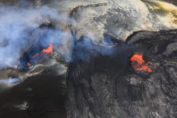
During a USGS Hawaiian Volcano Observatory overflight on November 4, geologists were fortunate to have near-perfect views of both the north and southwest vents in Halema‘uma‘u at the summit of Kīlauea. Here, the north vent is on the right, filled with a lava pond around 100 feet (30 meters) across. Though not overflowing, the pond was vigorously roiling at the time of the flight. The southwest vent on the left also hosted a roiling lava pond, but it was sitting around 20 meters down with a more elongate shape, about 130 feet (40 meters) long and 65 feet (20 meters) wide. USGS photo by M. Zoeller.
Sources/Usage: Public Domain. View Media Details
Media
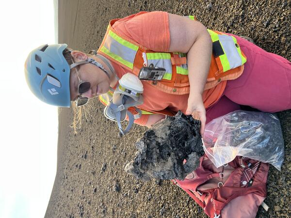
On November 5, 2026, tephra erupted during episode 56 of lava fountaining in the ongoing episodic eruption at the summit of Kīlauea was collected by USGS Hawaiian Volcano Observatory field crews for laboratory analysis. This frothy clast was more than 50 centimeters (about 20 inches) long. USGS photo by B. Wenzel.
Sources/Usage: Public Domain. View Media Details
Media
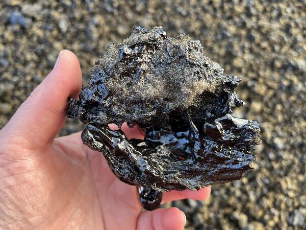
The tephra deposit from episode 56 of the ongoing episodic lava fountaining eruption in Halema‘uma‘u at the summit of Kīlauea appeared to have two distinct types of clasts: dense (bottom side) and frothy (top side). This clast had both types and was welded together, likely as the molten material was solidifying and flying through the air. USGS photo by K. Lynn.
Sources/Usage: Public Domain. View Media Details
Media
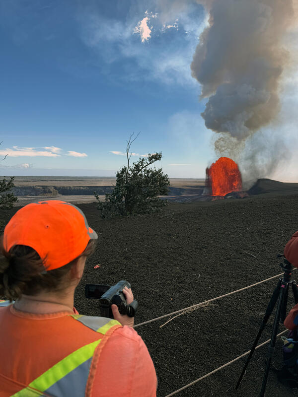
A USGS Hawaiian Volcano Observatory geologist collects high resolution video of the episode 56 lava fountaining from the ongoing eruption at Kīlauea summit that began in December 2024. Video and other data collection during these episodic fountaining events help scientists to analyze eruption dynamics. The north vent fountain from episode 56 reached a maximum height of approximately 660 ft (200 m) and produced tephra (volcanic rock fragments) which was deposited downwind primarily to the southwest in a closed area of Hawai‘i Volcanoes National Park (right side of fountain in this image). USGS photo taken by L. DeSmither on November 5, 2026, from Uēkahuna overlook in Hawai‘i Volcanoes National Park.
Sources/Usage: Public Domain. View Media Details
Media
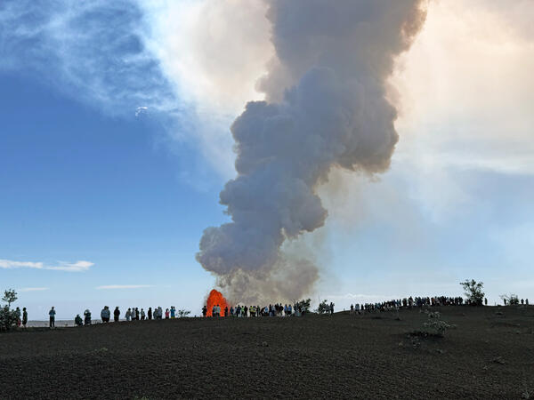
A crowd of people gathered at Uēkahuna overlook in Hawai‘i Volcanoes National Park on November 5, 2026, to watch the episode 56 lava fountains at Kīlauea's summit. The episode 56 eruption occurred between 12:10 p.m. and 6:01 p.m. HST with a lava fountain from the north vent. A large plume of volcanic gas rises above the fountain in this image. USGS photo taken by L. DeSmither.
Sources/Usage: Public Domain. View Media Details
Media
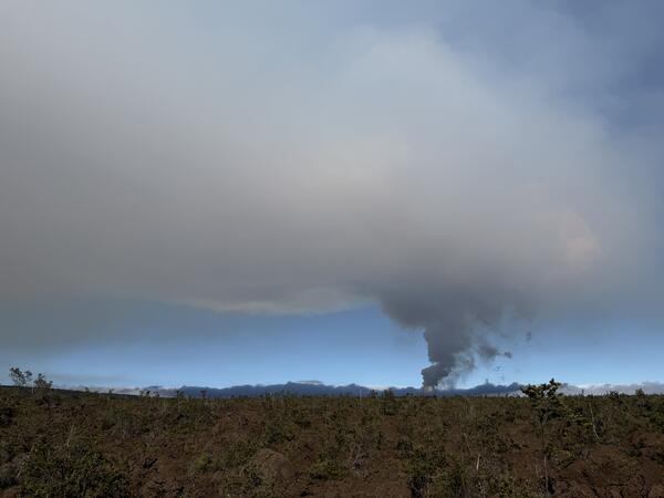
A view of the north vent lava fountain and eruption plume from episode 56 on the horizon, as seen from the Footprints Trailhead in Hawai‘i Volcanoes National Park, which is about 5.5 miles (9 kilometers) southwest of the eruptive vent. The eruption plume rose over Halema‘uma‘u crater and then headed northwest (left side of image) towards Mauna Loa. Fine ash and Pele’s hair, carried downwind by the plume, fell along a portion of Highway 11 located west of the summit. USGS photo taken by L. DeSmither on November 5, 2026.
Sources/Usage: Public Domain. View Media Details
Media
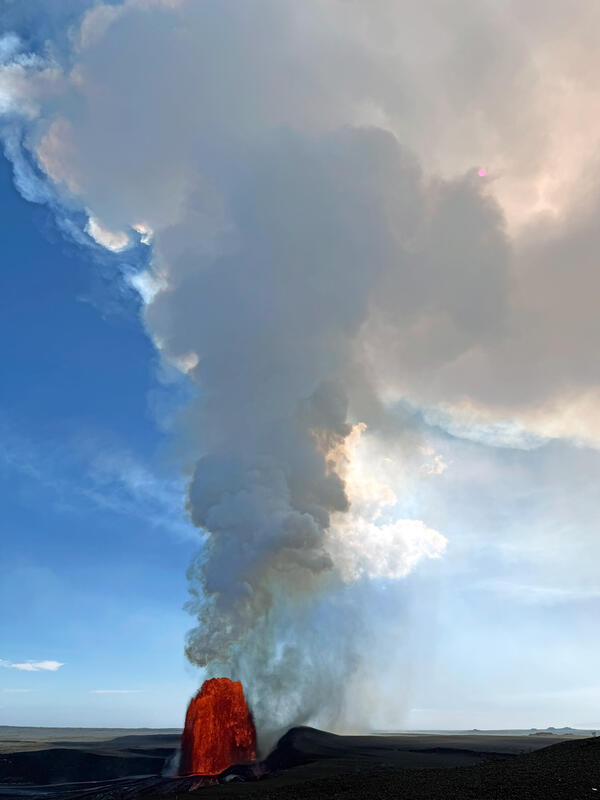
Episode 56 of the ongoing Kīlauea summit eruption produced an eruption plume of volcanic gases that reached 18,000 ft (5,500 m) above sea level. Upper-level winds from the east and southeast carried the higher-level plume northwest towards Mauna Loa summit. In this photo, the sun is mostly obscured by the plume in the upper right of the image and appears as a faint pink circle. USGS photo taken by L. DeSmither on November 5, 2026, from Uēkahuna overlook in Hawai‘i Volcanoes National Park.
Sources/Usage: Public Domain. View Media Details
Media
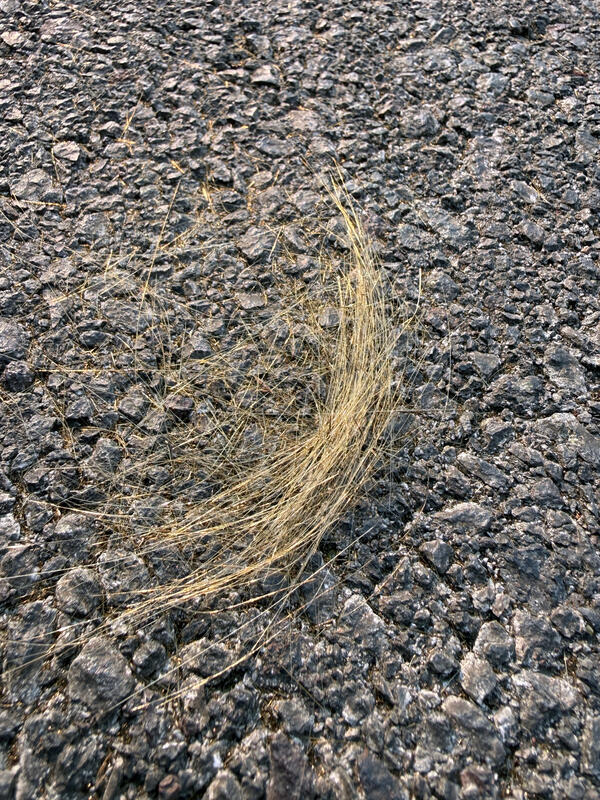
A small clump of fresh Pele’s hair, strands of volcanic glass, from episode 56 of the ongoing Kīlauea summit eruption was found along Highway 11 at the Footprints Trailhead in Hawai‘i Volcanoes National Park. Fine ash and Pele’s hair were carried downwind by the eruption plume and deposited west of the summit along a portion of Highway 11. USGS photo taken by L. DeSmither on November 5, 2026.
Sources/Usage: Public Domain. View Media Details