
Photo & Video Chronology — February 16, 2026 — Kīlauea episode 42 fountains and fallout
By Hawaiian Volcano Observatory
February 17, 2026
Episode 42 of lava fountaining in Halemaʻumaʻu at the summit of Kīlauea lasted for just under 10 hours on February 15, 2026. Both the north and south vents erupted, with peak lava fountain heights at the south vent reaching about 400 m (1300 ft). A volume of 15 million cubic yards (11.4 million m³) of lava erupted. Light tephra (fine ash & Pele’s hair) was reported in the communities downwind.
Media

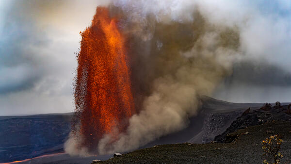
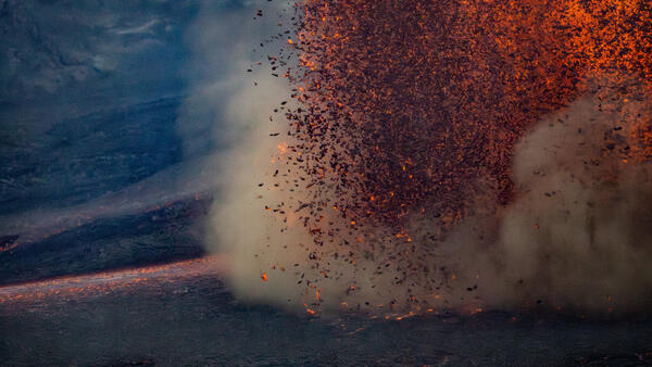
Late in the afternoon on Sunday, February 15, USGS Hawaiian Volcano Observatory scientists monitoring Kīlauea summit eruption episode 42 hiked west of Halema‘uma‘u crater for an angle of both the north and south vent lava fountains side by side. During most of episode, the south vent lava fountain (right) was slightly taller than the north vent's (left). Substantial tephra fall from the fountains was further building the cone that stands on the western rim of Halema‘uma‘u crater, with some falling lava fragments impacting the surface semi-molten and shattering to create an incandescent "sparking" effect. USGS photo by C. Cauley.
Sources/Usage: Public Domain. View Media Details
Media
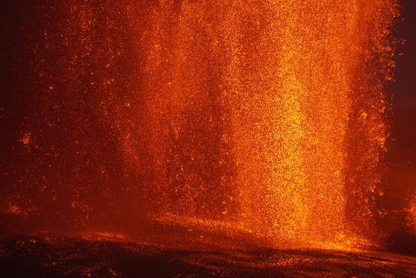
This photo north vent lava fountain during Kīlauea summit eruption episode 42 was captured from the northwest rim of Halema‘uma‘u crater on February 15, 2026. Rainy conditions prevented accurate laser rangefinder measurements of the lava fountains during this episode, but USGS Hawaiian Volcano Observatory scientists estimated that the north vent fountain reached about 300 meters (about 1,000 feet) in height at the time. Also visible here is substantial secondary tephra fragmentation (brown cloud) around the cone on the western rim of Halema‘uma‘u crater, along with more distal fallout downwind to the southwest (far right, black cloud). USGS photo by C. Cauley.
Sources/Usage: Public Domain. View Media Details
Media
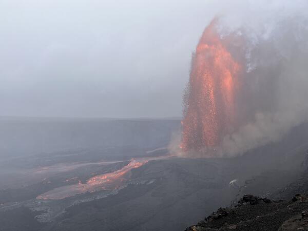
On Sunday, February 15, USGS Hawaiian Volcano Observatory scientists monitored episode 42 of the Kīlauea summit eruption from the northwest rim of Halema‘uma‘u crater. Despite driving rains, this location provided good views of the north vent's lava fountains and flows on the crater floor. Around 4:20 p.m. HST in the afternoon, scientists witnessed a dramatic redirection of the vent's main lava channel; earlier, most lava was flowing toward the center of the crater floor, but over the course of a few minutes it shifted into the northwestern section. In this photo captured almost immediately after the redirection began, the new channel alignment is in the early stages of formation, with fast-moving lava flows advancing down the slope from the vent. Subsequent analysis of time-lapse webcam imagery indicated that the shift was caused by slow slumping of the entire flank of the vent complex, resulting in a failure of the original channel levee on the north side. USGS photo by M. Zoeller.
Sources/Usage: Public Domain. View Media Details
Media
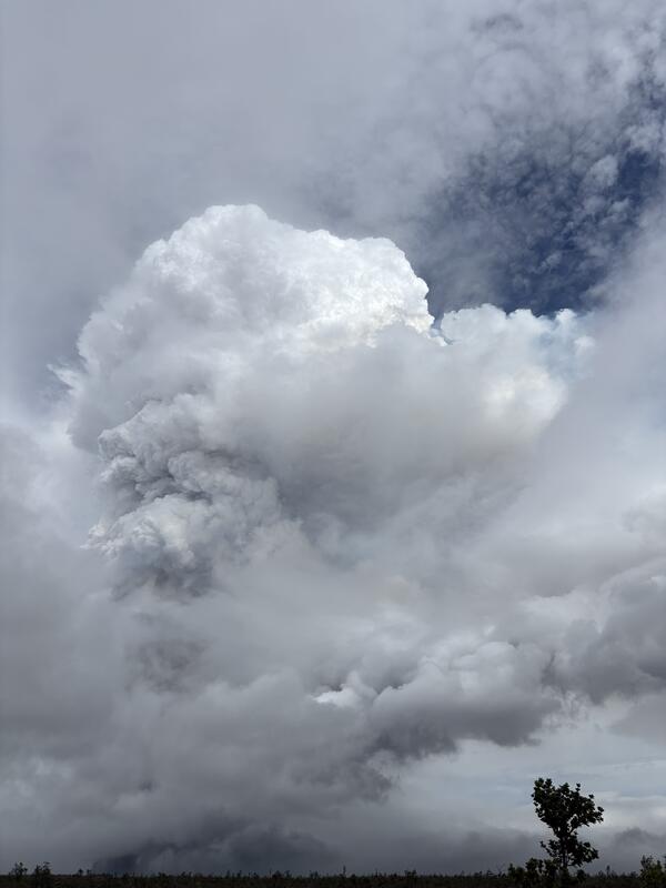
Gas and tephra plume from Kīlauea summit episode 42 as observed from the Footprints Trail in Hawai‘i Volcanoes National Park at about an hour and a half after this episode started. The plume at this time had risen to over 20,000 ft (over 6,000 m). Trade winds were blowing and deposited tephra to the southwest of the north and south vents. USGS photo by D. Downs.
Sources/Usage: Public Domain. View Media Details
Media
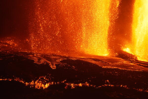
Photograph of the north vent fountain during episode 42, taken from the northwest rim of Halema‘uma‘u crater on February 15, 2026. Semi-molten clasts feed a small ‘a‘ā lava flow carrying lava north from the base of the north vent lava fountain within the caldera. Material feeding the ‘a‘ā lava flow was soon cut off as the falling clasts material was captured by the main pāhoehoe lava flow to the north-northeast. USGS photo by C. Cauley.
Sources/Usage: Public Domain. View Media Details
Media
A telephoto view of the south vent fountain, taken from the south rim of Halema‘uma‘u crater at night on February 15, 2026. Molten clasts falling near the base of the fountain were feeding a channelized flow that carried lava into the eastern portion of the crater. Those clasts falling slightly to the south (left side in this photos) were accumulating and feeding a slowly moving spatter-fed ‘a‘ā flow along the south rim of the crater floor. USGS photo by M. Patrick.
Sources/Usage: Public Domain. View Media Details
Media
This telephoto view of the base of the Kīlauea summit episode 42 lava fountains shows the advancing spatter-fed ‘a‘ā flow, taken from the south rim of Halema‘uma‘u crater. In the left side of the photo, molten clasts falling from the south fountain accumulate and feed the source of the spatter-fed flow. USGS photo by M. Patrick.
Sources/Usage: Public Domain. View Media Details
Media
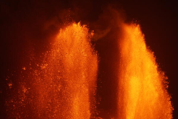
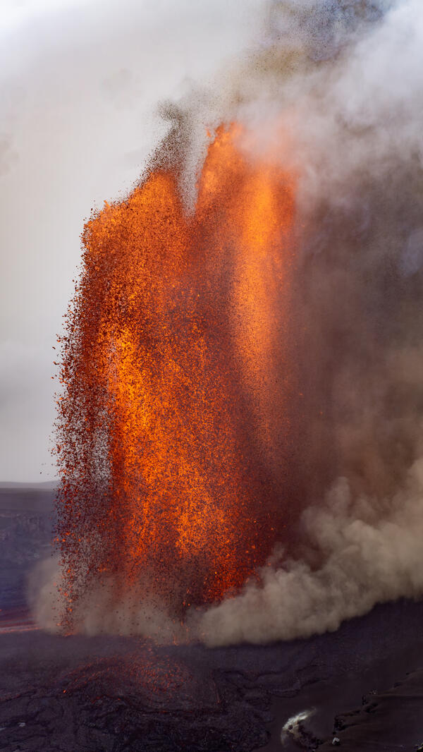
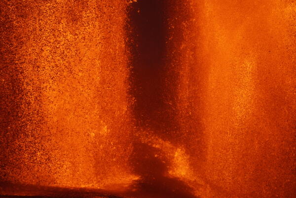
At brief moments during episode 42 Kīlauea summit lava fountaining on February 15, 2026, the south (left) and north (right) fountains were similar in height, and wispy fingers of gas and small particles from the two fountains mingled in the gap between them. USGS photo by M. Patrick.
Sources/Usage: Public Domain. View Media Details
Media
A telephoto view of the base of the two lava fountains, and the narrow gap that was present between them, during episode 42 of the Kīlauea summit eruption on February 15, 2026. On the south side of the north fountain (right), a very small third fountain was active, with frequent bubble bursting. USGS photo by M. Patrick.
Sources/Usage: Public Domain. View Media Details
Media

Sources/Usage: Public Domain. View Media Details
Media
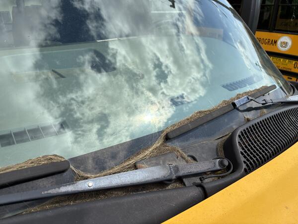
Tephra accumulated in the community of Pāhala, about 18.5 miles (30 km) to the southwest of north and south vents in Halema‘uma‘u crater at the summit of Kīlauea. A few hours after episode 42 started on February 15, 2026, fine ash of less than 0.03 inch (1 mm) diameter began to accumulate on surfaces. This photo was taken near the Pāhala High School the day after episode 42 ended, showing how much tephra fell throughout the lava fountaining. USGS photo by D. Downs.
Sources/Usage: Public Domain. View Media Details
Media
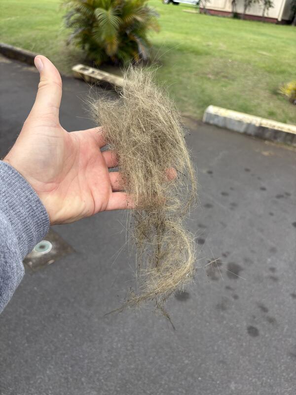
Long strands of Pele's hair, which is made of volcanic glass, drifted on the wind to the southwest during episode 42 of Kīlauea summit lava fountaining on February 15, 2026. This photo shows a bundle of these long strands of Pele's hair after they had blown around in the wind in the community of Pāhala and became tangled up. USGS photo by D. Downs.
Sources/Usage: Public Domain. View Media Details