U.S. flag

An official website of the United States government

January 21, 2026

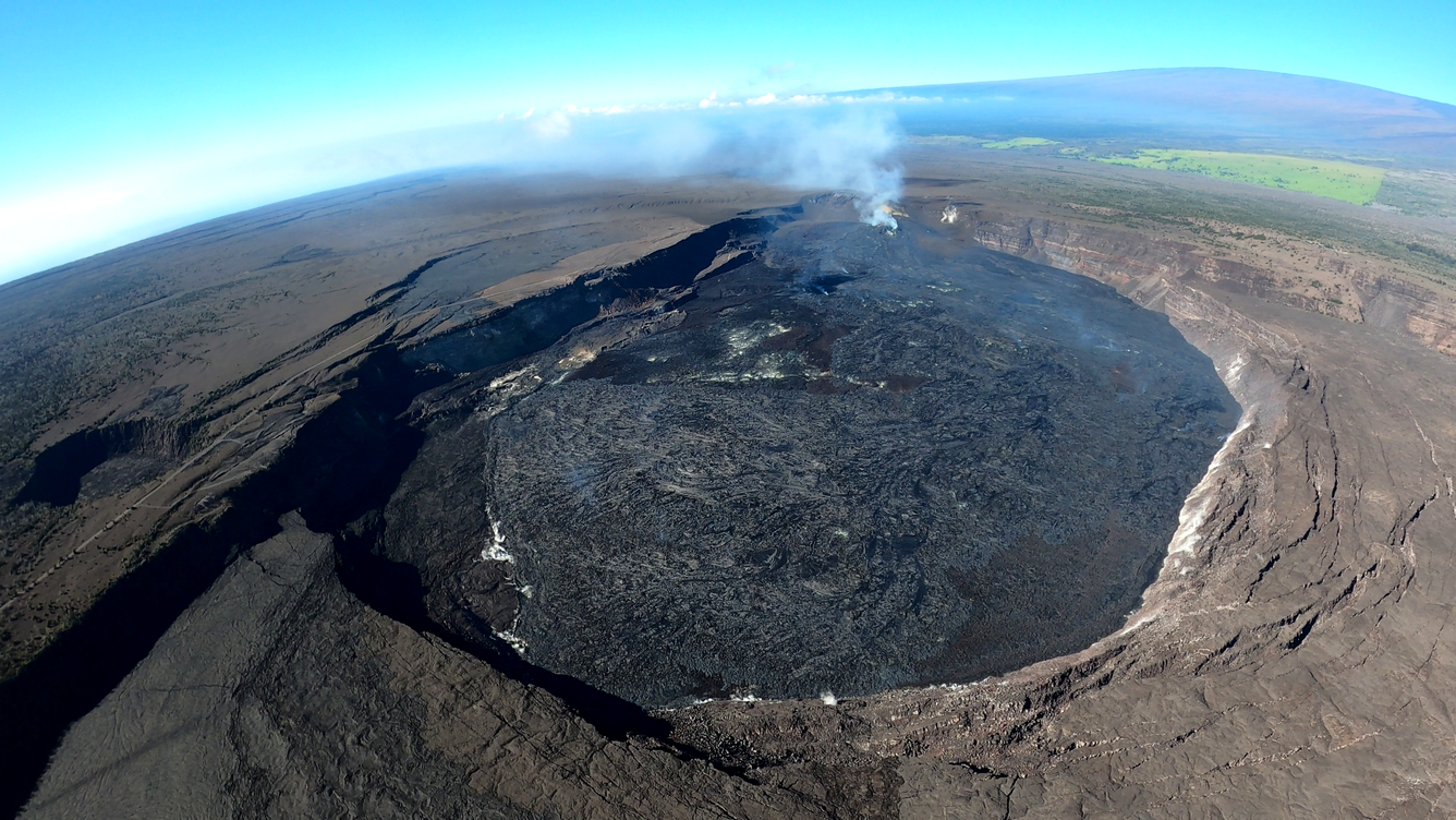
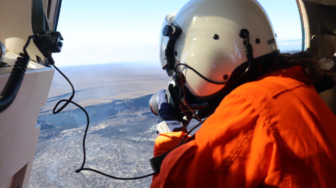
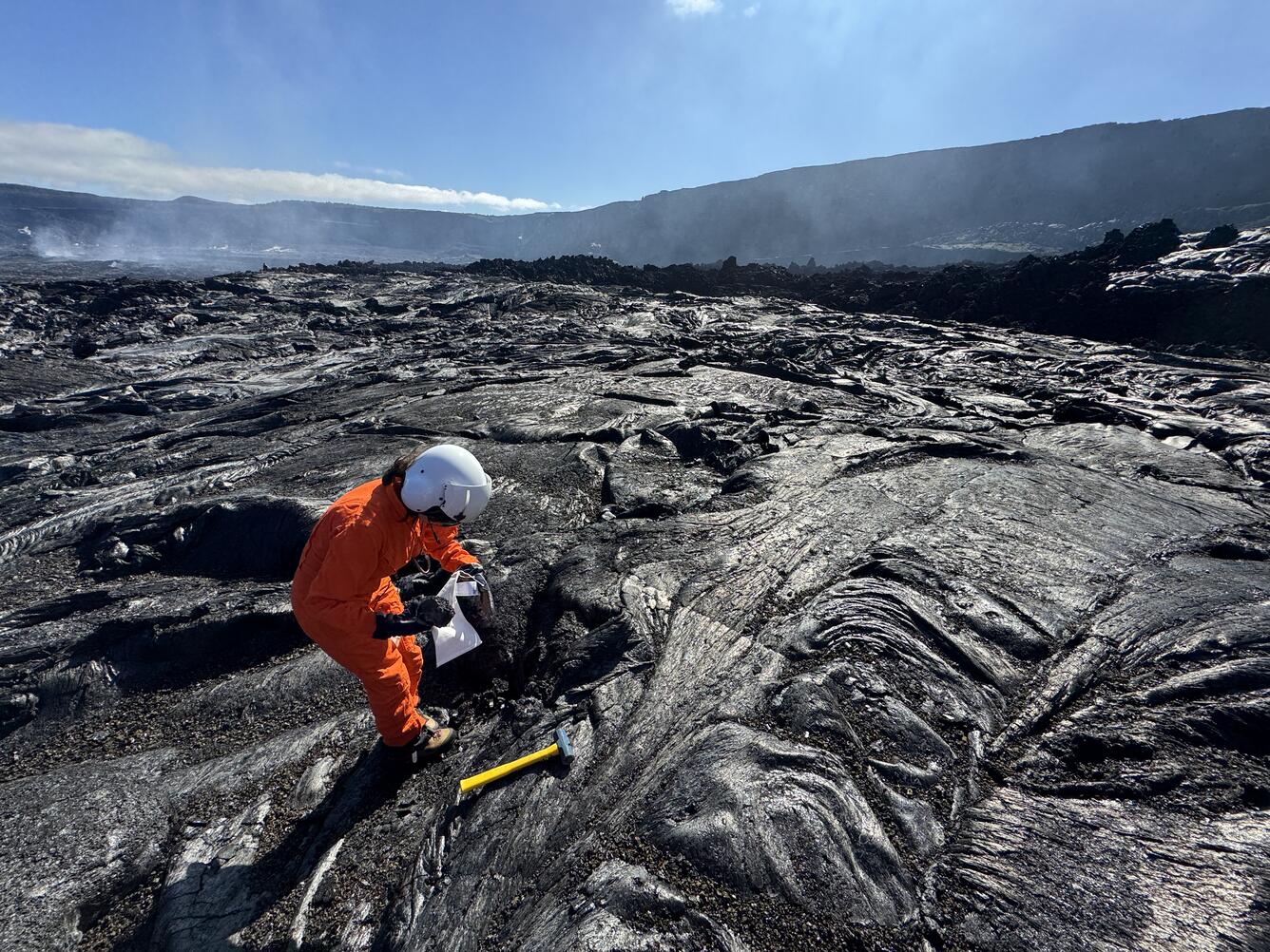
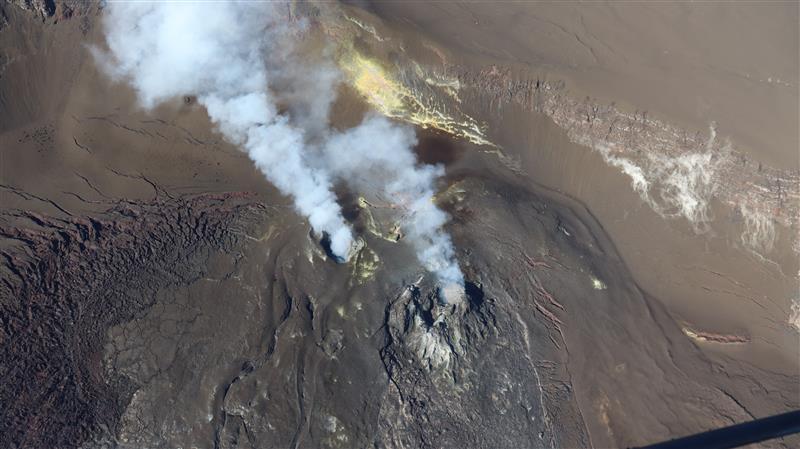
USGS Hawaiian Volcano Observatory scientists conducted a monitoring overflight of Kīlauea summit on January 16, following the eruption of episode 40 in Halemaʻumaʻu on January 12, 2026. 


Media
Color photograph of crater
On Friday, January 16, USGS Hawaiian Volcano Observatory geologists conducted an overflight of Kīlauea summit to map the effects of episode 40 and collect samples of the lava. This wide-angle photo shows the episode 40 flows reaching the crater wall in the foreground, with the vents in the distance. A passive outgassing plume originates from the vents and is carried southwest in the tradewinds. Mauna Loa is visible in the upper right portion of the photo. USGS photo by M. Patrick.
Media
Color photograph of scientist in helicopter photo-documenting volcanic eruption
A USGS Hawaiian Volcano Observatory geologist collects images for photogrammetric processing at the summit of Kīlauea following episode 40 lava fountaining. These surveys help determine the volume of lava erupted during each episode, and the crater infilling rates. USGS photo by T. Orr.
Media
Color photograph of scientist collecting sample of cooled and solidified lava from a recent eruption
A USGS Hawaiian Volcano Observatory geologist collects a sample of the short lava flows that were erupted from the south vent just before episode 40 lava fountaining began on January 12, 2026. All sampling in Halema‘uma‘u crater is done with permission from Hawai‘i Volcanoes National Park. The chemistry of these lava flows is studied to better understand the magma plumbing system and assess volcanic hazards during the ongoing eruption. USGS photo by M. Patrick.
Media
Color photograph of volcanic vents degassing
This photograph shows the current vent area at the summit of Kīlauea, with passive outgassing plumes originating from the south (left) and north (right) vents. The plumes are carried to the southwest by the tradewinds. On the left side of the photo, the cracked area shows a region of the crater floor where thick deposits of spatter from an earlier lava fountaining episode began to flow downhill, forming a spatter-fed lava flow. USGS photo by T. Orr.
Was this page helpful?