
Photo & Video Chronology — July 17, 2025 — UAS mission at Kīlauea summit
By Hawaiian Volcano Observatory
July 17, 2025
On July 17, USGS Hawaiian Volcano Observatory staff conducted a UAS (uncrewed aircraft systems) flight of the recent eurption site at Kīlauea summit.
Media
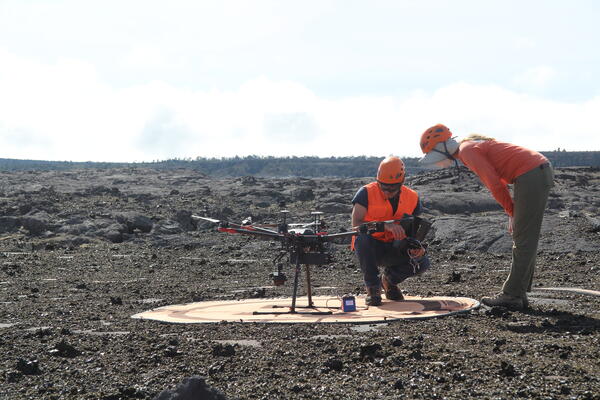
USGS Hawaiian Volcano Observatory scientists prepare for a UAS (uncrewed aircraft systems) flight at Kīlauea summit on July 17, 2025. UAS flights are conducted for aerial views into the north vent within Halemaʻumaʻu and to characterize volcanic gas emissions during eruptive pauses, UAS flights are conducted with the permission of Hawai‘i Volcanoes National Park and contribute to the Hawaiian Volcano Observatory's mission to monitor active volcanoes in Hawaii, assess their hazards, issue warnings, and advance scientific understanding to reduce the impacts of eruptions. Unauthorized launching, landing, or operating of a UAS from or on lands and waters administered by the National Park Service is prohibited under 36 CFR Closures & Public Use. USGS photo by K. Mulliken.
Sources/Usage: Public Domain. View Media Details
Media
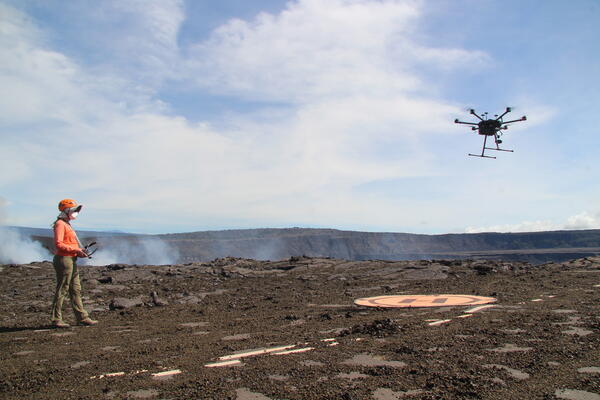
A USGS Hawaiian Volcano Observatory pilot guides a UAS (uncrewed aircraft systems) to the landing pad after an observational flight over the eruptive vents in Halemaʻumaʻu. UAS flights are conducted with the permission of Hawai‘i Volcanoes National Park, owing to the Hawaiian Volcano Observatory's mission to monitor active volcanoes in Hawaii, assess their hazards, issue warnings, and advance scientific understanding to reduce the impacts of eruptions. Unauthorized launching, landing, or operating of a UAS from or on lands and waters administered by the National Park Service is prohibited under 36 CFR Closures & Public Use. USGS photo by K. Mulliken.
Sources/Usage: Public Domain. View Media Details
Media
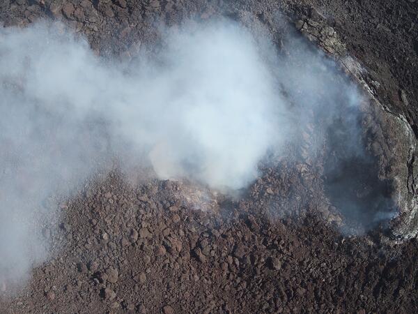
This near-vertical view into the north vent within Halema‘uma‘u crater was captured during a USGS Hawaiian Volcano Observatory UAS (uncrewed aircraft systems) flight on July 17, 2025. The aircraft was about 150 m (500 ft) above the vent, with north oriented to the upper left in this view. No incandescence or lava was visible within the vent. These UAS flights were conducted with the permission of Hawai‘i Volcanoes National Park, owing to the Hawaiian Volcano Observatory's mission to monitor active volcanoes in Hawaii, assess their hazards, issue warnings, and advance scientific understanding to reduce the impacts of eruptions. Unauthorized launching, landing, or operating of a UAS from or on lands and waters administered by the National Park Service is prohibited under 36 CFR Closures & Public Use. USGS photo by M. Zoeller.
Sources/Usage: Public Domain. View Media Details
Media
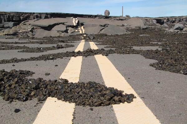
Crater Rim Drive within Hawaiʻi Volcanoes National Park was damaged during the earthquakes and collapse events in 2018. Tephra has been deposited parts of the damaged road during recent lava fountaining episodes in Halemaʻumaʻu, underscoring the hazardous nature of this area that has remained closed to the public since 2008. USGS photo by K. Mulliken.
Sources/Usage: Public Domain. View Media Details
Media
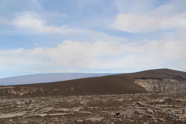
The tephra mound on the crater rim southwest of the active vents in Halemaʻumaʻu is nearly 100 feet (30 m) tall after 28 episodes of lava fountaining since December 23, 2024. The profile of the tephra mound nearly mirrors that of Mauna Loa, outlined behind it. USGS photo by K. Mulliken.
Sources/Usage: Public Domain. View Media Details
Media
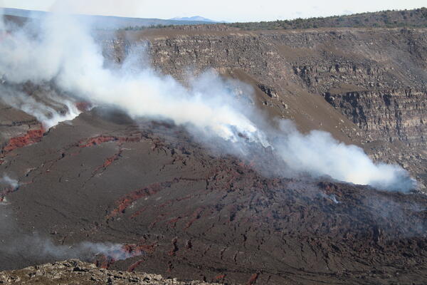
Significant cracks have appeared in the cone around the eruptive vents in Halemaʻumaʻu, as this feature has slumped downwards following episode 28. The south vent, which did not erupt during episode 28, was completely covered but the north vent remains visibly degassing. Mauna Kea is on the horizon in the background of the image. USGS photo by K. Mulliken.
Sources/Usage: Public Domain. View Media Details
Media
Sources/Usage: Public Domain. View Media Details