



Photo & Video Chronology — Kīlauea summit monitoring overflight
By Hawaiian Volcano Observatory
July 14, 2026
On Tuesday, July 14, USGS Hawaiian Volcano Observatory geologists completed a brief monitoring helicopter overflight of Halema‘uma‘u crater at the summit of Kīlauea.
Media
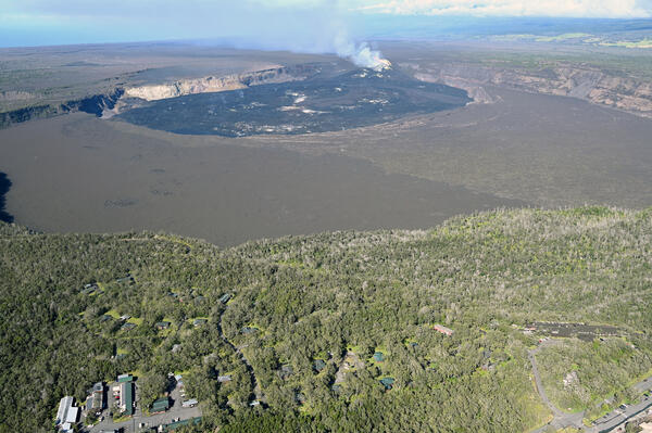
A wide view of Kaluapele and Kūpina‘i Pali (Waldron Ledge) in Hawai‘i Volcanoes National Park. Park infrastructure dots the landscape in the lower left and center, with Volcano House in the lower right. The historic Volcano House hotel has existed in various forms and locations at the summit of Kīlauea since 1846. USGS photo by L. Gallant.
Sources/Usage: Public Domain. View Media Details
Media
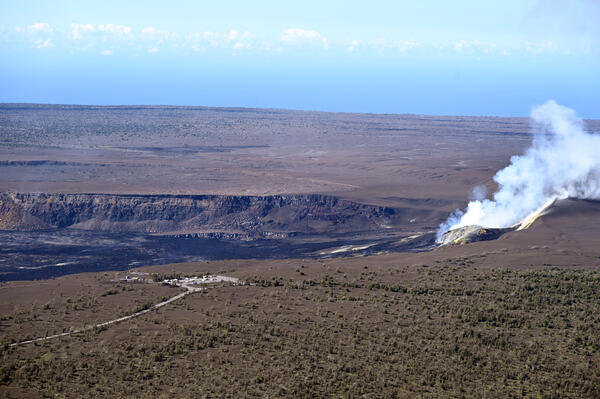
A view of Halema‘uma‘u with Uēkahuna in the foreground. Uēkahuna is the celebrated wahi pana (legendary place) of Kaluapele, the caldera of Kīlauea. An important site for Native Hawaiian ritual and cultural practices, Uēkahuna presents visitors with spectacular vistas of Kaluapele, Mauna Loa, and surrounding areas from the highest point on the rim. The former USGS Hawaiian Volcano Observatory building, perched on Kīlauea caldera rim, had views of the summit eruption from this location. This building was damaged during the 2018 summit collapse and was removed in 2024. USGS photo by L. Gallant.
Sources/Usage: Public Domain. View Media Details
Media
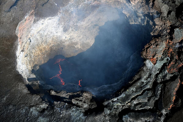
Aerial view looking down into the south vent, taken during a USGS Hawaiian Volcano Observatory monitoring overflight on the morning of July 14, 2026. The glowing edges of cooled plates can be seen, similar to the lava lake that persisted in Halema‘uma‘u from 2008 through 2018. Activity in south vent is less vigorous compared to the overflight on Friday July 10, 2026, where the lava in the vent could be seen roiling and bubbling. USGS photo by L. Gallant.
Sources/Usage: Public Domain. View Media Details
Media
During the July 14 monitoring overflight of Kīlauea's summit region, a USGS Hawaiian Volcano Observatory scientist captured this telephoto view into the south vent in Halema‘uma‘u. Unlike the incandescent but spattering north vent, the south vent hosted an active lava pond within. The pond was estimated to be sitting 25 meters (82 feet) down within the vent, which itself was estimated at 30 meters (98 meters) wide on the surface but narrowing with depth. Stretch marks in the pond's crust suggest active but slow lava circulation. The up direction in this image is approximately southwest. USGS photo by M. Zoeller.
Sources/Usage: Public Domain. View Media Details
Media
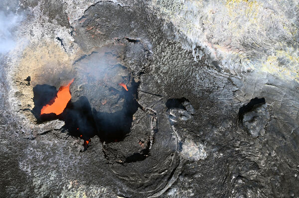
This aerial view, looking down into the north vent in Halema‘uma‘u, was taken during a USGS Hawaiian Volcano Observatory monitoring overflight on the morning of July 14, 2026. Small amounts of spatter over the last 12 hours have deposited on and around the vent, giving it a more textured look in the interior part of the depression. A small spatter cone had been building over the vent, but it collapsed prior to the overflight. USGS photo by L. Gallant.
Sources/Usage: Public Domain. View Media Details
Media
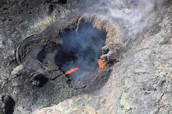
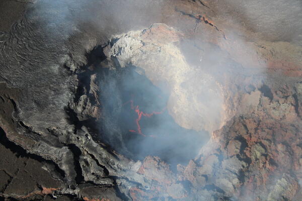
On July 14, USGS Hawaiian Volcano Observatory scientists on a monitoring overflight of Kīlauea's summit region had excellent views into both eruptive vents in Halema‘uma‘u. This is a telephoto view into the north vent, where the scientists could see two incandescent pukas (holes); the one on the left in this view was actively spattering during the flight. They estimated that the main vent opening was about 10 meters (33 feet) wide, and the incandescent pukas were 15 meters (49 feet) down. The up direction in this image is approximately southeast. USGS photo by M. Zoeller.
Sources/Usage: Public Domain. View Media Details