
Photo & Video Chronology — Kīlauea summit monitoring overflight
By Hawaiian Volcano Observatory
June 10, 2026
USGS scientists conduct Kīlauea summit monitoring overflight on June 9, 2026, to document changes to the eruptive vents and crater floor after episode 48 that took place on June 1.
Media
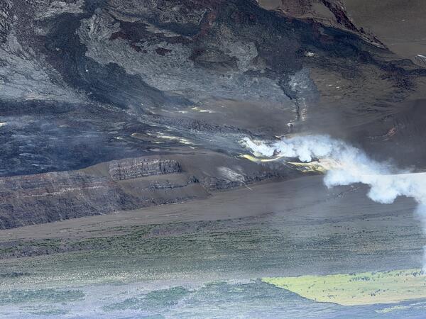
Aerial photograph showing the eruptive vents in Halema‘uma‘u crater at the summit of Kīlauea during a USGS Hawaiian Volcano Observatory monitoring overflight on June 9, 2026. Erupted material (lava flows and tephra) continues to build up the base of the vents, and sulfur precipitation is present on the vent walls (yellow patches). USGS photo by H. Winslow.
Sources/Usage: Public Domain. View Media Details
Media
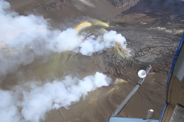
USGS scientists conduct Kīlauea summit monitoring overflight on June 9, 2026, to document changes to the eruptive vents and crater floor after episode 48 that took place on June 1. Both the north (top) and south (bottom) vents continue to emit volcanic gases during the pauses between fountaining episodes, and visible glow from south vent during the overflight on June 9 shows that magma is at shallow depths within the vent. USGS photo by B. Corsa.
Sources/Usage: Public Domain. View Media Details
Media
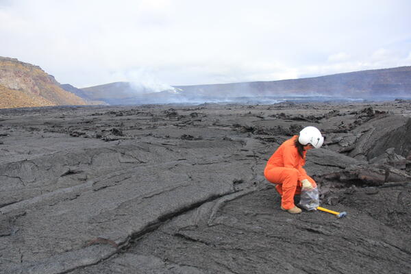
Halema‘uma‘u is a culturally significant location, being the home of Pele—the Native Hawaiian deity associated with lava. USGS scientists access this area of Kīlauea summit with permission from Hawai‘i Volcanoes National Park. On June 9, 2026, USGS scientists landed on the Halema‘uma‘u crater floor to collect lava flow samples from episode 48. Lava flow samples are used to help constrain the geochemistry of the magma and inform scientists about pre-eruptive magma storage conditions. The lava flow here is being collected about a one week after the eruptive episode and is still warm to the touch during sample collection. The eruptive vents can be seen in the background of this photo. USGS photo by B. Corsa.
Sources/Usage: Public Domain. View Media Details
Media
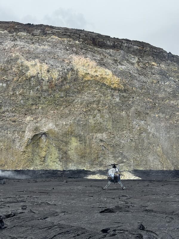
On June 9, 2026, USGS-Hawaiian Volcano Observatory scientists landed on the floor of Halema'uma'u crater in the vicinity of the south sulphur bank, visible in the background of this photo. The south sulphur bank was prominently visible in the mid-19th century but was covered as lava flows filled the caldera and wasn't visible in the twentieth century. As the caldera floor dropped during the 2018 summit collapse, the south sulphur bank was again exposed. History repeats itself as the south sulphur bank is being slowly but surely buried by lava flows during the current Halemaʻumaʻu eruption. USGS photo by M. Patrick.
Sources/Usage: Public Domain. View Media Details