U.S. flag

An official website of the United States government

July 16, 2026

USGS Hawaiian Volcano Observatory scientists completed a helicopter overflight of Halema‘uma‘u on July 16, following Kīlauea summit eruption episode 51 the day before.


Media
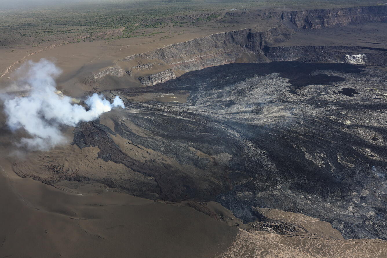
Color photograph of volcanic vents degassing
USGS Hawaiian Volcano Observatory scientists completed a helicopter overflight of Halema‘uma‘u on July 16, following Kīlauea summit eruption episode 51 the day before. Nearly the entire western portion of the crater floor was resurfaced with lava flows, including some of the down-dropped block with a remnant section of former Crater Rim Drive, collapsed in 2018 and visible in the lower right of this frame. Areas that are brown-colored on the left side of the photograph are draped in tephra fallout from the lava fountaining. Due to residual heat, it was not possible to fly directly over the eruptive vents, but it appeared there was persistent incandescence in the north vent following its eight hours of lava fountaining during episode 51. USGS photo by E. Johnson.
Media
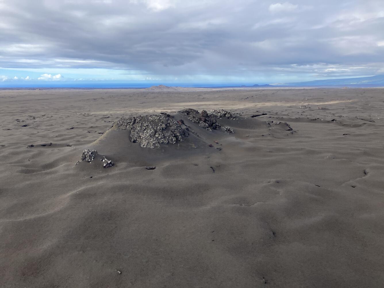
Color photograph of volcanic vent covered with tephra
During the USGS Hawaiian Volcano Observatory overflight on July 16, scientists flew across Kīlauea's Southwest Rift Zone for measurements of the gas plume drifting downwind of the Halema‘uma‘u eruptive vents. While transiting underneath the plume for upward-looking spectroscopy to determine the summit's sulfur dioxide emission rate, one of the scientists snapped this photo of the main spatter cone from the September 1971 Southwest Rift Zone eruption. This five-day eruption formed a narrow lava-flow field along approximately 5 miles (8 kilometers) of fissures, not spreading far because much of the effused lava poured into open ground cracks along the rift zone. Most of the flow field is now obscured from view due to the tephra blanket that extends across the region from the summit eruption that began in December 2024. USGS photo by M. Zoeller.
Media
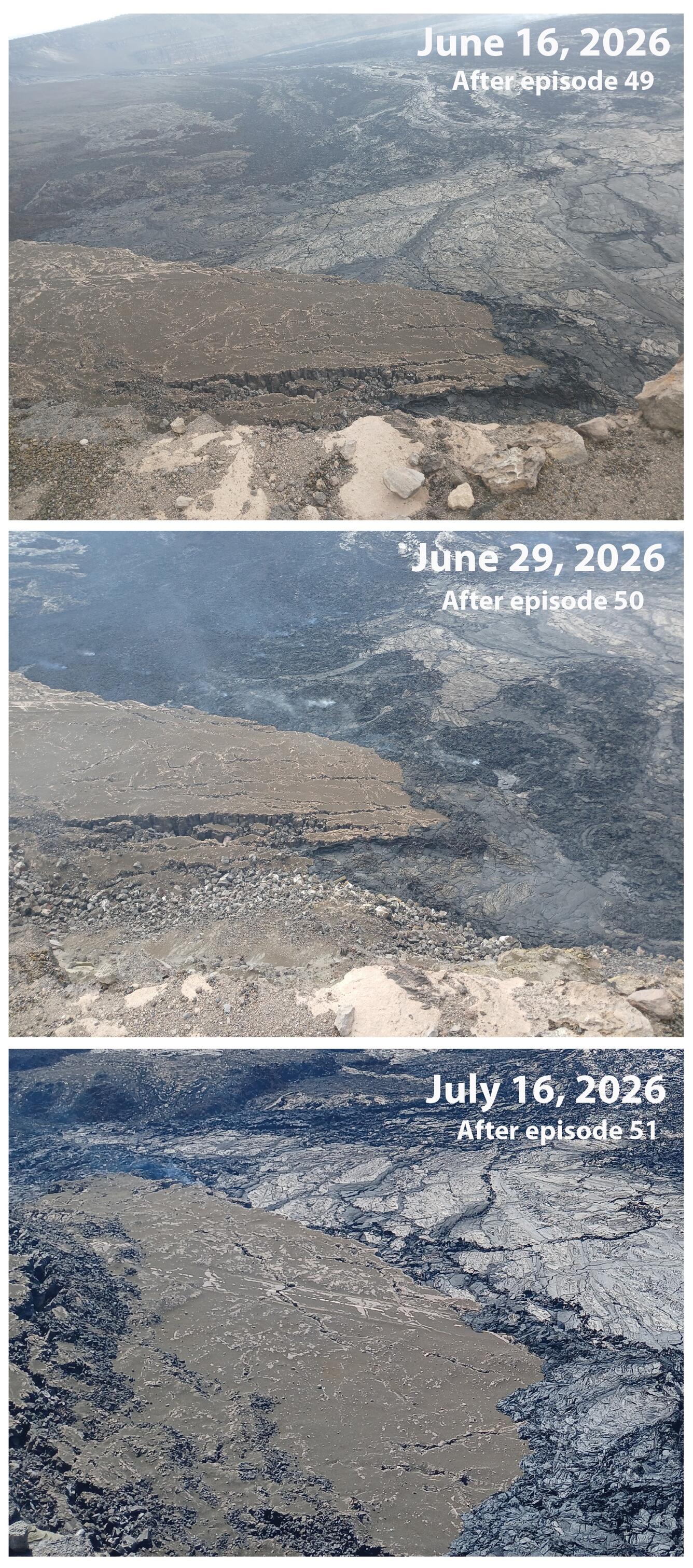
Color photographs showing lava covering a broken road over time
During the 2018 summit collapse of Kīlauea, portions of Crater Rim Drive fell into Halemaʻumaʻu crater. Eruptions in Halemaʻumaʻu since 2018 have slowly filled in much of the collapsed area. Lava fountaining episodes during the ongoing episodic eruption in Halemaʻumaʻu have generated lava flows that are slowly covering the remaining section of road, as visible in these three images taken after episode 49, 50 and 51. USGS photos by R. Adams. 
Was this page helpful?