
Volcano Watch — HVO debuts time-lapse movie Web page
Time-lapse cameras have long been used to monitor volcanic eruptions, including the current eruption at Pu`u `O`o.
In the good old days, the cameras used at Pu`u `O`o were powered by rubber bands and running mice, and the film had to be processed in dark caves by alchemists using strange chemical concoctions. Though these cameras did provide useful information, the resolution of the images was often poor.
Now we have entered the enlightened age of multi-megapixel digital cameras and multi-gigabyte memory cards. The time-lapse cameras currently in use at Pu`u `O`o are hand-held digital cameras with a programmable shutter-release, housed in waterproof enclosures. The camera and enclosure can be mounted onto a surveyor's tripod, or simply placed on the ground, depending on the situation. A small, inexpensive solar panel is sometimes added to recharge the battery at long-term sites.
These cameras systems are easy to build, easy to deploy in the field, and are relatively inexpensive. They also take more pictures more frequently at higher resolutions than ever before. Because the images are in a digital format, they can be readily reviewed and studied.
But how does one glean information from thousands of picture per week, from multiple cameras, without going crazy or falling asleep? Rather than reviewing the images one-by-one, sequences of pictures are strung together as fast-forward animations. This allows a week's worth of pictures to be reviewed in just a few minutes. When something unusually interesting or exciting occurs, the pertinent sequence of images is clipped out and converted into a short movie.
The technological advancements in digital photography have provided scientists at the Hawaiian Volcano Observatory with an exciting new way to record and study numerous volcanic phenomena, some of which have never before been observed, in unparalleled detail.
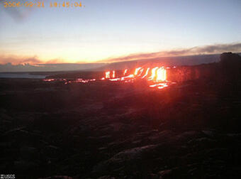
For example, throughout the past spring and summer, one of the vents on the floor of the Pu`u `O`o crater-the Drainhole vent-was exhibiting bright flashes at night, as seen from the Pu`u `O`o Webcam. A time-lapse camera was placed on the brink of the Drainhole vent to peer down into its throat. This camera took pictures for two weeks, showing that the degassing behavior in the Drainhole vent was dominated by gas pistoning-a process by which gas accumulates beneath a column of lava in the vent until it begins to rise, pushing the lava column (the "piston") upward. When the gas reaches the surface, it abruptly escapes into the atmosphere, sometimes as a forceful jet of fume and spatter. The lava then drains back into the vent to repeat the process. The largest of the gas pistoning events in the Drainhole vent were responsible for the bright nighttime flashes. These gas pistoning sequences are some of the best ever recorded.
In another case, a time-lapse camera was deployed to observe delta growth at the East Lae`apuki ocean entry. This camera recorded the huge collapse that occurred there about a year ago. The camera images, taken once a minute, showed the collapse occurring in piecemeal fashion-that is, in narrow slices of the delta rather than as a single huge chunk.
There are many other examples that could be described here, but it would be a lot easier for you to just take a look for yourself. The Hawaiian Volcano Observatory has just added a new page to its Web site that features some of the best sequences captured by our time-lapse cameras. Check it out at https://volcanoes.usgs.gov/volcanoes/kilauea/multimedia_chronology.html. This Web page is a work in progress and will be periodically updated with new movies.
The web page is broken down into four sections-movies of the Pu`u `O`o crater, Pu`u `O`o flank vents, flow field, and ocean entries. The movies are in QuickTime format (.mov) and require an updated version of the QuickTime player and a broadband internet connection. Follow the link on the Web page to download a free version of QuickTime.
Remember, cameras can be put in places where people should not be. In many cases, they are deployed in dangerous locations under hazardous conditions with the knowledge that they may not survive. Pu`u `O`o remains off-limits to the general public because of multiple and significant volcanic hazards.
————————————————————————————————————————————————————————————————
Volcano Activity Update
This past week, activity levels at the summit of Kīlauea Volcano have remained at background levels. The number of earthquakes located in the summit area is low (usually less than 10 per day that are large enough to locate). Widening of the summit caldera, indicating inflation, stopped in early October.
Eruptive activity at Pu`u `O`o continues. On clear nights, glow is visible from several vents within the crater. Lava is fed through the PKK lava tube from its source on the southwest flank of Pu`u `O`o to the ocean. About 1 kilometer south of Pu`u `O`o, the Campout flow branches off from the PKK tube. The PKK and Campout tubes feed two widely separated ocean entries, at East Lae`apuki and East Ka`ili`ili, respectively. Both entries are located inside Hawai`i Volcanoes National Park.
In the last week, intermittent breakouts from the Campout tube have been scattered from midway up Pulama pali to the coastal plain. On the evening of November 15, breakouts resumed from the PKK tube just inland of the sea cliff at East Lae`apuki.
Access to the sea cliff near the ocean entries is closed, due to significant hazards. The surrounding area, however, is open. If you visit the eruption site, check with the rangers for current updates, and remember to carry lots of water when venturing out onto the flow field.
There were six earthquakes beneath Hawai`i Island reported felt within the past week. Four of these quakes were aftershocks of the October 15 magnitude-6.7 earthquake. A magnitude-2.6 aftershock occurred at 9:11 p.m. H.s.t. on Friday, November 10, and was located 14 km (9 miles) southwest of Waikoloa town at a depth of 34 km (21 miles). A magnitude-2.8 earthquake occurred at 4:08 a.m. on Saturday, November 11, and was located 6 km (3 miles) south of Mauna Loa summit at a depth of 2 km (1 mile). A magnitude-3.7 aftershock occurred at 3:36 p.m. on Sunday, November 12, and was located 8 km (5 miles) southwest of Waikoloa at a depth of 36 km (23 miles). A magnitude-3.1 earthquake occurred at 10:08 a.m. on Wednesday, November 15, and was located 11 km (7 miles) northwest of Ka`ena Point on Kīlauea at a depth of 10 km (6 miles). A magnitude 2.2 aftershock occurred at 11:15 a.m. and was located 7 km (4 miles) southwest of Waimea at a depth of 13 km (8 miles). A magnitude 2.0 aftershock occurred at 9:37 p.m. and was located 25 km northwest of Kailua-Kona at a depth of 41 km (25 miles).
Mauna Loa is not erupting. During the past week, earthquake activity remained low beneath the volcano's summit (two earthquakes were located). Extension of distances between locations spanning the summit, indicating inflation, continues at slow rates.