
USGS energy and wildlife research update (Sept 2025-March 2026)
Every year, USGS scientists work with partners across the country to better understand how energy development intersects with the natural world. The research summarized here highlights new findings from the first half of FY26, spanning topics from wildlife and habitat responses to oil, gas, wind, solar, and hydropower infrastructure to advances in ecological forecasting, restoration, and species monitoring. Together, these studies offer timely, science‑based insights that help natural resource managers balance the Nation’s growing energy needs with the stewardship of ecosystems, wildlife, and public lands. By providing data, models, and decision‑support tools, USGS continues to inform smarter planning, reduce environmental risks, and support responsible energy development that protects the landscapes and species we all depend on.
Recent research from USGS and collaborators advances the state of ecosystems science knowledge in relation to various energy generation technologies, including oil and gas, transmission lines, hydropower, wind, solar, and geologic storage and other associated infrastructure. Studies span assessments of energy resources including oil and gas development, wind turbine decommissioning and repowering trends, analyses of biodiversity impacts across wind and solar landscapes, advancements in modeling and monitoring wildlife fatalities, and evaluations of habitat alteration in response to infrastructure such as transmission lines and solar arrays. Scientists have also developed decision-support tools, vulnerability indices, and risk assessment frameworks to inform site selection, operational strategies, and mitigation approaches. These findings offer science-based guidance for natural resource managers, supporting informed decisions and best practices to accelerate project permitting and balance the demands of energy development with management of habitats and species of concern.
This research supports Executive Order 14154 and 14285, Unleashing American Energy and Unleashing America’s Offshore Critical Minerals and Resources by providing new information that can be used to accelerate permitting of energy and critical mineral projects that are vital to the Nation’s security, economic resilience, and energy independence.
Oil and Gas Development Onshore
Effects of Oil and Gas Development on Wildlife and Habitat
Mule Deer Population Management in Wyoming
This study used a 40-year dataset of 37 Wyoming mule deer populations and shows that juvenile recruitment is most positively influenced by agricultural and shrubland cover, while energy development, drought, wildfire, and wind turbines have negative impacts. Results can be used to weigh the relative strength of threats and the value of restoration actions, interpret historic demographic change, prioritize populations for conservation, and optimize options for wildlife habitat management.
- Citation: Hayes, T.A., Johnston, A.N., Hall, L.E., Randall, J., Kauffman, M., Keefe, C., Monteith, K., and Graves, T., 2026, Integrating climate and anthropogenic dynamics can inform multifaceted management for declining mule deer populations: Ecological Applications, v. 36, no. 1, e70107, 21 p., https://doi.org/10.1002/eap.70107.
Landscape change and age ratios for mule deer herd units in Wyoming,1980-2019
This study assesses the change in winter use areas over 1985-2019 in relation to energy development, weather, forage, land cover (agriculture development, shrubland, rangeland), wildfire, and habitat treatments. Researchers use long-term datasets to support decisions on tradeoffs for managers to balance goals, including energy and big game.
- Citation: Hayes, T.A., Johnston, A., Hall, E., Randall, J., Keefe, C., Kauffman, M, Monteith, K, and Graves, T.A. (In Press, 2026), Landscape change and age ratios for mule deer (Odocoileus hemionus) herd units in Wyoming, 1980-2019: BLM Cooperator Report.
Modeling of drought, energy development, and restoration provide information on constraints and options for mule deer winter range across Wyoming sagebrush ecosystems
Large-scale landscape change can constrain management options. Using a 40-year dataset for herd units across Wyoming, researchers quantify the relative influence of drought, temperature, precipitation, energy, landcover, and wildfire disturbance, and habitat restoration in winter use areas on mule deer recruitment, indexed by age ratios.
- Citation: Hayes, T.A., Johnston, A., Hall, E., Randall, J., Kauffman, M, Keefe, C., Monteith, K.L., Graves, T.A, (In Press, 2026), Modeling of drought, energy development, and restoration provide information on constraints and options for mule deer winter range across Wyoming sagebrush ecosystems: Ecological Applications
Effects of Roads on Sage Grouse in Wyoming
Increases in roads often happen with increases in energy development. For disturbance assessments, USGS mapped all roads network and ages and traffic volumes, across the state of Wyoming. They then developed models to assess sage-grouse population responses to changes in roads and traffic volume, over time. (publication in prep). See Road Ecology | U.S. Geological Survey
Effects of traffic on the establishment and spread of invasive annual grasses
USGS scientists published a data release that includes citation details, abstracts, and results of a semi-automated content analysis for 88 publications they identified on the topic of the potential effects of traffic from oil and gas development on invasive annual grasses.
- Data Release: Varner, D.M., Bailey, L.N., Whipple, S.E., Valler, J.B., Rutherford, T.K., and Carter, S.K., 2026, Effects of traffic on the establishment and spread of invasive annual grasses: an annotated bibliography produced through a structured literature search and semi-automated content analysis: U.S. Geological Survey data release, https://doi.org/10.5066/P137BRLP.
Environmental Contaminants
Land application of biosolid, livestock, and drilling wastes to U.S. farmland: A potential pathway for the redistribution of contaminants in the environment
This study reveals that land application of biosolid, livestock, and drilling wastes on U.S. farmland introduces complex mixtures of contaminants, including chemicals, microbes, and bioactive substances that can affect ecosystem, wildlife, and human health. Results of this study provide a snapshot of chemical compositions and concentrations that can be used to inform the development of best-management practices to help maximize beneficial reuse of these wastes and minimize risk to the environment and human health.
- Citation: Masoner, J.R., Kolpin, D., Cozzarelli, I.M., Akob, D.M., Conaway, C.H., Givens, C.E., Hladik, M.L., Hubbard, L.E., Lane, R.F., McCleskey, R., Preston, T.M., Raines, C.D., Varonka, M., and Wilson, M.C., 2025, Land application of biosolid, livestock, and drilling wastes to US farmland: A potential pathway for the redistribution of contaminants in the environment: Environmental Science: Processes & Impacts, v. 27, p. 3372-3402, https://doi.org/10.1039/D5EM00312A.
Natural source zone depletion (NSZD) of crude oil in the subsurface: Processes controlling mass losses of individual compounds
This study evaluates more than 40 years of natural attenuation at the 1979 Bemidji, Minnesota crude‑oil spill by comparing conservative biomarkers and volatile compounds in original and weathered oil samples. Using data from source‑zone wells and oil‑saturation measurements, researchers identified how solubility, biodegradation, and oil‑saturation patterns drive compound‑specific losses. The approach provides a framework for understanding NSZD processes at long‑term petroleum spill sites.
- Citation: Bekins, B. A., & Herkelrath, W. N. (2026). Natural source zone depletion of crude oil in the subsurface: Processes controlling mass losses of individual compounds. Water Resources Research, 62, e2025WR041964. https://doi.org/10.1029/2025WR041964
Habitat Restoration
Supporting dryland restoration success with applied ecological forecasting of seeding outcomes
This study introduces an ecological forecasting system that integrates weather, water balance, and plant establishment models to predict restoration seeding outcomes in western U.S. drylands. By enabling land managers to anticipate and adapt to environmental variability, this approach supports more informed decisions for energy development and natural resource management and maximize restoration success.
- Citation: Siegmund, G.-F., Schlaepfer, D.R., Andrews, C., Bennion, L.D., Ferguson, J., Jeffries, M.I., Olwell, P., Pilliod, D.S., Simler-Williamson, A., Stears, A.E., Zweng, R. and Bradford, J.B. (2026), Supporting dryland restoration success with applied ecological forecasting of seeding outcomes. Restor Ecol, 34: e70179. https://doi.org/10.1111/rec.70179
Oil and gas offshore
Pacific Ocean
Factors structuring macrofaunal communities of hydrocarbon seeps along the Cascadia margin
This study identifies key environmental drivers—such as sediment composition, organic carbon, nitrogen ratios, stable isotopes, and depth—that shape the diversity and function of macrofaunal communities at cold seeps along the Cascadia margin. The findings provide essential baseline data, highlighting how local geochemical variability influences benthic ecosystems and informing strategies to minimize ecological impacts from potential offshore development activities.
- Citation: McCowen, P.J., Bourque, J.R., Behringer, D.C., Prouty, N.G., and Demopoulos, A.W.J., 2025, Factors structuring macrofaunal communities of hydrocarbon seeps along the Cascadia margin: Deep Sea Research Part I: Oceanographic Research Papers, v. 225, art. 104590, https://doi.org/10.1016/j.dsr.2025.104590, Nov 2025
- Data Release: Bourque, J.R., McCowen, P.J., McClain-Counts, J.P., and Demopoulos, A.W.J., 2025, Sediment macrofaunal composition, stable isotopes, organic content, and grain size of the Cascadia margin (Pacific Ocean), June 2019: U.S. Geological Survey data release, https://doi.org/10.5066/P138ZSH7.
- Data Release: Mccowen, P.J.; Pereira, T.J.; Demopoulos, A.W; Bourque, J.R; Bik, H.M.; Aunins, A.W; Barros, M.M.; Eackles, M.S.; Morrison, C.L: Shotgun sequencing of multiple families of Polychaeta from U.S. Atlantic margin seeps and eDNA metabarcoding sequences of benthic community from Cascadia margin seeps using 18S marker, 2018-2019.
Deepwater Horizon oil spill restoration
Ecophysiology of two mesophotic octocorals intended for restoration: Effects of light and temperature
This study found that the mesophotic octocorals Swiftia exserta and Muricea pendula exhibit low sensitivity to local temperature ranges, with M. pendula showing greater sensitivity to higher temperatures. These insights help inform restoration strategies and resource management decisions, supporting efforts to mitigate impacts from energy development on marine habitats following the Deepwater Horizon oil spill.
- Citation: Lange, K., Aquilina-Beck, A., Mccauley, M., Johnstone, J., Demopoulos, A., Greig, T., Beers, J.M., Spalding, H.L., and Etnoyer, P.J., 2025, Ecophysiology of two mesophotic octocorals intended for restoration: Effects of light and temperature: Limnology and Oceanography, v. 70, no. 11, p. 3309-3321, https://doi.org/10.1002/lno.70214.
Spawning and larval development of the mesophotic octocoral Swiftia exserta in aquaria
This study documents successful captive spawning and larval development of Swiftia exserta collected from the Gulf of America, providing the first records of reproductive behavior for this mesophotic coral. These findings offer essential baseline data to inform restoration strategies, resource management, and mitigation decisions for coral species impacted by environmental disturbances such as oil spills.
- Citation: Johnstone, J.W., Jenkins, W.G., Jankiewicz, M., Quigley, J.M., Frometa, J., Salgado, E., Higgins, B., Demopoulos, A.W.J., Gardner, C.L., Etnoyer, P.J., and Benson, K.G., 2025, Spawning and larval development of the mesophotic octocoral Swiftia exserta in aquaria: Marine Biology, v. 172, no. 2, art. 41, https://doi.org/10.1007/s00227-024-04588-y.

Hydropower
Shortnose sturgeon in the Hudson River
The USGS Eastern Ecological Science Center published an article highlighting the use of New York Harbor by endangered shortnose sturgeon. This study was requested by the New York State Department of Environmental Conservation to could guide policymaking (e.g., potential time of year restrictions for activities within the harbor area). That publication comes on the heels of another recent study where we estimated the abundance of shortnose sturgeon in the Hudson River. In concert, this work suggests that the Hudson River supports the largest population of wild sturgeon anywhere on the planet, and that these fish spend significant time among the hive of human activity around New York City. There are many current and planned energy infrastructure projects in this vicinity, associated with offshore wind, fossil fuels, and hydropower (i.e. the Champlain Hudson Power Express transmission line, which runs down the Hudson through important sturgeon habitats).
Daily fluctuating flows affect riparian plant species distributions
This study demonstrates that daily fluctuating flows from hydropower dams (hydropeaking) can negatively affect riparian plant species at both local and regional scales, particularly those dependent on wetland habitats, while favoring species adapted to frequent inundation. These findings highlight the importance of considering hydropeaking impacts when operating hydropower facilities and managing natural resources to minimize adverse effects on plant communities and associated fish and wildlife.
Cryptic life history diversity supports endangered species recovery in an ultra-urbanized landscape
Daily fluctuating flows affect riparian plant species distributions from local to regional scales
Transmission lines
The effects of powerline rights-of-way on flowering plants and bees across an elevation gradient in Arizona
In collaboration with the Salt River Project, Electrical Power Research Institute, and Northern Arizona University, USGS examined how vegetation management along powerline rights-of-way can influence native plants and pollinators in Arizona. Findings from this forthcoming study can be used to guide targeted vegetation management along powerline corridors based on vegetation type and elevation gradient.
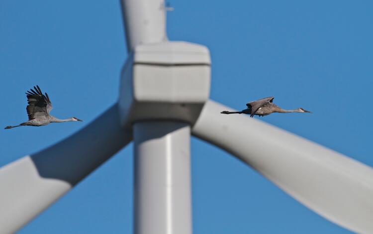
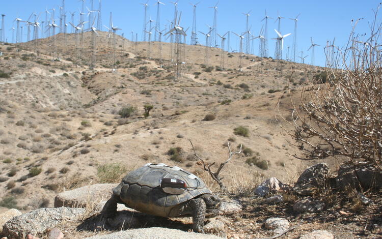
Wind Energy
Trends and Global Biodiversity Impacts
USGS scientists examined trends in wind turbine decommissioning and repowering in the U.S. and developed a novel predictive model for wind turbine decommissioning. Currently, they are preparing an analysis of the drivers of variation in bird and bat mortality at wind energy facilities, including power production, turbine size, and seasonality.
Empirical trends in U.S. land-based wind turbine decommissioning and repowering
This study uses a comprehensive U.S. dataset to determine which types of wind turbines are most likely to be decommissioned, with most sites subsequently being repowered using fewer but higher-capacity turbines. The study findings highlight an opportunity to proactively plan for future wind turbine retirement and repowering, considering the potential impacts on land use, wildlife habitat, and energy production.
- Citation: Rand, J., Kramer, L., Hoen, B., Diffendorfer, J., and Garrity, C., 2026, Out with the old: Empirical trends in U.S. land-based wind turbine decommissioning and repowering: Wind Energy, v. 29, no. 3, e70099, 13 p., https://doi.org/10.1002/we.70099
Impacts of onshore wind energy production on biodiversity
This review describes the growth of land-based wind energy development globally, its effects on wildlife and habitats throughout all project stages and discusses how impacts can be reduced by site selection, wildlife deterrence, operational curtailment, and habitat restoration. Scenario-based modeling and consideration of cumulative effects are important for informed decision making and effective mitigation strategies.
- Citation: Katzner, T.E., Nelson, D.M., Marques, A.T. et al. Impacts of onshore wind energy production on biodiversity. Nat. Rev. Biodivers. 1, 567–580 (2025). https://doi.org/10.1038/s44358-025-00078-1
Bat Fatality Estimation and Mitigation Strategies
Software for a national model of bat fatalities at wind facilities
The USGS released new software for a national model of bat fatalities at wind facilities. A corresponding manuscript has been submitted to the journal.
- Software Release: Labuzzetta, C.J., Wiens, A.M., Udell, B.J., Bohner, T.F., Johnsen, A., Seymour, M., Lopez, A., Mai, T., Thogmartin, W.E., Diffendorfer, J.E., and Straw, B.R., 2025, Software for a national model of bat fatalities at wind facilities, (version 1.0.0): U.S. Geological Survey software release, https://doi.org/10.5066/P1HPDQDM.
Bat carcass persistence at wind energy facilities
This study analyzed over 10,000 carcass persistence records at wind facilities in France, revealing that habitat and facility characteristics significantly affect carcass persistence. The results highlight that modeling alone cannot reliably predict persistence and cannot replace field-based trials. These findings emphasize the need to use local field-based persistence estimates rather than relying on modeling to accurately assess wind turbine impacts on biodiversity and inform mitigation strategies.
- Citation: Ravache, A, Huso M., Barré, K., Normand, B., Sotillo, A., Besnard, A., Kerbiriou, C, 2026, Habitat and site age drive carcass persistence at wind energy facilities: Evidence from a large-scale analysis: Journal of Environmental Management, v. 401, 128906, ISSN 0301-4797, https://doi.org/10.1016/j.jenvman.2026.128906
Hierarchical mixture models and high-resolution monitoring data can inform siting and operational strategies to mitigate bat fatalities at wind turbines
This study demonstrates that hierarchical mixture models using detailed monitoring data can identify species-specific factors and turbine placement effects influencing bat fatalities at wind energy facilities. The findings provide actionable insights for improving siting and operational strategies, such as targeted turbine placement and smart curtailment, to better mitigate or minimize impacts on bat populations and inform broader wildlife conservation decisions related to energy development.
- Citation: Labuzzetta, C.J., Johnsen, A.(., Andress, A., Bohner, T., Grajal-Puche, A., Seymour, M., Straw, B., Thogmartin, W.E., Udell, B.J., Wiens, A.M., Diffendorfer, J., 2026, Hierarchical mixture models and high-resolution monitoring data can inform siting and operational strategies to mitigate bat fatalities at wind turbines: Ecological Informatics, v. 94, 103652, 13 p., https://doi.org/10.1016/j.ecoinf.2026.103652
- Data Release: Labuzzetta, C.J., Johnsen, A., Bohner, T.F., Wiens, A.M., Udell, B.J., Seymour, M., Andress, A., Diffendorfer, J.E., Thogmartin, W.E., and Straw, B.R., 2025, Software for a multi-species Bayesian hierarchical model of bat fatalities at wind turbines, (version 1.0.0): U.S. Geological Survey software release, https://doi.org/10.5066/P1HVFES6.
Bat Detection and Population Monitoring
Multi-scale Predictors of Northern Long-eared Bat (Myotis septentrionalis) Occupancy in the United States
Using integrated acoustic and live-capture data, this study provides updated, spatially explicit predictions of summer occupancy for Northern Long-eared Bats, accounting for observation biases and uncertainty. These results offer reliable information to guide actions to manage bat populations.
- Citation: Wray, A.K., Udell, B.J., Davis, H.T., Inman, R.D., Lohre, B.T., Price, H.B., Reichard, J.D., Schuhmann, A.N., Straw, B., Tousley, F.C., Utrup, J., Wiens, A.M., and Reichert, B., 2025, Multi-scale predictors of Northern Long-eared Bat (Myotis septentrionalis) occupancy in the United States: Journal of North American Bat Research, v. 3, no. 15, p. 1-18. https://eaglehill.us/nabr-pdfs-regular/nabr-015-Wray.pdf
- Data Release: Wray, A.K., Davis, H.T., Udell, B.J., Bohner, T.F., Inman, R.D., Lohre, B.T., Price, H.B., Reichard, J.D., Schuhmann, A.N., Straw, B.R., Tousley, F.C., Utrup, J., and Reichert, B.E., 2024, North American Bat Monitoring Program (NABat) Predicted Northern Long-Eared Bat Occupancy Probabilities: U.S. Geological Survey data release, https://doi.org/10.5066/P1BE5QTK.
An integrated species distribution model for North American bats
This study introduces a multi-scale, integrated species distribution model that combines different types of monitoring data to provide more comprehensive assessments of bat populations, revealing significant declines in tricolored bats and highlighting spatial differences in population impacts. This approach offers enhanced tools for evaluating risks and targeting mitigation strategies to minimize energy development impacts on bats.
- Citation: Udell, B.J., Stratton, C., Irvine, K.M., Straw, B.R., Reichard, J.D., Gaulke, S., Coleman, J.T., Tousley, F.C., Schuhmann, A.N., Inman, R.D. and Turner, M., 2025. Integrated distribution modeling resolves asynchrony between bat population impacts and occupancy trends through latent abundance. Communications Biology, 8(1), p.832. https://www.nature.com/articles/s42003-025-08238-x
- Data Release: Udell, B.J., Straw, B.R., Davis, H.T., Lohre, B.T., Reichard, J.D., Coleman, J.T.H., and Reichert, B.E., 2025, Results and Code From the North American Bat Monitoring Program's (NABat) Integrated Species Distribution and Trend Models for Hoary Bat and Silver-Haired Bat: U.S. Geological Survey data release, https://doi.org/10.5066/P134REO7.
- Data release: Udell, B.J, Stratton, C., Irvine, K.M., Straw, B.R., Reichard, J.D., Gaulke, S.M., Coleman, J.T.H., Tousley, F., Schuhmann, A.N., Inman, R.D, Turner, M., Nystrom, S., and Reichert, B.E., 2025, Supplemental Results and Code from North American Bat Monitoring Program (NABat) Integrated Species Distribution Model for Tricolored Bat: U.S. Geological Survey data release, https://doi.org/10.5066/P1FKYTMA.
Summer roost site suitability analyses for 4 special status bat species in the Eastern United States
This study presents a high-resolution framework for identifying suitable summer roost habitats for four bat species of conservation concern, providing actionable spatial data to support targeted conservation planning. By revealing species-specific habitat relationships and areas of greatest certainty, these findings help prioritize mitigation efforts and guide management strategies for protecting critical bat habitats.
- Citation: Inman, R.D., Schuhmann, A.N., Sawyer, S.C., Gaulke, S.M., Tousley, F.C., Davis, H.T., Udell, B.J., Straw, B.R., Reichard, J.D. and Reichert, B.E., 2025. Summer roost site suitability analyses for 4 special status bat species in the Eastern United States. Journal of Mammalogy, 106(6), pp.1399-1411. https://doi.org/10.1093/jmammal/gyaf057
- Data release: Inman, R.D., Schuhmann, A.N., Sawyer, S.C., Gaulke, S.M., Tousley, F., Davis, H.T., Udell, B.J., Straw, B.R., Reichard, J., Cryan, P., and Reichert, B.E., 2024, Summer Roost Site Suitability Analyses of Four North American Bat Species in the Eastern United States: U.S. Geological Survey data release, https://doi.org/10.5066/P1AEIUMU.\
Evaluating evidence of changing regional occupancy of four bat species in response to forest management practices.
This study demonstrates that different forest management actions—such as ground vegetation management, fire, thinning, and clear-cutting—have varying effects on the regional occupancy of four bat species of conservation concern. The findings provide actionable insights to inform forest management.
- Citation: Inman, R.D., Udell, B.J., Wray, A.K., Straw, B.R., Schuhmann, A.N., Davis, H.T., Sawyer, S.C. and Reichert, B.E., 2026. Evaluating evidence of changing regional occupancy of four bat species in response to forest management practices. Forest Ecology and Management, 609, p.123639. https://doi.org/10.1016/j.foreco.2026.123639
Leveraging an observed-data likelihood improves the use of machine learning labels in a Bayesian hierarchical model for bioacoustic data
This study presents a modeling approach that combines expert validation with machine learning predictions to improve the accuracy and efficiency of species identification from bioacoustic data.
- Citation: Oram, J.K., Banner, K.M., Stratton, C., Hoegh, A. and Irvine, K.M., 2025. Leveraging an observed-data likelihood improves the use of machine learning labels in a Bayesian hierarchical model for bioacoustic data. The Annals of Applied Statistics, 19(4), pp.2957-2980. https://doi.org/10.1214/25-AOAS2096
Birds and Wind Energy
Underestimated Fatalities of a Cryptic Avian Species of Conservation Concern at Wind Energy Facilities in California
This study reveals that tricolored blackbird fatalities at California wind energy facilities are significantly underreported due to frequent misidentification, highlighting the need for improved species identification methods to ensure accurate impact assessments and inform effective mitigation strategies for at-risk wildlife.
- Citation: Katzner TE, Spicer AM, Ortiz PA and Conkling TG, 2026, Ecol Evol. 26;16(1):e72855. doi: 10.1002/ece3.72855
Revised Marine Bird Collision and Displacement Vulnerability Index for U.S. Pacific Outer Continental Shelf Offshore Wind Energy Development
This updated Vulnerability Index provides natural resources professionals with current, species-specific assessments of marine bird risks from offshore wind energy development in the U.S. Pacific Outer Continental Shelf, helping to guide informed decisions on siting, mitigation, and minimizing impacts to marine birds.
- Citation: Kelsey, E.C., Felis, J.J., Pereksta, D.M., and Adams, J., 2025, Revised marine bird collision and displacement vulnerability index for U.S. Pacific Outer Continental Shelf offshore wind energy development (ver. 1.1, November 2025): U.S. Geological Survey Data Report 1214, 32 p., https://doi.org/10.3133/dr1214
Movement Models to Predict Low ‐ Altitude Flight of Soaring Birds
This study introduces a fine-scale, data-driven Markov model that predicts golden eagle flight paths at rotor-swept altitudes, enabling spatially and temporally explicit risk mapping of turbine collisions using real-time terrain and wind data. Wind facility operators can use this model to inform targeted mitigation strategies, such as curtailment technologies, helping minimize impacts of wind energy development on golden eagles.
- Citation: Sandhu, R., C.Tripp, E.Quon, et al. 2026. “Movement Models to Predict Low-Altitude Flight of Soaring Birds Using Look-Ahead Environmental Factors.” Ecology and Evolution16, no. 3: e73059. https://doi.org/10.1002/ece3.73059.
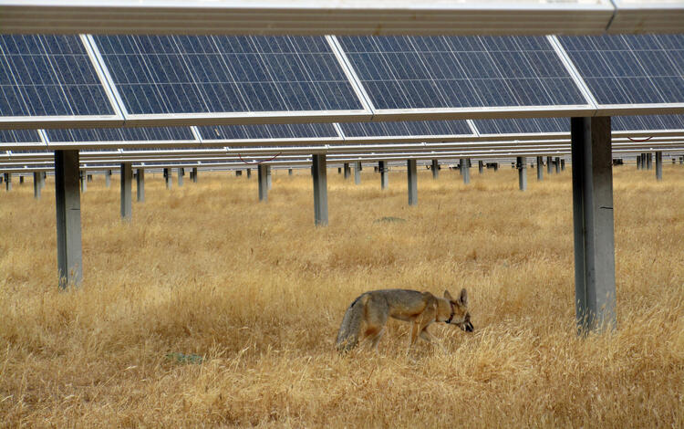
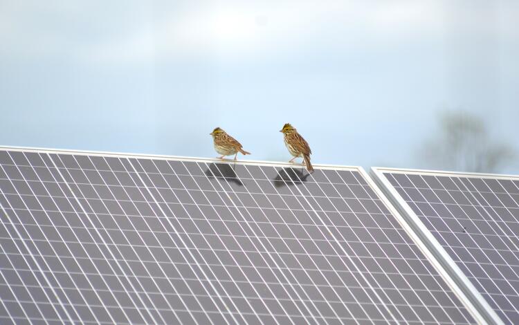
Solar Energy
Forthcoming: Aligning biodiversity conservation and solar energy development: A horizon scan approach to identify research gaps and opportunities
The rise of U.S. photovoltaics: An exploration of land use density trends in large-scale solar facility attributes, 2012-2021
This study analyzes recent trends in land use associated with large-scale solar photovoltaic facilities in the United States, revealing significant variation in capacity density based on factors such as facility design, location, and previous land use. The findings can be used to forecast solar expansion and evaluate potential impacts on land use.
- Citation: Fujita, K.S., Hoen, B., Robson, D., Rand, J., Ancona, Z.H., Diffendorfer, J., Kramer, L., Garrity, C., Gu, J., and Macknick, J., 2025, The rise of U.S. photovoltaics: An exploration of land use density trends in large-scale solar facility attributes, 2012-2021: International Journal of Photoenergy, v. 2025, 6686514, 18 p., https://doi.org/10.1155/ijph/6686514
Utility-Scale Solar Energy Effects on Native Plants and Habitat
Desert Annual Plant Responses to Panel Microsites in a Low-Impact Utility-Scale Solar Energy Facility
This study demonstrates that solar panels constructed with methods to minimize disturbance on soils in desert environments can both increase and decrease native annual plant diversity and density depending on local soil and vegetation types, with microclimate changes such as moisture and temperature driving these effects. The findings highlight the importance of considering site-specific vegetation–soil characteristics when designing and managing solar energy facilities to minimize ecological impacts and conserve native plant diversity.
- Citation: Karban, C. C., and S. M. Munson. 2026. “Desert Annual Plant Responses to Panel Microsites in a Low-Impact Utility-Scale Solar Energy Facility.” Applied Vegetation Science29, no. 1: e70055. https://doi.org/10.1111/avsc.70055.
Solar energy development effects to microclimate, temperature, and soil moisture in panel array interspaces in a warm desert
This study of the Solar Gemini Project in the Mojave Desert found that ecovoltaic solar installations can alter microclimate conditions by reducing evaporative demand and increasing soil moisture, but also cause daytime increases in air and soil surface temperature and persistent soil warming. These results suggest that solar facility design and operation can produce both beneficial and adverse environmental changes, and can provide solar developers new information on strategies to minimize impacts on desert ecosystems.
- Citation: Pinos, J., Munson, S.M., Karban, C.C., and Petrie, M.D., 2026, Ecovoltaic solar energy development effects to microclimate, temperature, and soil moisture in panel array interspaces in a warm desert: Journal of Environmental Management, v. 398, 128436, 13 p., https://doi.org/10.1016/j.jenvman.2025.128436.
Rare milkvetch persistence at a utility-scale solar energy facility in the Mojave Desert
This study found that the rare annual Mojave threecorner milkvetch can persist and even thrive within a utility-scale solar energy facility using novel low-impact construction methods, although suitable habitat is reduced directly beneath and adjacent to photovoltaic panels. These findings suggest that innovative solar facility designs can help minimize impacts on sensitive plant species, providing guidance for balancing energy development with conservation of native flora.
- Citation: Pereira, T.J., Karban, C.C., Kobelt, L., and Munson, S.M., 2025, Rare milkvetch (Astragalus) persistence at a utility-scale solar energy facility in the Mojave Desert: Frontiers in Ecology and Evolution, v. 13, 1697878, 12 p., https://doi.org/10.3389/fevo.2025.1697878
Floating Solar Energy Effects on Reservoirs and Potential Bird Interactions
Potential interactions between birds and floating solar energy
This study presents a risk assessment framework for evaluating how floating photovoltaic (FPV) solar installations on waterbodies may affect avian biodiversity, identifying high-risk areas where FPV development could impact vulnerable bird species. Findings suggest that careful site selection—especially avoiding smaller, high-risk waterbodies near the Atlantic coast and Great Lakes—can minimize negative effects on birds while supporting sustainable energy development and offering additional social and recreational benefits.
- Citation: Binley, A.D., Gallaher, A., Rodewald, A.D., and Grodsky, S.M., 2026, Potential interactions between birds and floating photovoltaic solar energy: Spatially informed species vulnerabilities, techno-ecological risks, and sustainability trade-offs: Environmental Science and Technology, v. 60, no. 1, p. 510-621, https://doi.org/10.1021/acs.est.5c09819
Modeling diverse environmental responses of reservoirs to floating photovoltaic systems
This study uses process-based modeling to show that floating photovoltaic (FPV) coverage on reservoirs consistently cools surface waters and alters thermal stratification, but the ecological impacts—especially on fish habitat suitability—vary by local environmental context. These results highlight the need for site-specific assessments to guide energy development decisions and ensure effective mitigation of potential impacts to aquatic biodiversity.
- Citation: Bredeweg, E.M., Arismendi, I., Murphy, C.A., and Henkel, S.K., 2025, Modeling diverse environmental responses of reservoirs to floating photovoltaic systems: Limnologica - Ecology and Management of Inland Waters, v. 115, 126293, 11 p., https://doi.org/10.1016/j.limno.2025.126293
Biofuels
Terrestrial ecosystem health and biodiversity
The USGS Northern Prairie Wildlife Research Center contributed to a government report with the Environmental Protection Agency on the impacts of the Renewable Fuel Standard on terrestrial ecosystem health and biodiversity. Chapter 12 within the Biofuels and the Environment: Third Triennial Report to Congress.
Terrestrial ecosystem health and biodiversity
Other anthropogenic infrastructure
Communication towers across the greater sage-grouse range
USGS scientists are examining effects from a growing network of communication tower infrastructure on Great Basin sage-grouse populations. Ongoing efforts include a forthcoming publication of a comprehensive inventory of communication tower infrastructure across the range of greater and Gunnison sage-grouse. This spatial timeseries dataset can support ecological research, infrastructure planning, environmental assessments, and management across the sagebrush biome.
Communication Towers across the Greater Sage-Grouse Range
A model-based decision support framework for siting communication tower infrastructure to reduce adverse effects on a sagebrush obligate species
Additional USGS Resources and Datasets
Rangeland Condition Monitoring Assessment and Projection (RCMAP)
RCMAP data can provide useful spatial and temporal context to energy decision making. The most recent data are available here: Multi-Resolution Land Characteristics (MRLC) Consortium
In addition to the following resources, please visit the USGS Energy Resources Program website for more USGS science on energy resources.
The U.S. Wind Turbine Database
The U.S. Wind Turbine Database (USWTDB) provides the locations of land-based and offshore wind turbines in the United States, corresponding wind project information, and turbine technical specifications. The latest release includes data on 75,417 turbines covering 45 states (plus Guam and PR). The most recent turbines added to the USWTDB became operational as recently as the first quarter of 2025, with a few from the second quarter of 2025.
The U.S. Large-Scale Solar Photovoltaic Database
The United States Large-Scale Solar Photovoltaic Database (USPVDB) provides the locations and array boundaries of U.S. photovoltaic (PV) facilities with capacity of 1 megawatt or more. It includes corresponding PV facility information, including panel type, site type, and initial year of operation. The latest release includes data on 5,712 facilities covering 49 states (plus the District of Columbia). The most recent facilities added to the USPVDB became operational as recently as the third quarter of 2024.
Ongoing research related to energy development and mining
Prioritizing Restoration of Sagebrush Ecosystems Tool (PReSET)
The Wyoming Landscape Conservation Initiative (WLCI)
Surface Disturbance and Reclamation Tracking Tool (SDARTT)
Greater Sage-Grouse Population Monitoring Framework
Every year, USGS scientists work with partners across the country to better understand how energy development intersects with the natural world. The research summarized here highlights new findings from the first half of FY26, spanning topics from wildlife and habitat responses to oil, gas, wind, solar, and hydropower infrastructure to advances in ecological forecasting, restoration, and species monitoring. Together, these studies offer timely, science‑based insights that help natural resource managers balance the Nation’s growing energy needs with the stewardship of ecosystems, wildlife, and public lands. By providing data, models, and decision‑support tools, USGS continues to inform smarter planning, reduce environmental risks, and support responsible energy development that protects the landscapes and species we all depend on.
Recent research from USGS and collaborators advances the state of ecosystems science knowledge in relation to various energy generation technologies, including oil and gas, transmission lines, hydropower, wind, solar, and geologic storage and other associated infrastructure. Studies span assessments of energy resources including oil and gas development, wind turbine decommissioning and repowering trends, analyses of biodiversity impacts across wind and solar landscapes, advancements in modeling and monitoring wildlife fatalities, and evaluations of habitat alteration in response to infrastructure such as transmission lines and solar arrays. Scientists have also developed decision-support tools, vulnerability indices, and risk assessment frameworks to inform site selection, operational strategies, and mitigation approaches. These findings offer science-based guidance for natural resource managers, supporting informed decisions and best practices to accelerate project permitting and balance the demands of energy development with management of habitats and species of concern.
This research supports Executive Order 14154 and 14285, Unleashing American Energy and Unleashing America’s Offshore Critical Minerals and Resources by providing new information that can be used to accelerate permitting of energy and critical mineral projects that are vital to the Nation’s security, economic resilience, and energy independence.
Oil and Gas Development Onshore
Effects of Oil and Gas Development on Wildlife and Habitat
Mule Deer Population Management in Wyoming
This study used a 40-year dataset of 37 Wyoming mule deer populations and shows that juvenile recruitment is most positively influenced by agricultural and shrubland cover, while energy development, drought, wildfire, and wind turbines have negative impacts. Results can be used to weigh the relative strength of threats and the value of restoration actions, interpret historic demographic change, prioritize populations for conservation, and optimize options for wildlife habitat management.
- Citation: Hayes, T.A., Johnston, A.N., Hall, L.E., Randall, J., Kauffman, M., Keefe, C., Monteith, K., and Graves, T., 2026, Integrating climate and anthropogenic dynamics can inform multifaceted management for declining mule deer populations: Ecological Applications, v. 36, no. 1, e70107, 21 p., https://doi.org/10.1002/eap.70107.
Landscape change and age ratios for mule deer herd units in Wyoming,1980-2019
This study assesses the change in winter use areas over 1985-2019 in relation to energy development, weather, forage, land cover (agriculture development, shrubland, rangeland), wildfire, and habitat treatments. Researchers use long-term datasets to support decisions on tradeoffs for managers to balance goals, including energy and big game.
- Citation: Hayes, T.A., Johnston, A., Hall, E., Randall, J., Keefe, C., Kauffman, M, Monteith, K, and Graves, T.A. (In Press, 2026), Landscape change and age ratios for mule deer (Odocoileus hemionus) herd units in Wyoming, 1980-2019: BLM Cooperator Report.
Modeling of drought, energy development, and restoration provide information on constraints and options for mule deer winter range across Wyoming sagebrush ecosystems
Large-scale landscape change can constrain management options. Using a 40-year dataset for herd units across Wyoming, researchers quantify the relative influence of drought, temperature, precipitation, energy, landcover, and wildfire disturbance, and habitat restoration in winter use areas on mule deer recruitment, indexed by age ratios.
- Citation: Hayes, T.A., Johnston, A., Hall, E., Randall, J., Kauffman, M, Keefe, C., Monteith, K.L., Graves, T.A, (In Press, 2026), Modeling of drought, energy development, and restoration provide information on constraints and options for mule deer winter range across Wyoming sagebrush ecosystems: Ecological Applications
Effects of Roads on Sage Grouse in Wyoming
Increases in roads often happen with increases in energy development. For disturbance assessments, USGS mapped all roads network and ages and traffic volumes, across the state of Wyoming. They then developed models to assess sage-grouse population responses to changes in roads and traffic volume, over time. (publication in prep). See Road Ecology | U.S. Geological Survey
Effects of traffic on the establishment and spread of invasive annual grasses
USGS scientists published a data release that includes citation details, abstracts, and results of a semi-automated content analysis for 88 publications they identified on the topic of the potential effects of traffic from oil and gas development on invasive annual grasses.
- Data Release: Varner, D.M., Bailey, L.N., Whipple, S.E., Valler, J.B., Rutherford, T.K., and Carter, S.K., 2026, Effects of traffic on the establishment and spread of invasive annual grasses: an annotated bibliography produced through a structured literature search and semi-automated content analysis: U.S. Geological Survey data release, https://doi.org/10.5066/P137BRLP.
Environmental Contaminants
Land application of biosolid, livestock, and drilling wastes to U.S. farmland: A potential pathway for the redistribution of contaminants in the environment
This study reveals that land application of biosolid, livestock, and drilling wastes on U.S. farmland introduces complex mixtures of contaminants, including chemicals, microbes, and bioactive substances that can affect ecosystem, wildlife, and human health. Results of this study provide a snapshot of chemical compositions and concentrations that can be used to inform the development of best-management practices to help maximize beneficial reuse of these wastes and minimize risk to the environment and human health.
- Citation: Masoner, J.R., Kolpin, D., Cozzarelli, I.M., Akob, D.M., Conaway, C.H., Givens, C.E., Hladik, M.L., Hubbard, L.E., Lane, R.F., McCleskey, R., Preston, T.M., Raines, C.D., Varonka, M., and Wilson, M.C., 2025, Land application of biosolid, livestock, and drilling wastes to US farmland: A potential pathway for the redistribution of contaminants in the environment: Environmental Science: Processes & Impacts, v. 27, p. 3372-3402, https://doi.org/10.1039/D5EM00312A.
Natural source zone depletion (NSZD) of crude oil in the subsurface: Processes controlling mass losses of individual compounds
This study evaluates more than 40 years of natural attenuation at the 1979 Bemidji, Minnesota crude‑oil spill by comparing conservative biomarkers and volatile compounds in original and weathered oil samples. Using data from source‑zone wells and oil‑saturation measurements, researchers identified how solubility, biodegradation, and oil‑saturation patterns drive compound‑specific losses. The approach provides a framework for understanding NSZD processes at long‑term petroleum spill sites.
- Citation: Bekins, B. A., & Herkelrath, W. N. (2026). Natural source zone depletion of crude oil in the subsurface: Processes controlling mass losses of individual compounds. Water Resources Research, 62, e2025WR041964. https://doi.org/10.1029/2025WR041964
Habitat Restoration
Supporting dryland restoration success with applied ecological forecasting of seeding outcomes
This study introduces an ecological forecasting system that integrates weather, water balance, and plant establishment models to predict restoration seeding outcomes in western U.S. drylands. By enabling land managers to anticipate and adapt to environmental variability, this approach supports more informed decisions for energy development and natural resource management and maximize restoration success.
- Citation: Siegmund, G.-F., Schlaepfer, D.R., Andrews, C., Bennion, L.D., Ferguson, J., Jeffries, M.I., Olwell, P., Pilliod, D.S., Simler-Williamson, A., Stears, A.E., Zweng, R. and Bradford, J.B. (2026), Supporting dryland restoration success with applied ecological forecasting of seeding outcomes. Restor Ecol, 34: e70179. https://doi.org/10.1111/rec.70179
Oil and gas offshore
Pacific Ocean
Factors structuring macrofaunal communities of hydrocarbon seeps along the Cascadia margin
This study identifies key environmental drivers—such as sediment composition, organic carbon, nitrogen ratios, stable isotopes, and depth—that shape the diversity and function of macrofaunal communities at cold seeps along the Cascadia margin. The findings provide essential baseline data, highlighting how local geochemical variability influences benthic ecosystems and informing strategies to minimize ecological impacts from potential offshore development activities.
- Citation: McCowen, P.J., Bourque, J.R., Behringer, D.C., Prouty, N.G., and Demopoulos, A.W.J., 2025, Factors structuring macrofaunal communities of hydrocarbon seeps along the Cascadia margin: Deep Sea Research Part I: Oceanographic Research Papers, v. 225, art. 104590, https://doi.org/10.1016/j.dsr.2025.104590, Nov 2025
- Data Release: Bourque, J.R., McCowen, P.J., McClain-Counts, J.P., and Demopoulos, A.W.J., 2025, Sediment macrofaunal composition, stable isotopes, organic content, and grain size of the Cascadia margin (Pacific Ocean), June 2019: U.S. Geological Survey data release, https://doi.org/10.5066/P138ZSH7.
- Data Release: Mccowen, P.J.; Pereira, T.J.; Demopoulos, A.W; Bourque, J.R; Bik, H.M.; Aunins, A.W; Barros, M.M.; Eackles, M.S.; Morrison, C.L: Shotgun sequencing of multiple families of Polychaeta from U.S. Atlantic margin seeps and eDNA metabarcoding sequences of benthic community from Cascadia margin seeps using 18S marker, 2018-2019.
Deepwater Horizon oil spill restoration
Ecophysiology of two mesophotic octocorals intended for restoration: Effects of light and temperature
This study found that the mesophotic octocorals Swiftia exserta and Muricea pendula exhibit low sensitivity to local temperature ranges, with M. pendula showing greater sensitivity to higher temperatures. These insights help inform restoration strategies and resource management decisions, supporting efforts to mitigate impacts from energy development on marine habitats following the Deepwater Horizon oil spill.
- Citation: Lange, K., Aquilina-Beck, A., Mccauley, M., Johnstone, J., Demopoulos, A., Greig, T., Beers, J.M., Spalding, H.L., and Etnoyer, P.J., 2025, Ecophysiology of two mesophotic octocorals intended for restoration: Effects of light and temperature: Limnology and Oceanography, v. 70, no. 11, p. 3309-3321, https://doi.org/10.1002/lno.70214.
Spawning and larval development of the mesophotic octocoral Swiftia exserta in aquaria
This study documents successful captive spawning and larval development of Swiftia exserta collected from the Gulf of America, providing the first records of reproductive behavior for this mesophotic coral. These findings offer essential baseline data to inform restoration strategies, resource management, and mitigation decisions for coral species impacted by environmental disturbances such as oil spills.
- Citation: Johnstone, J.W., Jenkins, W.G., Jankiewicz, M., Quigley, J.M., Frometa, J., Salgado, E., Higgins, B., Demopoulos, A.W.J., Gardner, C.L., Etnoyer, P.J., and Benson, K.G., 2025, Spawning and larval development of the mesophotic octocoral Swiftia exserta in aquaria: Marine Biology, v. 172, no. 2, art. 41, https://doi.org/10.1007/s00227-024-04588-y.
Hydropower
Shortnose sturgeon in the Hudson River
The USGS Eastern Ecological Science Center published an article highlighting the use of New York Harbor by endangered shortnose sturgeon. This study was requested by the New York State Department of Environmental Conservation to could guide policymaking (e.g., potential time of year restrictions for activities within the harbor area). That publication comes on the heels of another recent study where we estimated the abundance of shortnose sturgeon in the Hudson River. In concert, this work suggests that the Hudson River supports the largest population of wild sturgeon anywhere on the planet, and that these fish spend significant time among the hive of human activity around New York City. There are many current and planned energy infrastructure projects in this vicinity, associated with offshore wind, fossil fuels, and hydropower (i.e. the Champlain Hudson Power Express transmission line, which runs down the Hudson through important sturgeon habitats).
Daily fluctuating flows affect riparian plant species distributions
This study demonstrates that daily fluctuating flows from hydropower dams (hydropeaking) can negatively affect riparian plant species at both local and regional scales, particularly those dependent on wetland habitats, while favoring species adapted to frequent inundation. These findings highlight the importance of considering hydropeaking impacts when operating hydropower facilities and managing natural resources to minimize adverse effects on plant communities and associated fish and wildlife.
Cryptic life history diversity supports endangered species recovery in an ultra-urbanized landscape
Daily fluctuating flows affect riparian plant species distributions from local to regional scales
Transmission lines
The effects of powerline rights-of-way on flowering plants and bees across an elevation gradient in Arizona
In collaboration with the Salt River Project, Electrical Power Research Institute, and Northern Arizona University, USGS examined how vegetation management along powerline rights-of-way can influence native plants and pollinators in Arizona. Findings from this forthcoming study can be used to guide targeted vegetation management along powerline corridors based on vegetation type and elevation gradient.
Wind Energy
Trends and Global Biodiversity Impacts
USGS scientists examined trends in wind turbine decommissioning and repowering in the U.S. and developed a novel predictive model for wind turbine decommissioning. Currently, they are preparing an analysis of the drivers of variation in bird and bat mortality at wind energy facilities, including power production, turbine size, and seasonality.
Empirical trends in U.S. land-based wind turbine decommissioning and repowering
This study uses a comprehensive U.S. dataset to determine which types of wind turbines are most likely to be decommissioned, with most sites subsequently being repowered using fewer but higher-capacity turbines. The study findings highlight an opportunity to proactively plan for future wind turbine retirement and repowering, considering the potential impacts on land use, wildlife habitat, and energy production.
- Citation: Rand, J., Kramer, L., Hoen, B., Diffendorfer, J., and Garrity, C., 2026, Out with the old: Empirical trends in U.S. land-based wind turbine decommissioning and repowering: Wind Energy, v. 29, no. 3, e70099, 13 p., https://doi.org/10.1002/we.70099
Impacts of onshore wind energy production on biodiversity
This review describes the growth of land-based wind energy development globally, its effects on wildlife and habitats throughout all project stages and discusses how impacts can be reduced by site selection, wildlife deterrence, operational curtailment, and habitat restoration. Scenario-based modeling and consideration of cumulative effects are important for informed decision making and effective mitigation strategies.
- Citation: Katzner, T.E., Nelson, D.M., Marques, A.T. et al. Impacts of onshore wind energy production on biodiversity. Nat. Rev. Biodivers. 1, 567–580 (2025). https://doi.org/10.1038/s44358-025-00078-1
Bat Fatality Estimation and Mitigation Strategies
Software for a national model of bat fatalities at wind facilities
The USGS released new software for a national model of bat fatalities at wind facilities. A corresponding manuscript has been submitted to the journal.
- Software Release: Labuzzetta, C.J., Wiens, A.M., Udell, B.J., Bohner, T.F., Johnsen, A., Seymour, M., Lopez, A., Mai, T., Thogmartin, W.E., Diffendorfer, J.E., and Straw, B.R., 2025, Software for a national model of bat fatalities at wind facilities, (version 1.0.0): U.S. Geological Survey software release, https://doi.org/10.5066/P1HPDQDM.
Bat carcass persistence at wind energy facilities
This study analyzed over 10,000 carcass persistence records at wind facilities in France, revealing that habitat and facility characteristics significantly affect carcass persistence. The results highlight that modeling alone cannot reliably predict persistence and cannot replace field-based trials. These findings emphasize the need to use local field-based persistence estimates rather than relying on modeling to accurately assess wind turbine impacts on biodiversity and inform mitigation strategies.
- Citation: Ravache, A, Huso M., Barré, K., Normand, B., Sotillo, A., Besnard, A., Kerbiriou, C, 2026, Habitat and site age drive carcass persistence at wind energy facilities: Evidence from a large-scale analysis: Journal of Environmental Management, v. 401, 128906, ISSN 0301-4797, https://doi.org/10.1016/j.jenvman.2026.128906
Hierarchical mixture models and high-resolution monitoring data can inform siting and operational strategies to mitigate bat fatalities at wind turbines
This study demonstrates that hierarchical mixture models using detailed monitoring data can identify species-specific factors and turbine placement effects influencing bat fatalities at wind energy facilities. The findings provide actionable insights for improving siting and operational strategies, such as targeted turbine placement and smart curtailment, to better mitigate or minimize impacts on bat populations and inform broader wildlife conservation decisions related to energy development.
- Citation: Labuzzetta, C.J., Johnsen, A.(., Andress, A., Bohner, T., Grajal-Puche, A., Seymour, M., Straw, B., Thogmartin, W.E., Udell, B.J., Wiens, A.M., Diffendorfer, J., 2026, Hierarchical mixture models and high-resolution monitoring data can inform siting and operational strategies to mitigate bat fatalities at wind turbines: Ecological Informatics, v. 94, 103652, 13 p., https://doi.org/10.1016/j.ecoinf.2026.103652
- Data Release: Labuzzetta, C.J., Johnsen, A., Bohner, T.F., Wiens, A.M., Udell, B.J., Seymour, M., Andress, A., Diffendorfer, J.E., Thogmartin, W.E., and Straw, B.R., 2025, Software for a multi-species Bayesian hierarchical model of bat fatalities at wind turbines, (version 1.0.0): U.S. Geological Survey software release, https://doi.org/10.5066/P1HVFES6.
Bat Detection and Population Monitoring
Multi-scale Predictors of Northern Long-eared Bat (Myotis septentrionalis) Occupancy in the United States
Using integrated acoustic and live-capture data, this study provides updated, spatially explicit predictions of summer occupancy for Northern Long-eared Bats, accounting for observation biases and uncertainty. These results offer reliable information to guide actions to manage bat populations.
- Citation: Wray, A.K., Udell, B.J., Davis, H.T., Inman, R.D., Lohre, B.T., Price, H.B., Reichard, J.D., Schuhmann, A.N., Straw, B., Tousley, F.C., Utrup, J., Wiens, A.M., and Reichert, B., 2025, Multi-scale predictors of Northern Long-eared Bat (Myotis septentrionalis) occupancy in the United States: Journal of North American Bat Research, v. 3, no. 15, p. 1-18. https://eaglehill.us/nabr-pdfs-regular/nabr-015-Wray.pdf
- Data Release: Wray, A.K., Davis, H.T., Udell, B.J., Bohner, T.F., Inman, R.D., Lohre, B.T., Price, H.B., Reichard, J.D., Schuhmann, A.N., Straw, B.R., Tousley, F.C., Utrup, J., and Reichert, B.E., 2024, North American Bat Monitoring Program (NABat) Predicted Northern Long-Eared Bat Occupancy Probabilities: U.S. Geological Survey data release, https://doi.org/10.5066/P1BE5QTK.
An integrated species distribution model for North American bats
This study introduces a multi-scale, integrated species distribution model that combines different types of monitoring data to provide more comprehensive assessments of bat populations, revealing significant declines in tricolored bats and highlighting spatial differences in population impacts. This approach offers enhanced tools for evaluating risks and targeting mitigation strategies to minimize energy development impacts on bats.
- Citation: Udell, B.J., Stratton, C., Irvine, K.M., Straw, B.R., Reichard, J.D., Gaulke, S., Coleman, J.T., Tousley, F.C., Schuhmann, A.N., Inman, R.D. and Turner, M., 2025. Integrated distribution modeling resolves asynchrony between bat population impacts and occupancy trends through latent abundance. Communications Biology, 8(1), p.832. https://www.nature.com/articles/s42003-025-08238-x
- Data Release: Udell, B.J., Straw, B.R., Davis, H.T., Lohre, B.T., Reichard, J.D., Coleman, J.T.H., and Reichert, B.E., 2025, Results and Code From the North American Bat Monitoring Program's (NABat) Integrated Species Distribution and Trend Models for Hoary Bat and Silver-Haired Bat: U.S. Geological Survey data release, https://doi.org/10.5066/P134REO7.
- Data release: Udell, B.J, Stratton, C., Irvine, K.M., Straw, B.R., Reichard, J.D., Gaulke, S.M., Coleman, J.T.H., Tousley, F., Schuhmann, A.N., Inman, R.D, Turner, M., Nystrom, S., and Reichert, B.E., 2025, Supplemental Results and Code from North American Bat Monitoring Program (NABat) Integrated Species Distribution Model for Tricolored Bat: U.S. Geological Survey data release, https://doi.org/10.5066/P1FKYTMA.
Summer roost site suitability analyses for 4 special status bat species in the Eastern United States
This study presents a high-resolution framework for identifying suitable summer roost habitats for four bat species of conservation concern, providing actionable spatial data to support targeted conservation planning. By revealing species-specific habitat relationships and areas of greatest certainty, these findings help prioritize mitigation efforts and guide management strategies for protecting critical bat habitats.
- Citation: Inman, R.D., Schuhmann, A.N., Sawyer, S.C., Gaulke, S.M., Tousley, F.C., Davis, H.T., Udell, B.J., Straw, B.R., Reichard, J.D. and Reichert, B.E., 2025. Summer roost site suitability analyses for 4 special status bat species in the Eastern United States. Journal of Mammalogy, 106(6), pp.1399-1411. https://doi.org/10.1093/jmammal/gyaf057
- Data release: Inman, R.D., Schuhmann, A.N., Sawyer, S.C., Gaulke, S.M., Tousley, F., Davis, H.T., Udell, B.J., Straw, B.R., Reichard, J., Cryan, P., and Reichert, B.E., 2024, Summer Roost Site Suitability Analyses of Four North American Bat Species in the Eastern United States: U.S. Geological Survey data release, https://doi.org/10.5066/P1AEIUMU.\
Evaluating evidence of changing regional occupancy of four bat species in response to forest management practices.
This study demonstrates that different forest management actions—such as ground vegetation management, fire, thinning, and clear-cutting—have varying effects on the regional occupancy of four bat species of conservation concern. The findings provide actionable insights to inform forest management.
- Citation: Inman, R.D., Udell, B.J., Wray, A.K., Straw, B.R., Schuhmann, A.N., Davis, H.T., Sawyer, S.C. and Reichert, B.E., 2026. Evaluating evidence of changing regional occupancy of four bat species in response to forest management practices. Forest Ecology and Management, 609, p.123639. https://doi.org/10.1016/j.foreco.2026.123639
Leveraging an observed-data likelihood improves the use of machine learning labels in a Bayesian hierarchical model for bioacoustic data
This study presents a modeling approach that combines expert validation with machine learning predictions to improve the accuracy and efficiency of species identification from bioacoustic data.
- Citation: Oram, J.K., Banner, K.M., Stratton, C., Hoegh, A. and Irvine, K.M., 2025. Leveraging an observed-data likelihood improves the use of machine learning labels in a Bayesian hierarchical model for bioacoustic data. The Annals of Applied Statistics, 19(4), pp.2957-2980. https://doi.org/10.1214/25-AOAS2096
Birds and Wind Energy
Underestimated Fatalities of a Cryptic Avian Species of Conservation Concern at Wind Energy Facilities in California
This study reveals that tricolored blackbird fatalities at California wind energy facilities are significantly underreported due to frequent misidentification, highlighting the need for improved species identification methods to ensure accurate impact assessments and inform effective mitigation strategies for at-risk wildlife.
- Citation: Katzner TE, Spicer AM, Ortiz PA and Conkling TG, 2026, Ecol Evol. 26;16(1):e72855. doi: 10.1002/ece3.72855
Revised Marine Bird Collision and Displacement Vulnerability Index for U.S. Pacific Outer Continental Shelf Offshore Wind Energy Development
This updated Vulnerability Index provides natural resources professionals with current, species-specific assessments of marine bird risks from offshore wind energy development in the U.S. Pacific Outer Continental Shelf, helping to guide informed decisions on siting, mitigation, and minimizing impacts to marine birds.
- Citation: Kelsey, E.C., Felis, J.J., Pereksta, D.M., and Adams, J., 2025, Revised marine bird collision and displacement vulnerability index for U.S. Pacific Outer Continental Shelf offshore wind energy development (ver. 1.1, November 2025): U.S. Geological Survey Data Report 1214, 32 p., https://doi.org/10.3133/dr1214
Movement Models to Predict Low ‐ Altitude Flight of Soaring Birds
This study introduces a fine-scale, data-driven Markov model that predicts golden eagle flight paths at rotor-swept altitudes, enabling spatially and temporally explicit risk mapping of turbine collisions using real-time terrain and wind data. Wind facility operators can use this model to inform targeted mitigation strategies, such as curtailment technologies, helping minimize impacts of wind energy development on golden eagles.
- Citation: Sandhu, R., C.Tripp, E.Quon, et al. 2026. “Movement Models to Predict Low-Altitude Flight of Soaring Birds Using Look-Ahead Environmental Factors.” Ecology and Evolution16, no. 3: e73059. https://doi.org/10.1002/ece3.73059.
Solar Energy
Forthcoming: Aligning biodiversity conservation and solar energy development: A horizon scan approach to identify research gaps and opportunities
The rise of U.S. photovoltaics: An exploration of land use density trends in large-scale solar facility attributes, 2012-2021
This study analyzes recent trends in land use associated with large-scale solar photovoltaic facilities in the United States, revealing significant variation in capacity density based on factors such as facility design, location, and previous land use. The findings can be used to forecast solar expansion and evaluate potential impacts on land use.
- Citation: Fujita, K.S., Hoen, B., Robson, D., Rand, J., Ancona, Z.H., Diffendorfer, J., Kramer, L., Garrity, C., Gu, J., and Macknick, J., 2025, The rise of U.S. photovoltaics: An exploration of land use density trends in large-scale solar facility attributes, 2012-2021: International Journal of Photoenergy, v. 2025, 6686514, 18 p., https://doi.org/10.1155/ijph/6686514
Utility-Scale Solar Energy Effects on Native Plants and Habitat
Desert Annual Plant Responses to Panel Microsites in a Low-Impact Utility-Scale Solar Energy Facility
This study demonstrates that solar panels constructed with methods to minimize disturbance on soils in desert environments can both increase and decrease native annual plant diversity and density depending on local soil and vegetation types, with microclimate changes such as moisture and temperature driving these effects. The findings highlight the importance of considering site-specific vegetation–soil characteristics when designing and managing solar energy facilities to minimize ecological impacts and conserve native plant diversity.
- Citation: Karban, C. C., and S. M. Munson. 2026. “Desert Annual Plant Responses to Panel Microsites in a Low-Impact Utility-Scale Solar Energy Facility.” Applied Vegetation Science29, no. 1: e70055. https://doi.org/10.1111/avsc.70055.
Solar energy development effects to microclimate, temperature, and soil moisture in panel array interspaces in a warm desert
This study of the Solar Gemini Project in the Mojave Desert found that ecovoltaic solar installations can alter microclimate conditions by reducing evaporative demand and increasing soil moisture, but also cause daytime increases in air and soil surface temperature and persistent soil warming. These results suggest that solar facility design and operation can produce both beneficial and adverse environmental changes, and can provide solar developers new information on strategies to minimize impacts on desert ecosystems.
- Citation: Pinos, J., Munson, S.M., Karban, C.C., and Petrie, M.D., 2026, Ecovoltaic solar energy development effects to microclimate, temperature, and soil moisture in panel array interspaces in a warm desert: Journal of Environmental Management, v. 398, 128436, 13 p., https://doi.org/10.1016/j.jenvman.2025.128436.
Rare milkvetch persistence at a utility-scale solar energy facility in the Mojave Desert
This study found that the rare annual Mojave threecorner milkvetch can persist and even thrive within a utility-scale solar energy facility using novel low-impact construction methods, although suitable habitat is reduced directly beneath and adjacent to photovoltaic panels. These findings suggest that innovative solar facility designs can help minimize impacts on sensitive plant species, providing guidance for balancing energy development with conservation of native flora.
- Citation: Pereira, T.J., Karban, C.C., Kobelt, L., and Munson, S.M., 2025, Rare milkvetch (Astragalus) persistence at a utility-scale solar energy facility in the Mojave Desert: Frontiers in Ecology and Evolution, v. 13, 1697878, 12 p., https://doi.org/10.3389/fevo.2025.1697878
Floating Solar Energy Effects on Reservoirs and Potential Bird Interactions
Potential interactions between birds and floating solar energy
This study presents a risk assessment framework for evaluating how floating photovoltaic (FPV) solar installations on waterbodies may affect avian biodiversity, identifying high-risk areas where FPV development could impact vulnerable bird species. Findings suggest that careful site selection—especially avoiding smaller, high-risk waterbodies near the Atlantic coast and Great Lakes—can minimize negative effects on birds while supporting sustainable energy development and offering additional social and recreational benefits.
- Citation: Binley, A.D., Gallaher, A., Rodewald, A.D., and Grodsky, S.M., 2026, Potential interactions between birds and floating photovoltaic solar energy: Spatially informed species vulnerabilities, techno-ecological risks, and sustainability trade-offs: Environmental Science and Technology, v. 60, no. 1, p. 510-621, https://doi.org/10.1021/acs.est.5c09819
Modeling diverse environmental responses of reservoirs to floating photovoltaic systems
This study uses process-based modeling to show that floating photovoltaic (FPV) coverage on reservoirs consistently cools surface waters and alters thermal stratification, but the ecological impacts—especially on fish habitat suitability—vary by local environmental context. These results highlight the need for site-specific assessments to guide energy development decisions and ensure effective mitigation of potential impacts to aquatic biodiversity.
- Citation: Bredeweg, E.M., Arismendi, I., Murphy, C.A., and Henkel, S.K., 2025, Modeling diverse environmental responses of reservoirs to floating photovoltaic systems: Limnologica - Ecology and Management of Inland Waters, v. 115, 126293, 11 p., https://doi.org/10.1016/j.limno.2025.126293
Biofuels
Terrestrial ecosystem health and biodiversity
The USGS Northern Prairie Wildlife Research Center contributed to a government report with the Environmental Protection Agency on the impacts of the Renewable Fuel Standard on terrestrial ecosystem health and biodiversity. Chapter 12 within the Biofuels and the Environment: Third Triennial Report to Congress.
Terrestrial ecosystem health and biodiversity
Other anthropogenic infrastructure
Communication towers across the greater sage-grouse range
USGS scientists are examining effects from a growing network of communication tower infrastructure on Great Basin sage-grouse populations. Ongoing efforts include a forthcoming publication of a comprehensive inventory of communication tower infrastructure across the range of greater and Gunnison sage-grouse. This spatial timeseries dataset can support ecological research, infrastructure planning, environmental assessments, and management across the sagebrush biome.
Communication Towers across the Greater Sage-Grouse Range
A model-based decision support framework for siting communication tower infrastructure to reduce adverse effects on a sagebrush obligate species
Additional USGS Resources and Datasets
Rangeland Condition Monitoring Assessment and Projection (RCMAP)
RCMAP data can provide useful spatial and temporal context to energy decision making. The most recent data are available here: Multi-Resolution Land Characteristics (MRLC) Consortium
In addition to the following resources, please visit the USGS Energy Resources Program website for more USGS science on energy resources.
The U.S. Wind Turbine Database
The U.S. Wind Turbine Database (USWTDB) provides the locations of land-based and offshore wind turbines in the United States, corresponding wind project information, and turbine technical specifications. The latest release includes data on 75,417 turbines covering 45 states (plus Guam and PR). The most recent turbines added to the USWTDB became operational as recently as the first quarter of 2025, with a few from the second quarter of 2025.
The U.S. Large-Scale Solar Photovoltaic Database
The United States Large-Scale Solar Photovoltaic Database (USPVDB) provides the locations and array boundaries of U.S. photovoltaic (PV) facilities with capacity of 1 megawatt or more. It includes corresponding PV facility information, including panel type, site type, and initial year of operation. The latest release includes data on 5,712 facilities covering 49 states (plus the District of Columbia). The most recent facilities added to the USPVDB became operational as recently as the third quarter of 2024.