U.S. flag

An official website of the United States government

About

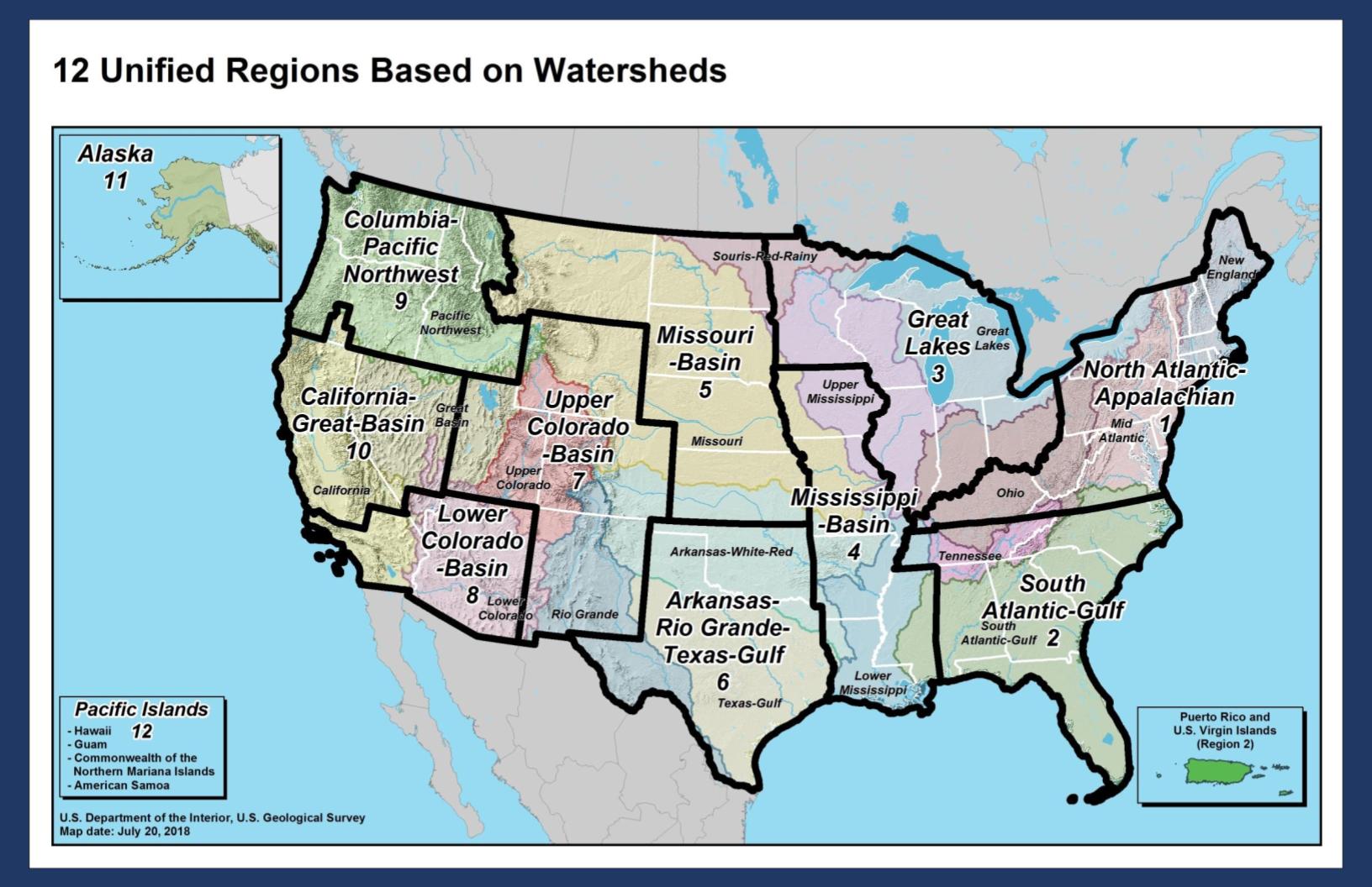
Welcome to the USGS Columbia-Pacific Northwest Region (DOI Region 9) website.  In conjunction with our adjacent Pacific Islands Region (DOI Region 12) our combined Northwest – Pacific Island Region spans more than 5000 miles and includes the states of Hawaii, Washington, Oregon, Idaho, and Western Montana and the United States Pacific Territories of American Samoa, Guam, and the Northern Marianas.

As the Nation's largest water, earth, and biological science and civilian mapping agency, USGS collects, monitors, analyzes, models, interprets, and communicates scientific information essential to better understanding and managing our ecosystems, water resources, energy and mineral resources, natural hazards, and natural resources.  Our diverse expertise enables us to carry out large-scale, multidisciplinary investigations and provide impartial scientific information to resource managers, planners, and other customers.

Representing two of the Department of the Department of Interior’s twelve regions, our combined Northwest – Pacific Island Region includes forty-four federally recognized tribes and over one hundred Native Hawaiian Organizations.  Our regional office administers seven science centers and provides support to the more than five hundred regional employees that conduct and support our scientific endeavors.  We hope you find our website to be a helpful gateway to the wide array of our scientific resources and we encourage you to connect with us.

Sincerely,

Dr. Jill Rolland

USGS Regional Director, Columbia-Pacific Northwest Region (Interior Region 9) & Pacific Islands Region (Interior Region 12)