
Water Temperature Data for Tantalus Creek Upstream from the Reservoir, Yellowstone National Park
This site collects water from all parts of the Norris Geyser Basin except The Gap and Hundred Springs Plain.
The temperature is measured immediately prior to where the Creek enters the lake-like water body known as The Reservoir. The site is off-limits to the public and is surrounded by unstable thermal ground. Click the site name to access the temperature graphs.

These temperatures reflect both meteorological conditions (solar radiation and air temperature) and the amount of flow from nearby thermal features. Rapid temperature increases can reflect geyser eruptions or other changes in water discharge. Rapid temperature drops may be caused by precipitation. Comparison of the different channel temperatures (as well as the air-temperature control station) can reveal specific parts of the basin affected by increased hydrothermal discharge.
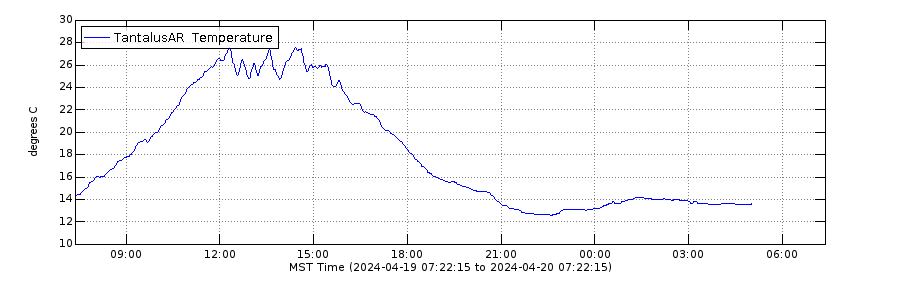
Daily Temperature Graph
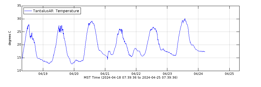
Weekly Temperature Graph
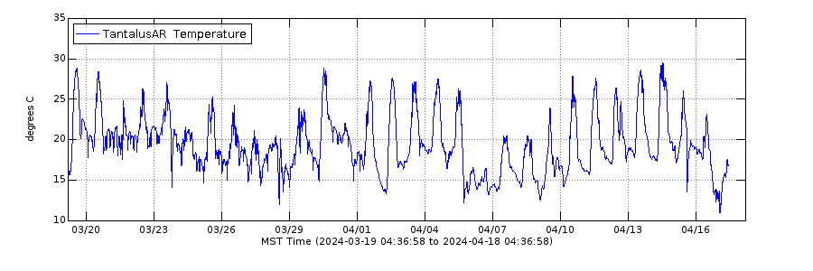
Monthly Temperature Graph
Additional Information
This site collects water from all parts of the Norris Geyser Basin except The Gap and Hundred Springs Plain.
The temperature is measured immediately prior to where the Creek enters the lake-like water body known as The Reservoir. The site is off-limits to the public and is surrounded by unstable thermal ground. Click the site name to access the temperature graphs.
These temperatures reflect both meteorological conditions (solar radiation and air temperature) and the amount of flow from nearby thermal features. Rapid temperature increases can reflect geyser eruptions or other changes in water discharge. Rapid temperature drops may be caused by precipitation. Comparison of the different channel temperatures (as well as the air-temperature control station) can reveal specific parts of the basin affected by increased hydrothermal discharge.
Daily Temperature Graph
Weekly Temperature Graph
Monthly Temperature Graph