



3D National Topography Model Data Acquisition Project Tracker (3DNTM Tracker) Now Available
USGS released a web tool that provides up-to-date status information about 3D Elevation Program (3DEP) lidar data acquisition projects, including when data will become publicly available on The National Map.
This tool responds to a common question from the 3DEP elevation data user community: “When will the data for my area of interest be available?”
With the interactive map and dashboard, users can:
- View the status of active and recently completed lidar projects
- Access project completion estimates
- Track progress through key project milestones
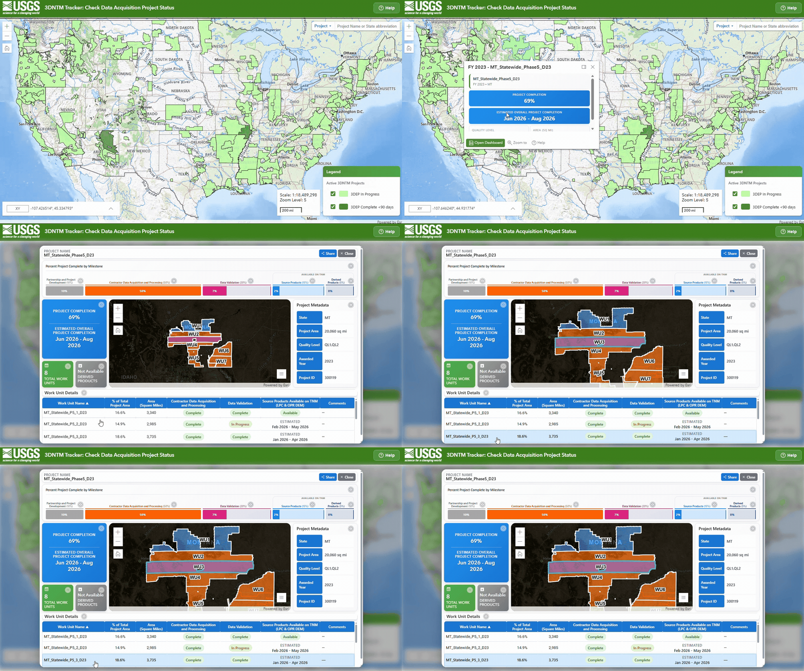
Estimated project timelines are based on typical data acquisition schedules but may be affected by factors such as weather, airspace restrictions, or data errors requiring multiple correction cycles.
Projects remain visible for 90 days post-publication. For information about all published projects and to access the data, please visit The National Map Downloader or the 3DEP Lidar Explorer.
The application currently focuses on 3DEP lidar projects, with the potential to expand coverage to include 3D Hydrography Program (3DHP) data acquisition projects. For more information about key milestones in the lifecycle of a lidar or 3DHP data acquisition project, from inception to publication, visit 3D National Topography Model (3DNTM Project Lifecycle & Milestones).
Access the Beta release of the 3DNTM Tracker
Questions or feedback about the 3DNTM Tracker or geospatial data acquisition projects can be submitted to TNMHelp@usgs.gov.