
California Waters – Spring 2026 - Vol. VI | Issue I
As we welcome the Spring 2026 edition of California Waters, I am confident that the USGS California Water Science Center’s commitment to scientific excellence, innovation, and collaboration will help chart the course for understanding and stewarding our water systems in the decades to come. This issue reflects a season of meaningful progress—from advancing our understanding of harmful algal blooms and celebrating new field and project office milestones, to deepening our insights into groundwater trends, watershed change, and species conservation. Across the state and working with many partners, our teams are producing data, tools, and research that not only illuminate California’s dynamic water systems but also support communities, resource managers, and decision‑makers who rely on high-quality science every day. I hope you enjoy exploring these stories and the important work they represent.
Anke Mueller-Solger, PhD
Center Director
California Water Science Center
Predicting Harmful Algal Blooms and Toxicity in the San Francisco Estuary
In fall 2023, National Oceanic and Atmospheric Administration (NOAA) awarded a five‑year, $3 million Monitoring and Event Response Research Program (MERHAB) grant to improve Harmful Algal Bloom (HAB) detection in the San Francisco Estuary.

Decadal trends in the quality of groundwater used for public drinking-water supply in California, 2004–2023, California groundwater ambient monitoring and assessment program, priority basin project
This study provides a comprehensive assessment of decadal changes in the quality of groundwater used for public drinking-water supply at 444 monitoring sites across California during 2004–2023. We assessed decadal step trends in groundwater quality for 145 water-quality constituents and geochemical indicators statewide and across geographic and land-use based network groups. We evaluated...
Revisiting chlorophyll a thresholds for San Francisco Bay: Insights from observations of phytoplankton molecular abundance
Harmful Algal Blooms (HABs) are a hazard for coastal environments worldwide; identifying screening thresholds of chlorophyll-a (chl-a) associated with increased risk of HABs is a management priority. Molecular surveillance of coastal phytoplankton and bivalve biotoxins could be used to link chl-a with HAB risk, but requires an understanding of whether the HAB risks increase uniformly as...
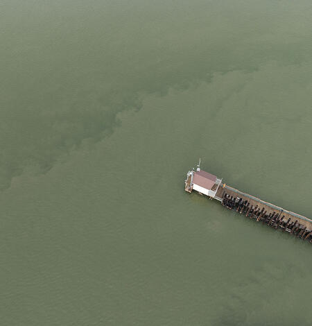
West Sacramento Projects Office Facility
Inside the West Sacramento Projects Office CAWSC Facility: A Hub for Innovation, Field Science, and Collaboration
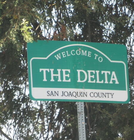
Recent scientific contributions by the U.S. Geological Survey in the San Francisco Bay and Sacramento–San Joaquin Delta Estuary
Introduction The San Francisco Bay and Sacramento–San Joaquin Delta Estuary (hereafter, Bay-Delta) is the largest estuary on the West Coast of the United States. The Bay-Delta covers more than 1,600 square miles and drains a watershed of more than 75,000 square miles, which is greater than 40 percent of California. The region surrounding the Bay-Delta is home to about 10 million people...

Los Angeles River Suspended Sediment Concentration Data, April 2021- November 2023
The Los Angeles River flows through a heavily urbanized area and the river is managed for multiple uses, including flood control, habitat, and recreation. The objective of this study was to collect data on stream flow and suspended sediment concentrations (SSC) at sites along the Los Angeles River and its tributaries in the Sepulveda Flood Control Basin (SFCB) to better understand...
Barka Slough Hydrology and Biology Explorer
Barka Slough is a historically perennial wetland located at the downstream western end of California's San Antonio Creek Valley watershed. Plant and animal species in the area are experiencing impacts from habitat changes. The tool lets users explore and enhance the understanding of the hydrology and biology of the slough.
New USGS California Water Science Center Field Office
San Luis Obispo has its grand opening
Upper Feather River Watershed 30-meter Basin Characterization Model - Monthly Historical Climate and Hydrology
This data release includes the revised downscaled climate inputs and hydrologic outputs from the Basin Characterization Model (BCM) version 8 (v8), described in Flint and others (2021a), in a 30 by 30-meter spatial resolution at a monthly time step from water years 1896 to 2024 for the upper Feather River watershed. This data release includes five child items: 1. 30-year summaries, 2...
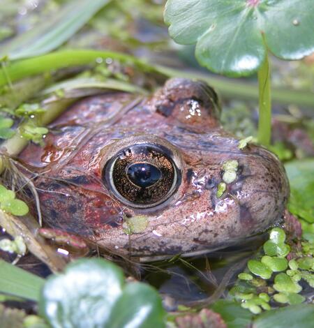
Conducting feasibility assessments of potential conservation reintroductions: A case study with the imperiled foothill yellow-legged frog, Rana boylii
Conservation translocations are an increasingly common and often necessary component of recovering species that have become extirpated from portions of their range. Understanding and ameliorating potential threats that reduce the likelihood of successful population establishment at recipient sites is a key component of successful translocation planning. We examined multiple potential...
Mercury, methylmercury, and related geochemical data from incubations of materials flocculated in mesocosms within the Cache Creek Settling Basin, California
The U.S Geological Survey (USGS) is assessing the potential for in-situ addition of metal-based coagulants to enhance mercury (Hg) capture in the Cache Creek Settling Basin (CCSB), a wetland-like environment designed to trap mercury-contaminated sediments from upstream historical mining activities in the Cache Creek watershed. Laboratory and field tests by the USGS show that three tested
Indigenous communities and migratory pathways
Connecting Hawaiian and Alaskan cultures through birds
Effect of passive integrated transponder tag size on survival, tag loss, and growth of Santa Ana Sucker
ObjectiveThe Santa Ana Sucker Pantosteus santaanae is endemic to southern California and is listed as threatened under the U.S. Endangered Species Act. Seasonal limitations on conventional sampling and inconsistencies in survey methodologies have led to an incomplete understanding of population dynamics. Alternative sampling methods have the potential to fill important knowledge gaps in...
Multi-Year USGS and State Collaboration
A new publication from the U.S. Geological Survey and the California Department of Water Resources summarizes multiple years of collaborative work between the two agencies in the northern Sacramento–San Joaquin Delta.
Mercury, methylmercury, and related geochemical data from incubations of materials flocculated in mesocosms within the Cache Creek Settling Basin, California
The U.S Geological Survey (USGS) is assessing the potential for in-situ addition of metal-based coagulants to enhance mercury (Hg) capture in the Cache Creek Settling Basin (CCSB), a wetland-like environment designed to trap mercury-contaminated sediments from upstream historical mining activities in the Cache Creek watershed. Laboratory and field tests by the USGS show that three tested
Hydrogeologic characterization of the Cahuilla Valley and Terwilliger Valley Groundwater Basins, Riverside County, California
The relation between the groundwater and the amount of natural recharge to the Cahuilla Valley and Terwilliger Valley groundwater basins is not well understood. During the 20th century, the reliance on groundwater near Anza, California, used for agricultural, domestic, and municipal reasons has increased, and there is the potential for changes in groundwater availability related to...
Evaluation of water quality in the Langford Valley–Irwin Groundwater Subbasin, Fort Irwin National Training Center, California, 1993–2019
The U.S. Army Fort Irwin National Training Center (NTC), 120 miles northeast of Los Angeles in the Mojave Desert of California, obtains its potable water supply from the Bicycle Valley and Langford Valley groundwater basins; Langford Valley groundwater basin is further subdivided into the Langford Well Lake and Irwin groundwater subbasins. The Irwin groundwater subbasin contains younger
Assessing future hydrologic extremes using an integrated hydrology and river operations model in the Russian River watershed
Study regionThe Russian River watershed, situated in coastal, northern California, experiences hydrologic extremes, including periodic droughts and flooding. Water managers are working to maintain sustainable water supplies and environmental flows, while mitigating flood risks.Study focusThis paper introduces an integrated hydrology and river operations model for the Russian River...