
Boats, Trains, and Automobiles: A Historic Snapshot of Connecticut River Infrastructure
Looking across the Connecticut River from a USGS streamgage in Suffield, Connecticut, you can see structural remnants from the past and present infrastructure that have shaped and affected the river.
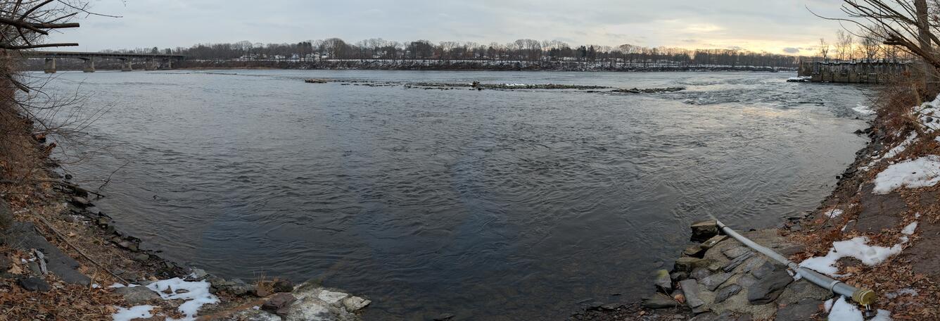
From the vantage point of the streamgage, scanning from right to left, you can see how transportation priorities have changed over time – shifting from boats traveling through a canal system, to a railroad, and ultimately to a highway.
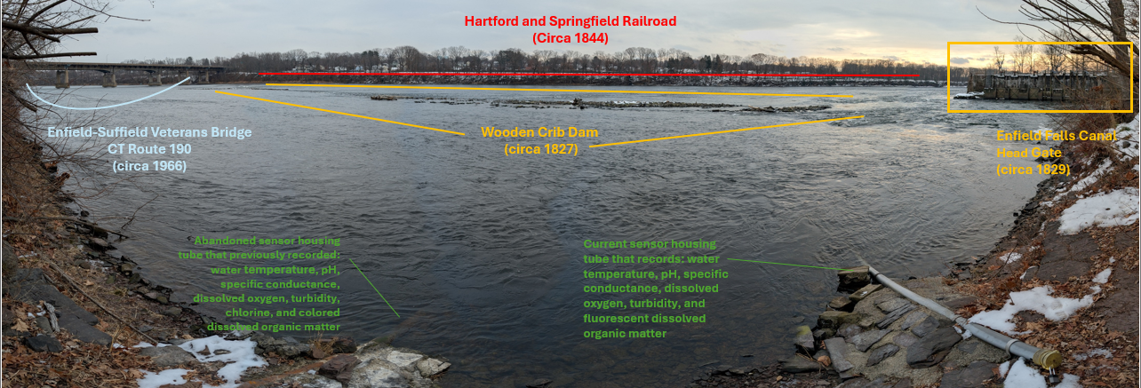
The remains of a wooden crib dam built in 1827 across the Connecticut River (are visible in this photo diagonally across the center of the river). This dam ensured the Enfield Falls Canal had the right water levels. The large gate structure (visible on the right of the photo) is the entrance to the canal. This gate allowed the precise control of water flow into the canal locks chambers. The canal allowed large boats (up to 90 feet-long and 20 feet-wide) returning from Long Island Sound to bypass the Connecticut River's first large falls, the Enfield Rapids, between Hartford, Connecticut, and Springfield, Massachusetts. Along its 5.25-mile course, through the current Connecticut towns of Suffield and Windsor Locks, the canal had a 32-foot vertical drop. Windsor Locks was originally a settlement sprung up around the water-powered factories built near the outlet of the canal. The “locks” controlled the water level at the outflow of the canal, which can still be seen just north of the I-91 bridge on the west side of the river.
Fifteen years after the canal began operating in 1844, the construction of the Hartford and Springfield Railroad (visible on the far riverbank at the top of this photo) gradually replaced the need for the transportation of goods and people along the Enfield Falls Canal. Yet, the canal continued to provide waterpower for mills and factories in Windsor Locks, up to a peak of 13 separate facilities in 1875, with one factory still using hydropower from the canal to this day.
The Enfield-Suffield Veterans Bridge (seen at the top left of this photo) was built in 1966 and represents another shift in the transportation needs of the area, as car travel began to replace train travel. In the decades after this bridge's construction, the dam and locks fell into disrepair. A rockslide between lock gates prevents boat travel along the canal. Breaches in the dam mean the average water level has dropped over the years as successive flood waves have scoured wood and stone from the wooden crib dam structure.
Since 1928, USGS streamgage, 01184000 Connecticut River at Thompsonville, Connecticut, has monitored the impact this dam and its erosion has on the water level and flow along this stretch of the river. (The brown and gray pipes on the bottom left and bottom right of the photo house some of the streamgage sensors). Gage height, discharge, water temperature, barometric pressure, specific conductance, dissolved oxygen, pH, dissolved organic matter fluorescence (fDOM), turbidity, and nitrate plus nitrite concentrations are all monitored in real-time at this site in cooperation with the Connecticut Department of Energy & Environmental Protection.
Bonus Trivia: Despite the streamgage structure always residing in Suffield, CT, the “at Thompsonville, CT” part of the name comes from the convention at the time of using the town of the closest US Postal Service Office.