USGS Predicts PFAS in Shallow Soils Throughout Northern New England and Identifies Possible Groundwater Risks
A U.S. Geological Survey (USGS) study across multiple states has found widespread presence of per- and polyfluoroalkyl substances (PFAS) in shallow soils in areas not associated with known contamination sources. The scientists also found that areas with lower concentrations in soils could have more PFAS in the groundwater.
“In an area where many residents get their drinking water from the groundwater, knowing how geology, soil pH, and climate can impact the contaminant levels of PFAS in rural New England and identifying what areas are most susceptible to PFAS pollution is a powerful tool,” said lead author, USGS research hydrologist Andrea Tokranov.
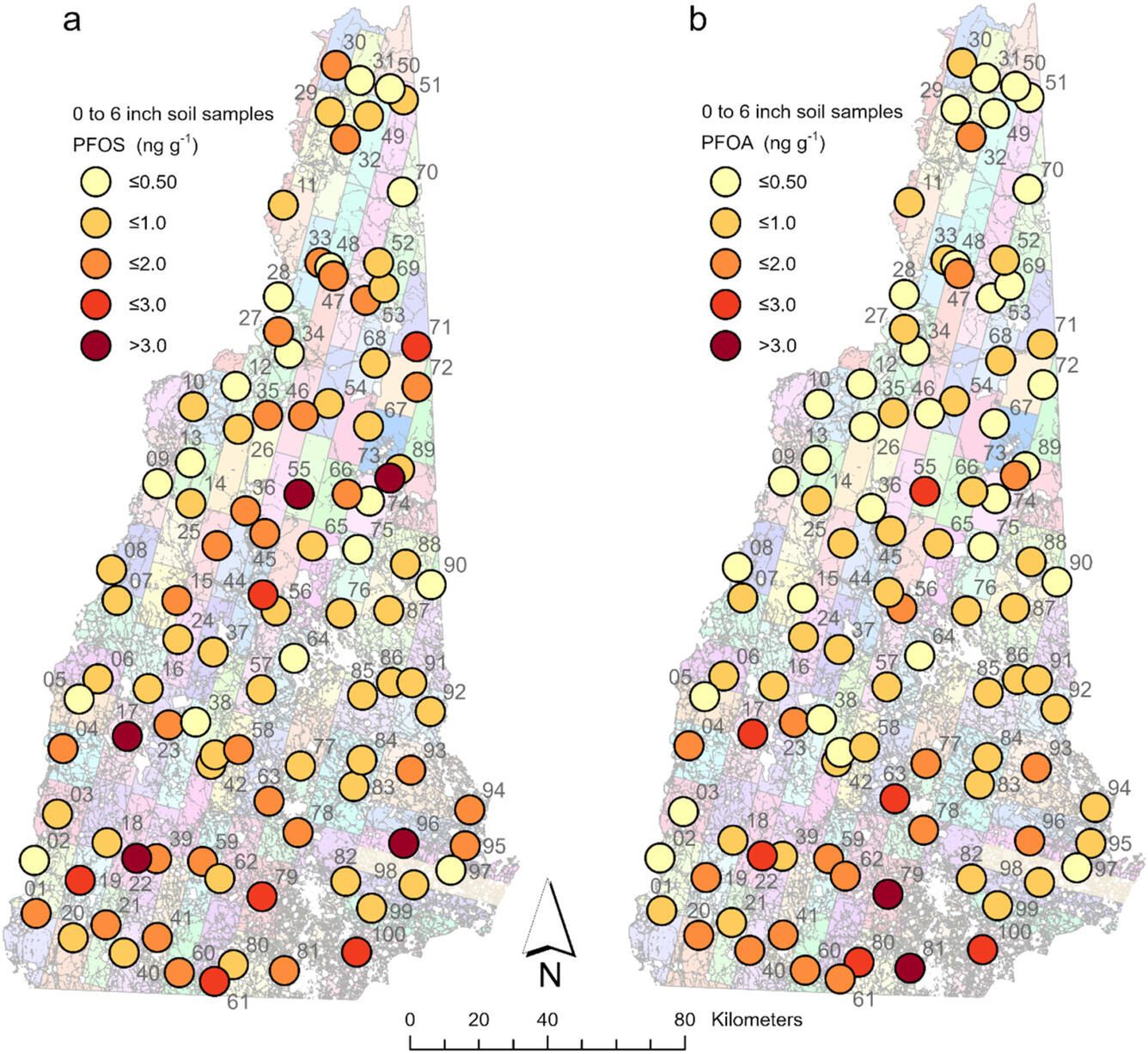
PFAS are manmade chemicals used for their water-resistant and nonstick properties that have been linked to various public health and environmental concerns, according to the U.S. Environmental Protection Agency (EPA). This study, published in Environmental Science & Technology, used advanced modeling techniques to predict background PFAS concentrations in shallow soils across Maine, Vermont, and New Hampshire. PFAS background concentrations in soil originate from atmospheric deposition, the process where PFAS travels through the air and either directly deposits from the air onto the ground or falls to the earth’s surface via rain or snowfall. This type of PFAS presence, where there is no known source of pollution like an industrial release or spill, is known as “anthropogenic background.”
“As the first regional model to predict PFAS background levels in soils, states can use this as a tool to better protect public health,” said Tokranov. “These findings ultimately confirm far-reaching PFAS presence in shallow soils, even in rural areas. Decision-makers can use this predictive map of PFAS background levels as baseline for where soil and groundwater monitoring should be prioritized. Site managers may find utility in comparing their site concentrations to the model to determine if their values are elevated above predicted anthropogenic background.”
What did we learn?
The model predicted that approximately 73% of the soils in Maine, Vermont, and New Hampshire exceed the New Hampshire Soil Remediation Standard threshold for PFOS, and about 41% exceed the threshold for PFOA.
The study also found that the areas where PFAS levels were lower in the soils may indicate a greater chance of PFAS contamination in the groundwater. This is because soils with higher pH and lower organic carbon tend to allow PFAS to leach through the soil and potentially reach aquifers instead of accumulating in the soil. In areas where groundwater is used for drinking water, this is potentially consequential to public health and may merit further investigation. Additionally, because bedrock containing calcareous minerals, such as calcite, can create higher pH soils, PFAS is more frequently detected in groundwater wells in these areas, according to the model.
How this Predictive Model Can Support PFAS Understanding
“Understanding the distribution of background PFAS in shallow soils and groundwater in northern New England will support agencies in making management decisions and determine what further scientific investigations are needed in certain areas as we continue to learn about how PFAS move in the environment,” said Tokranov.
Read the full report here.