



Evaluation of a Eutrophication Beneficial Use Impairment in the Grand Calumet River Area of Concern in Northwest Indiana
In cooperation with the Indiana Department of Environmental Management and the U.S. Environmental Protection Agency
BACKGROUND
In 1972 the Great Lakes Water Quality Agreement was established between the United States and Canada (the “Parties”). In the 1987 amendment to the Agreement, the Parties agreed to develop and implement Remedial Action Plans (RAPs) to address forty-three Areas of Concern (AOC) designated within the Great Lakes Basin (Indiana Department of Environmental Management, 2012). These AOCs were identified as having at least one impairment to the fourteen beneficial uses of the Great Lakes ecosystem. All fourteen beneficial use impairments (BUI) were determined to be present in the Grand Calumet River and Indiana Harbor Ship Canal, including a eutrophication, or undesirable algae beneficial use impairment (BUI 8).
Spring and summer seasonal data and analyses were needed during a two-year period for Indiana Department of Environmental Management (IDEM) to evaluate conditions related to the eutrophication beneficial use impairment in the Grand Calumet River (GCR) and Indiana Harbor Canal (IHC) and related sites in the Grand Calumet River/Indiana Harbor Canal AOC in northwest Indiana. In particular, water quality and biological data were needed to evaluate conditions relative to BUI 8 for segments of the GCR and IHC that are defined as impaired relative to BUI 8.
APPROACH
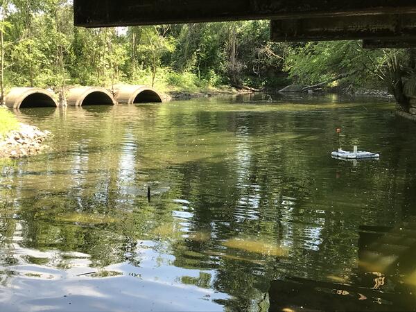
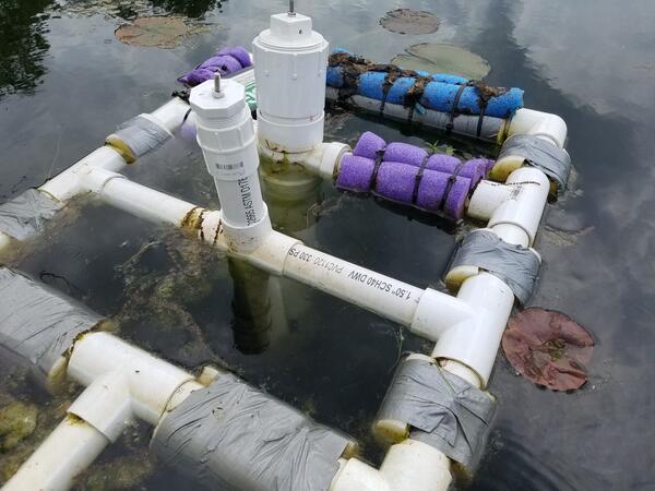
The U.S. Geological Survey, Ohio-Kentucky-Indiana Water Science Center, in cooperation with IDEM and the U.S. Environmental Protection Agency, collected continuous, probe-based measurements of dissolved oxygen (DO) and water temperature at 13 sites in the Grand Calumet River/Indiana Harbor Canal AOC in the spring of 2021 and at 5 sites in 2022 (Figure 1; Table 1). Other data being collected include continuous, probe-based chlorophyll measurements at four sites and continuous total algae measurements at one site. Links to USGS Water Data for the Nation site pages where the data is available for viewing and downloading are available in Table 1. In addition to continuous monitoring, discrete water quality samples were collected at 4 sites in 2022. These samples were analyzed for nutrients, biological oxygen demand, chemical oxygen demand, and isotopes of hydrogen, oxygen, and nitrogen. This data was used to further understand nutrient levels in the Grand Calumet River and Indiana Harbor Canal and to identify nitrate sources at each site.
Field visits to sites included observations by USGS personnel of the presence of blue-green algae or filamentous Cladophora blooms. This project also used other continuous data from USGS monitored sites on the IHC at Canal Street[1] and on the Grand Calumet River at Columbia Avenue[2] as comparison records for these sites.
A coordinated genomic-based assessment (Piredda and others, 2018; Wolf and Vis, 2020) was also be undertaken with U.S. Geological Survey, Great Lakes Science Center at a subset of five sites where physical continuous measurements of dissolved oxygen and temperature are planned in order to characterize algal communities related to eutrophic conditions, including species associated with harmful algal blooms and nuisance algae. Sampling and characterization of algal communities at peak photosynthetic periods is planned for three different periods in 2021.

Table 1. Monitoring site names, locations and available data types. Bolded sites are those with data in 2021 and 2022.
DO, Dissolved oxygen; Q, Discharge; GH, Gage height; SC, Specific conductance; fChl, Chlorophyll fluorescence; fPC, Phycocyanin fluorescence; Turb, Turbidity; Comm, Community algal information
| Map Number | Agency Code | USGS Site Identifier | Station Name | Available data types | Links to USGS Water Data For the Nation |
|---|---|---|---|---|---|
| 1 | USGS | 413722087304901 | GRAND CALUMET RIVER AT SOHL AV AT HAMMOND, IN | DO, T | Link to data |
| 2 | USGS | 05536356 | GRAND CALUMET RIVER AT COLUMBIA AV AT HAMMOND, IN | DO, T, Q, GH, SC, pH, fChl, fPC, Turb, Comm; discrete water quality sampling | Link to data |
| 3 | USGS | 413651087285001 | GRAND CALUMET R AT INDPLS BLVD AT EAST CHICAGO, IN | DO, T | Link to data |
| 4 | USGS | 413656087272301 | GRAND CALUMET R NR KENNEDY AV AT EAST CHICAGO, IN | DO, T | Link to data |
| 5 | USGS | 413646087260101 | GRAND CALUMET R AT CLINE AV AT EAST CHICAGO, IN | DO, T; discrete water quality sampling | Link to data |
| 6 | USGS | 04092677 | GRAND CALUMET RIVER AT INDUSTRIAL HWY AT GARY, IN | DO, T, Q, GH, fChl, Comm | Link to data |
| 7 | USGS | 413632087221900 | GRAND CALUMET RIVER AT BRIDGE ST AT GARY, IN | DO, T | Link to data |
| 8 | USGS | 413626087211101 | GRAND CALUMET RIVER AT BUCHANAN ST AT GARY, IN | DO, T | Link to data |
| 9 | USGS | 413628087201401 | GRAND CALUMET RIVER AT BROADWAY ST AT GARY, IN | DO, T | Link to data |
| 10 | USGS | 413859087302901 | DRAINAGE DITCH NEAR LAKE GEORGE AT HAMMOND, IN | DO, T, Comm | Link to data |
| 11 | USGS | 413704087153501 | GRAND CALUMET LAGOON AT MARQUETTE PARK AT GARY, IN | DO, T, fChl, Comm; discrete water quality sampling | Link to data |
| 12 | USGS | 413745087281601 | IHC AT CHICAGO AV AT EAST CHICAGO, IN | DO, T | Link to data |
| 13 | USGS | 04092750 | INDIANA HARBOR CANAL AT EAST CHICAGO, IN | DO, T, Q, GH, SC, pH, fChl, Turb, Comm; discrete water quality sampling | Link to data |
In cooperation with the Indiana Department of Environmental Management and the U.S. Environmental Protection Agency
BACKGROUND
In 1972 the Great Lakes Water Quality Agreement was established between the United States and Canada (the “Parties”). In the 1987 amendment to the Agreement, the Parties agreed to develop and implement Remedial Action Plans (RAPs) to address forty-three Areas of Concern (AOC) designated within the Great Lakes Basin (Indiana Department of Environmental Management, 2012). These AOCs were identified as having at least one impairment to the fourteen beneficial uses of the Great Lakes ecosystem. All fourteen beneficial use impairments (BUI) were determined to be present in the Grand Calumet River and Indiana Harbor Ship Canal, including a eutrophication, or undesirable algae beneficial use impairment (BUI 8).
Spring and summer seasonal data and analyses were needed during a two-year period for Indiana Department of Environmental Management (IDEM) to evaluate conditions related to the eutrophication beneficial use impairment in the Grand Calumet River (GCR) and Indiana Harbor Canal (IHC) and related sites in the Grand Calumet River/Indiana Harbor Canal AOC in northwest Indiana. In particular, water quality and biological data were needed to evaluate conditions relative to BUI 8 for segments of the GCR and IHC that are defined as impaired relative to BUI 8.
APPROACH
The U.S. Geological Survey, Ohio-Kentucky-Indiana Water Science Center, in cooperation with IDEM and the U.S. Environmental Protection Agency, collected continuous, probe-based measurements of dissolved oxygen (DO) and water temperature at 13 sites in the Grand Calumet River/Indiana Harbor Canal AOC in the spring of 2021 and at 5 sites in 2022 (Figure 1; Table 1). Other data being collected include continuous, probe-based chlorophyll measurements at four sites and continuous total algae measurements at one site. Links to USGS Water Data for the Nation site pages where the data is available for viewing and downloading are available in Table 1. In addition to continuous monitoring, discrete water quality samples were collected at 4 sites in 2022. These samples were analyzed for nutrients, biological oxygen demand, chemical oxygen demand, and isotopes of hydrogen, oxygen, and nitrogen. This data was used to further understand nutrient levels in the Grand Calumet River and Indiana Harbor Canal and to identify nitrate sources at each site.
Field visits to sites included observations by USGS personnel of the presence of blue-green algae or filamentous Cladophora blooms. This project also used other continuous data from USGS monitored sites on the IHC at Canal Street[1] and on the Grand Calumet River at Columbia Avenue[2] as comparison records for these sites.
A coordinated genomic-based assessment (Piredda and others, 2018; Wolf and Vis, 2020) was also be undertaken with U.S. Geological Survey, Great Lakes Science Center at a subset of five sites where physical continuous measurements of dissolved oxygen and temperature are planned in order to characterize algal communities related to eutrophic conditions, including species associated with harmful algal blooms and nuisance algae. Sampling and characterization of algal communities at peak photosynthetic periods is planned for three different periods in 2021.
Table 1. Monitoring site names, locations and available data types. Bolded sites are those with data in 2021 and 2022.
DO, Dissolved oxygen; Q, Discharge; GH, Gage height; SC, Specific conductance; fChl, Chlorophyll fluorescence; fPC, Phycocyanin fluorescence; Turb, Turbidity; Comm, Community algal information
| Map Number | Agency Code | USGS Site Identifier | Station Name | Available data types | Links to USGS Water Data For the Nation |
|---|---|---|---|---|---|
| 1 | USGS | 413722087304901 | GRAND CALUMET RIVER AT SOHL AV AT HAMMOND, IN | DO, T | Link to data |
| 2 | USGS | 05536356 | GRAND CALUMET RIVER AT COLUMBIA AV AT HAMMOND, IN | DO, T, Q, GH, SC, pH, fChl, fPC, Turb, Comm; discrete water quality sampling | Link to data |
| 3 | USGS | 413651087285001 | GRAND CALUMET R AT INDPLS BLVD AT EAST CHICAGO, IN | DO, T | Link to data |
| 4 | USGS | 413656087272301 | GRAND CALUMET R NR KENNEDY AV AT EAST CHICAGO, IN | DO, T | Link to data |
| 5 | USGS | 413646087260101 | GRAND CALUMET R AT CLINE AV AT EAST CHICAGO, IN | DO, T; discrete water quality sampling | Link to data |
| 6 | USGS | 04092677 | GRAND CALUMET RIVER AT INDUSTRIAL HWY AT GARY, IN | DO, T, Q, GH, fChl, Comm | Link to data |
| 7 | USGS | 413632087221900 | GRAND CALUMET RIVER AT BRIDGE ST AT GARY, IN | DO, T | Link to data |
| 8 | USGS | 413626087211101 | GRAND CALUMET RIVER AT BUCHANAN ST AT GARY, IN | DO, T | Link to data |
| 9 | USGS | 413628087201401 | GRAND CALUMET RIVER AT BROADWAY ST AT GARY, IN | DO, T | Link to data |
| 10 | USGS | 413859087302901 | DRAINAGE DITCH NEAR LAKE GEORGE AT HAMMOND, IN | DO, T, Comm | Link to data |
| 11 | USGS | 413704087153501 | GRAND CALUMET LAGOON AT MARQUETTE PARK AT GARY, IN | DO, T, fChl, Comm; discrete water quality sampling | Link to data |
| 12 | USGS | 413745087281601 | IHC AT CHICAGO AV AT EAST CHICAGO, IN | DO, T | Link to data |
| 13 | USGS | 04092750 | INDIANA HARBOR CANAL AT EAST CHICAGO, IN | DO, T, Q, GH, SC, pH, fChl, Turb, Comm; discrete water quality sampling | Link to data |