



SAWSC Hydrologist Presents at the Biennial Okefenokee Science Symposium
SAWSC Hydrologist Greg Cherry was invited to speak at the Biennial Okefenokee Science Symposium. Cherry presented on the Floridan aquifer system in Coastal Georgia and issues with saltwater intrusion in the Savannah/Hilton Head area and near downtown Brunswick, Georgia.
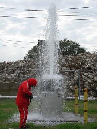
The Biennial Okefenokee Science Symposium brings together researchers, students, conservation professionals, and community members to explore the state of the science in the Okefenokee Swamp ecosystem. Greg Cherry presented “Groundwater studies and data to help evaluate effects of water management practices in coastal Georgia” which presented a brief history of groundwater development in the area and the role of the USGS to evaluate the mechanisms of saltwater intrusion in areas of high pumping in the Upper Floridan aquifer.
Abstract: In 2006, the Georgia Environmental Protection Division (GaEPD) established a “red zone” in coastal Georgia in which pumping rates in the Upper Floridan aquifer (UFA) were capped at 2004 rates. The red zone includes all of Chatham County and the southern part of Effingham County. Pumping restrictions were implemented over concern of potential saltwater intrusion in the Savannah-Hilton Head Island area and plume migration toward a potentiometric low in the UFA located in the Savannah area. In the Brunswick/Glynn County area, saltwater has intruded into the UFA and formed a plume with high chloride concentrations near downtown Brunswick. Water-management practices and improved water conservation have resulted in a consistent decrease in groundwater use along coastal Georgia. Groundwater use in Chatham County decreased from 85.5 million gallons per day (Mgal/d) in 1990 to 68.2 Mgal/d in 2000, 54.3 Mgal/d in 2010, and 43.2 Mgal/d during 2020. Groundwater use in Glynn County decreased from 71.9 million gallons per day (Mgal/d) in 1990 to 53.7 Mgal/d in 2000, 49.0 Mgal/d in 2010, and 39.8 Mgal/d during 2020. Studies performed by the U.S. Geological Survey as part of the Georgia Coastal Sound Science Initiative (CSSI), a regional assessment of the FAS, site-specific assessments of the LFA, and ongoing work in the Brunswick/Glynn County area have provided new insight into multilayer groundwater-flow systems and better delineation of saltwater contamination through time in the UFA along coastal Georgia.
Groundwater Monitoring Program for the Brunswick-Glynn County Area, Georgia: Project Page