
Data Collection
Data Collection
Filter Total Items: 5

New study confirms loss of storage capacity in Lake Powell
Beginning in 2017, the U.S. Geological Survey, in cooperation with the Bureau of Reclamation, completed topobathymetric surveys of Lake Powell for the first update of elevation-area-capacity relationships since 1986. The recent report presents results of these surveys and comparisons with estimates from previous surveys. Current storage capacity at full pool (3702.91 feet above NAVD 88) is 25,160...
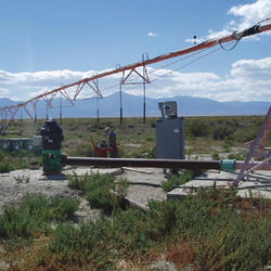
Groundwater Conditions in Utah
Since 1964, the U.S. Geological Survey, the Utah Department of Natural Resources, Division of Water Rights, and the Utah Department of Environmental Quality, Division of Water Quality have cooperatively published an annual report describing groundwater conditions in Utah. The annual paper reports provided data that enabled interested parties to maintain awareness of changing groundwater conditions...

Upper Colorado River Streamflow and Reservoir Contents
These reports summarize monthly data for selected rivers and reservoirs in the the Upper Colorado River Basin.

Lake Powell Coring
In response to the August 5, 2015, Gold King Mine Spill from the Bonita Peak Mining District that resulted in the release of three-million gallons of mine-impacted waters, the Utah Water Science Center, in partnership with the Utah Division of Water Quality, National Park Service, and U.S. Bureau of Reclamation, cored the San Juan and Colorado River deltas in multiple locations in Lake Powell...

Colorado Plateau Regional Groundwater Availability
Study goals This project seeks to quantify the status of groundwater as an integrated resource with surface water in the arid and semiarid region of the Colorado Plateau principal aquifer system. Surface-water resources that originate in this region are over allocated and serve 35 million people, 4.5 million acres of farmland, and are used to generate 12 billion kilowatt hours of electricity in...