U.S. flag

An official website of the United States government

Recharge

Filter Total Items: 2

Surface Water Gages in Utah

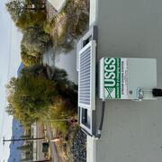
The Utah Water Science Center maintains approximately 187 real-time surface water gages. Of these, thirty-eight were established between June 2024 and September 2025, thanks to the dedication and fortitude of Utah Water Science Center Hydrologic Technicians in the Salt Lake City, Moab, and Cedar City Field Offices. This increase in the number of gages expanded the capability to monitor many more...
Surface Water Gages in Utah

Surface Water Gages in Utah

The Utah Water Science Center maintains approximately 187 real-time surface water gages. Of these, thirty-eight were established between June 2024 and September 2025, thanks to the dedication and fortitude of Utah Water Science Center Hydrologic Technicians in the Salt Lake City, Moab, and Cedar City Field Offices. This increase in the number of gages expanded the capability to monitor many more...
Learn More

Managed Aquifer Recharge

Sand Hollow Reservoir in Washington County, Utah, was completed in March 2002 and is operated for both surface-water storage and managed aquifer recharge via infiltration from surface basin spreading to the underlying Navajo Sandstone. From 2002 through 2014, about 216,000 acre-feet were diverted from the Virgin River to Sand Hollow Reservoir, and about 127,000 acre-feet of water seeped beneath...
Managed Aquifer Recharge

Managed Aquifer Recharge

Sand Hollow Reservoir in Washington County, Utah, was completed in March 2002 and is operated for both surface-water storage and managed aquifer recharge via infiltration from surface basin spreading to the underlying Navajo Sandstone. From 2002 through 2014, about 216,000 acre-feet were diverted from the Virgin River to Sand Hollow Reservoir, and about 127,000 acre-feet of water seeped beneath...
Learn More
Was this page helpful?