



The Issue:
Salmon and steelhead habitats in Skagit River tributaries face threats from stream drying, low flows, and high water temperatures.
How USGS will help:
USGS will identify vulnerable stream reaches using modeled data and field campaigns to inform conservation and restoration priorities.
Problem
Late‑summer low flows, stream drying, and high water temperatures threaten salmon and steelhead habitats in Skagit tributaries. The extent, drivers, and spatial patterns of these limiting conditions remain poorly documented, limiting the ability of managers to protect ESA‑listed populations.
Objectives
- Collect field data on flow presence and water temperature.
- Link vulnerability to geomorphic drivers.
- Provide baseline information to guide restoration, culvert prioritization, and long‑term monitoring.
Relevance and Benefits
Media
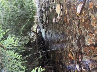
Sources/Usage: Public Domain. View Media Details
The project supports USGS Strategic Science Directions by improving climate‑ready water information, advancing ecological resilience, and delivering actionable decision support. Finding will inform restoration, improve understanding of flow permanence, and strengthen partnerships with tribes for protecting culturally important fisheries.
Approach
Use modeled data to identify vulnerable reaches, develop a stratified sampling plan, collect two years of flow and targeted temperature data, map conditions with FLOwPER data collection application for flow/no flow field observations, analyze geomorphic influences, coordinate with partners, and release data and an interpretive USGS report.
The Issue:
Salmon and steelhead habitats in Skagit River tributaries face threats from stream drying, low flows, and high water temperatures.
How USGS will help:
USGS will identify vulnerable stream reaches using modeled data and field campaigns to inform conservation and restoration priorities.
Problem
Late‑summer low flows, stream drying, and high water temperatures threaten salmon and steelhead habitats in Skagit tributaries. The extent, drivers, and spatial patterns of these limiting conditions remain poorly documented, limiting the ability of managers to protect ESA‑listed populations.
Objectives
- Collect field data on flow presence and water temperature.
- Link vulnerability to geomorphic drivers.
- Provide baseline information to guide restoration, culvert prioritization, and long‑term monitoring.
Relevance and Benefits
Media
Sources/Usage: Public Domain. View Media Details
The project supports USGS Strategic Science Directions by improving climate‑ready water information, advancing ecological resilience, and delivering actionable decision support. Finding will inform restoration, improve understanding of flow permanence, and strengthen partnerships with tribes for protecting culturally important fisheries.
Approach
Use modeled data to identify vulnerable reaches, develop a stratified sampling plan, collect two years of flow and targeted temperature data, map conditions with FLOwPER data collection application for flow/no flow field observations, analyze geomorphic influences, coordinate with partners, and release data and an interpretive USGS report.