Geology of Grand Teton National Park
Grand Teton National Park Geology

Geologic History
The towering mountains of Grand Teton National Park contain some of the oldest rocks in North America, but the forces that lifted the Teton Range are geologically recent. The processes of metamorphism, mountain building, and glaciation are all part of the geologic history of the Teton Range.
Approximately 2.7 billion years ago seafloor sediments and volcanic debris were buried up to 20 miles deep due to the collision of tectonic plates. The heat and pressure from the collision changed the sediments and volcanic debris into a metamorphic rock called gneiss, a type of rock where light and dark minerals are separated into distinct layers. The rocks along the trail to Inspiration Point, one of the most popular trails within the park, are composed of gneiss.

Right – Mount Moran contains basement rock, diabase, and sedimentary sandstone. NPS

Magma infiltrated cracks and weak zones in the gneiss 2.5 billion years ago, cooled slowly and formed the igneous rock granite. Many of the highest peaks within the Teton Range are made of granite, including Grand Teton, Middle Teton, Mount Owen Teewinot, and Mount Moran. Other peaks contain granite and gneiss, where the granite cross-cuts the gneiss.

About 775 million years ago, the region was stretched in a north-south direction, forming vertical cracks that trend east-west. Iron-rich magma squirted into these cracks, forming black diabase dikes. Diabase is an igneous rock with a composition similar to basalt, that crystalizes below the surface, forming a fine-grained texture. Mount Moran has a prominent diabase dike, 150 feet wide which stands out for its color, and also because diabase is more resistant to erosion than the surrounding gneiss.
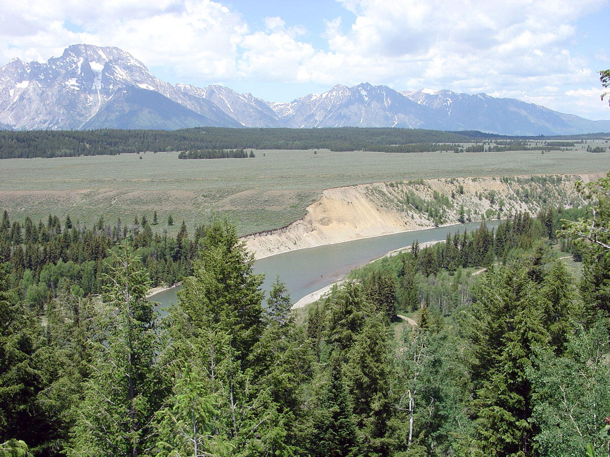
Lying on top of the igneous and metamorphic rocks are sedimentary rocks that formed when global sea levels rose 510 million years ago. First the beach sands of the Flathead Sandstone were deposited and subsequently limestones were deposited in shallow seas. Finally, mudstones were deposited on a deeper ocean floor. Fossils are found within these seafloor rocks, including trilobites, stromatolites, corals, and shells.
A tectonic plate subducted under the west coast of present-day North America beginning 120 million years ago, generating mountains farther inland. Around 70 million years ago mountain building reached the Rocky Mountains and Gros Ventre Range, causing large blocks of bedrock to be thrusted upwards. Eruptions of lava from volcanoes occurred throughout the region as the Rocky Mountain uplift ended, and leftover heat from these events caused the Earth’s crust to expand, eventually causing it to break. These blocks of the Earth’s crust slide past each other on faults, such as the Teton Fault.

Approximately 10 million years ago the Teton Fault began to move triggering a series of earthquakes. This movement tilted the mountain block upward, while down-dropping the valley block. These were large earthquakes, up to a magnitude 7.5, and offset the Earth’s surface by up to 10 feet. The total offset on the Teton fault is almost 30,000 feet. The Teton fault can be seen from the Cathedral Group Turnout on the Jenny Lake Scenic Loop. The last major earthquakes to occur on the Teton Fault were 4,800 and 8,000 years ago, but this fault is still active and can produce major earthquakes.
Grand Teton National Park is located near Yellowstone National Park. Beneath Yellowstone is a hotspot, a surface-level expression of a mantle plume. The Yellowstone hotspot erupted west of the Teton Range five million years ago, triggering earthquakes and causing further uplift along the Teton Range. The Yellowstone hotspot has erupted three times between two million and 640,000 years ago, and on top of Signal Mountain in Grand Teton National Park deposits from these eruptions can be seen by park visitors.
Earth’s climate began to cool significantly two million years ago causing glaciation within Grand Teton National Park, including the last two glacial advances, the Pinedale and the Bull Lake glaciations. The Pinedale occurred 50,000 to 14,000 years ago and formed Jackson Lake. The Bull Lake glaciation occurred 200,000 years ago and buried Jackson in 1,500 feet of ice. Much of the striking scenery within Grand Teton National Park was sculpted by glaciers. These glaciers have carved out channels across the valley floor, washed away soil, and have in turn affected the ecology seen today within Grand Teton National Park. Unglaciated stream drainages are V-shaped, and the glacial events transformed these drainages into U-shaped valleys.
Glaciers Today
Today more than eight feet of snow coat Grand Teton National Park during the winter. Snow begins to melt in the spring, but some snow remains all year long. This snow accumulates, and the weight of the accumulate snow compresses to become ice. Since this compacted ice is so heavy, the ice sheet starts to slowly slide downhill where the land is sloped, forming a glacier where snowfall exceeds melting. As the glaciers move, they scrape the rocks below and that rocky material is carried downslope within and on top of the glacial ice. This material is deposited at its terminus, or end point, creating ridges of unsorted sediment called moraines.

There are as many as 11 active glaciers with Grand Teton National Park, ten of which are named. The named glaciers are as follows: Teton, Middle Teton, Teepee, Schoolroom, Petersen, Falling Ice, Skillet, and East, Middle, and West Trip Glaciers. Several glaciers can be seen from the road, including Teton Glacier, Falling Ice Glacier, and Skillet Glacier. Today many of the glaciers within Grand Teton National Park are retreating, and some of these glaciers may have lost enough ice volume to stop flowing. If a glacier is no longer flowing, it is not considered to be an active glacier.
Glaciers also play a crucial role in the hydrology of Grand Teton National Park. The snowmelt from glaciers provides late-season water to downstream ecosystems, sustaining a variety of wildlife and plants.
Research within Grand Teton National Park
Mapping of Geologic Features Within Grand Teton National Park
The U.S. Geological Survey has mapped the geologic features within Grand Teton National and produced a detailed geologic map. In addition, the U.S. Geological Survey has researched the geologic history of Grand Teton National Park, investigating the formation of these mountains. Through this research, scientists have described each geologic unit within the park.
Glacial Research
Glaciers are affected by temperature and precipitation and glacial changes are indicators of climate change. Since the late 1800s, all the glaciers within Grand Teton have retreated other than the exception of a period from the mid-1970s to mid-1980s. The first survey of Grand Teton National Park glaciers occurred in the late 1920s. Today scientists measure how much the glaciers within Grand Teton National Park are retreating by using ground and aerial photos from the last 90 years taken at the same time of the year.

Scientists are focusing on monitoring Teton, Middle Teton, Schoolroom, Petersen, and Falling Ice glaciers and study every year how much is melting and what climatic factors affect these changes. Starting in 2014 scientist and climbing rangers have taken hundreds of GPS measurements of Middle Teton and Schoolroom each year to quantify the change in the amount of ice. Additionally, daily images from cameras allow scientists to see how much ice loss occurs.

Eventually the glaciers within Grand Teton National Park may cease to exist, but it is currently not known when this will happen due to multiple variables such as size, shape, and slope. Climatic models of Wyoming predict increased rainfall and decreased snowfall in the winter and warmer temperatures during the summer within Grand Teton National Park.
Hydrologic Research
The water quality within Grand Teton National Park is vitally important to maintaining a healthy ecosystem within the region. The alpine and sub-alpine ecosystems supply water for human recreation, consumption, agriculture, and industry in the area surrounding Grand Teton National Park. The rivers within the park are designated as Outstanding Natural Resource Waters and the Snake River and its tributaries are protected under the Wild and Scenic Rivers Act. The U.S. Geological Survey monitors the water the within the Greater Yellowstone Region, of which Grand Teton National Park is a part. Scientists measure several different water-quality indicators, such as major ions and nutrients, conductivity, dissolved oxygen, pH, and water temperature. The water quality within Grand Teton National Park meets the requirements of the Clean Water Act.
The U.S. Geological Survey is also conducting research using remote sensing, where scientists use satellites or high-flying aircrafts to obtain geologic information. This technique allows scientists to estimate water depth and over time observe how the Snake River changes.