
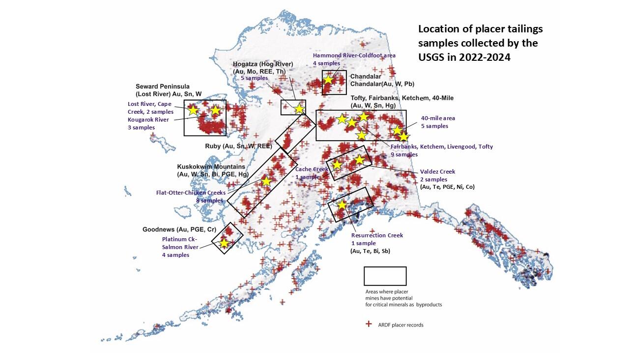
Alaska locations of USGS placer tailings sampling sites
Detailed Description
Map showing locations of placer mines in the Alaska Resource Data File (ARDF, red crosses), primary mineral districts that contain targeted critical minerals (black boxes) and locations that were sampled by the USGS in 2022 through 2024 (yellow stars).
Sources/Usage
Public Domain.
Graphic created by: Susan Karl, U.S. Geological Survey
Related

Critical Minerals in Alaska Placer Deposits and Southeast Alaska Mineral Systems
Critical minerals have been identified in most Alaskan placers, yet little is known about the concentration of these phases. Historic and active placer mines have typically produced gold and are widespread across Alaska. Activity in the placer districts has resulted in gravel piles and sluice tailings that are products of gold mining. Gold has been the traditional target of placer mining; however...
Related
Critical Minerals in Alaska Placer Deposits and Southeast Alaska Mineral Systems
Critical minerals have been identified in most Alaskan placers, yet little is known about the concentration of these phases. Historic and active placer mines have typically produced gold and are widespread across Alaska. Activity in the placer districts has resulted in gravel piles and sluice tailings that are products of gold mining. Gold has been the traditional target of placer mining; however...