
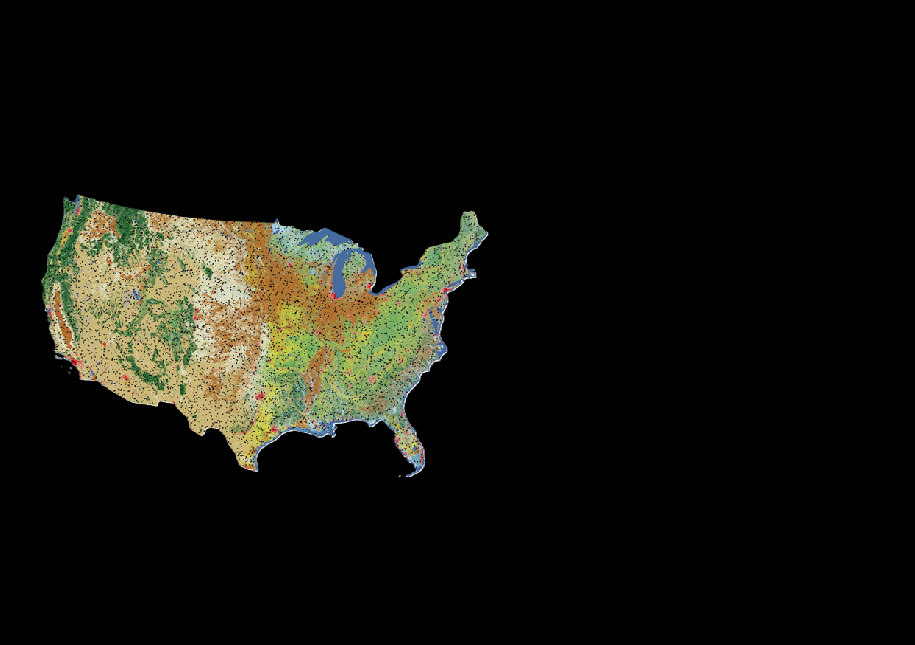
Annual NLCD reference plots on black background

Detailed Description
Black background with map showing the locations of the 8,360 plots included in the reference dataset that were used in the accuracy assessment of Annual National Land Cover Database (NLCD) CU (Conterminous United States) 1.0 (1985-2023). Each plot includes primary (most likely) and alternate (but could be) land cover labels for 1984 to 2023.
Sources/Usage
Public Domain.