
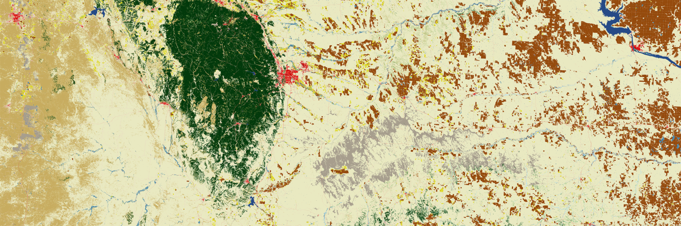
2025 Annual NLCD land cover image of western South Dakota
Detailed Description
This 2025 Annual National Land Cover Database (NLCD) land cover image shows a portion of western South Dakota. The Black Hills stand out in green, and the urban area of Rapid City in red at its eastern edge. The Badlands show up as gray hues, and vast range and grasslands fill the area leading over to the Missouri River.
Annual NLCD now contains 41 years of land cover and land change information for any area within the conterminous United States.
Sources/Usage
Public Domain.