
2025 Tracy Arm Landslide Before and After Satellite Imagery
Detailed Description
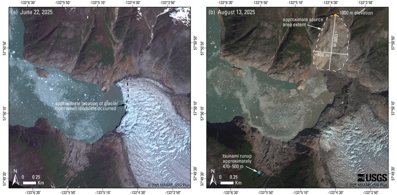
Comparison of (a) pre- and (b) post-event satellite images showing the source area of the August 10th landslide that impacted Tracy Arm. The dashed line in (a) shows the approximate location of the front of South Sawyer Glacier on August 7th, 2025 (mapped from imagery © 2025 Planet Labs PBC). Part (b) shows the approximate extent of the landslide source area, the area of the South Sawyer Glacier that was impacted by the landslide, and the approximate extent of tsunami runup on the opposite side of the fiord. Pre- and post-event images are from June 22, 2025 and August 13, 2025, respectively. Imagery © 2025 Maxar, USG Plus. Approximate headscarp and tsunami runup elevations were measured from a 5 m-resolution interferometric synthetic aperture radar (IFSAR) digital elevation model (DEM) collected in 2012.
Sources/Usage
Public Domain.
Related
2025 Tracy Arm Landslide-Generated Tsunami
Related