
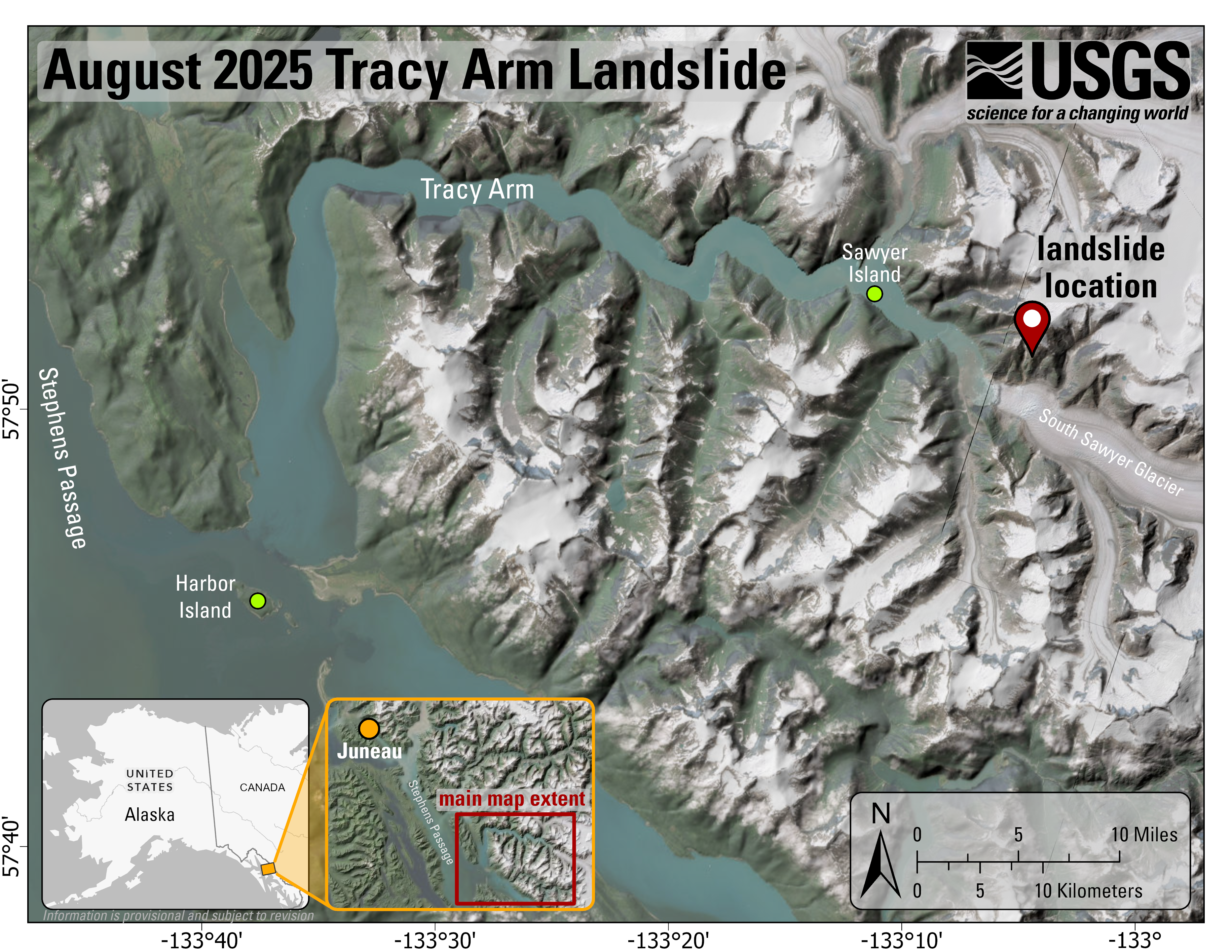
2025 Tracy Arm Landslide Overview Map

Detailed Description
Overview map and location of the Tracy Arm landslide-generated tsunami event. The imagery is not current, and the South Sawyer Glacier has retreated over a kilometer from what is depicted.
Sources/Usage
Public Domain.
Basemap: Earthstar Geographics, Airbus, USGS, NGA, NASA, CGIAR, NCEAS, NLS, OS, NMA, Geodatastyrelsen, GSA, GSI and the GIS User Community, Sources: Esri, TomTom, Garmin, FAO, NOAA, USGS, OpenStreetMap contributors, and the GIS User Community
Related
2025 Tracy Arm Landslide-Generated Tsunami
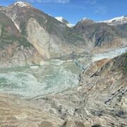
A landslide above the toe of the South Sawyer Glacier failed into the waters of Tracy Arm, south of Juneau, Alaska, producing a tsunami on Sunday, August 10th, 2025, at 05:26 AKDT / 13:26 UTC. No injuries or fatalities have been reported. This page may be updated as more information about the event is obtained. Steep, mountainous landslide areas are inherently unstable and will continue to change...
Related
2025 Tracy Arm Landslide-Generated Tsunami
A landslide above the toe of the South Sawyer Glacier failed into the waters of Tracy Arm, south of Juneau, Alaska, producing a tsunami on Sunday, August 10th, 2025, at 05:26 AKDT / 13:26 UTC. No injuries or fatalities have been reported. This page may be updated as more information about the event is obtained. Steep, mountainous landslide areas are inherently unstable and will continue to change...