
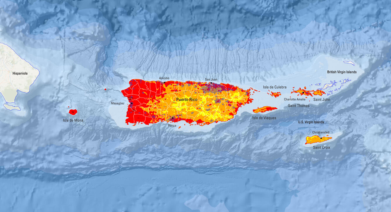
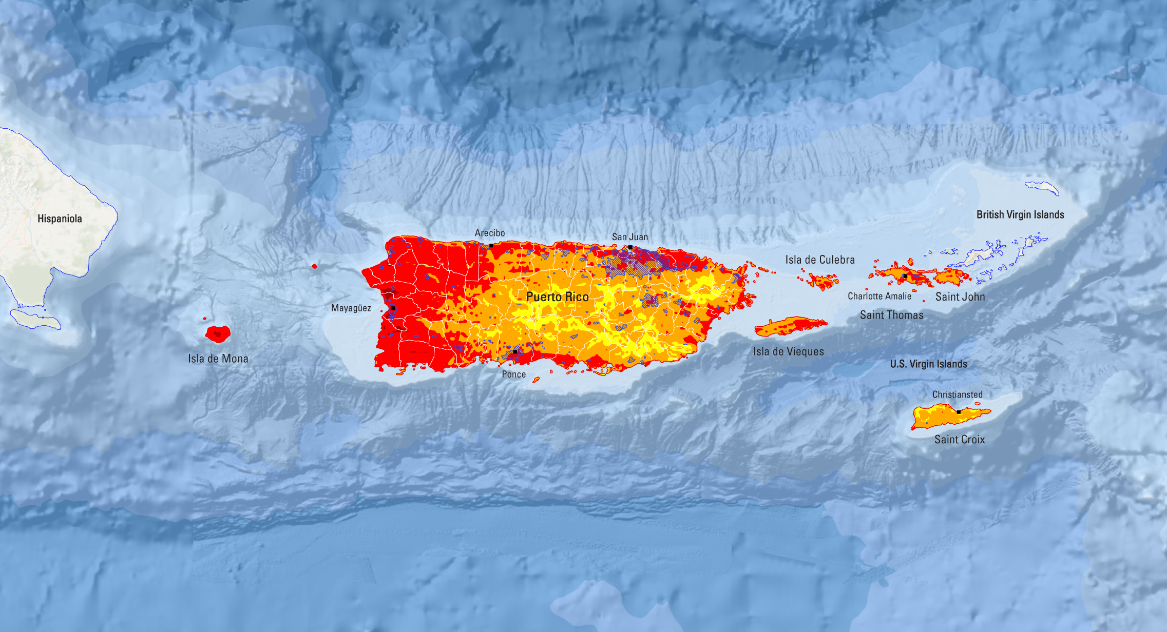
2025 USGS National Seismic Hazard Model for Puerto Rico and U.S. Virgin Islands Chance of Damaging Shaking Map
Detailed Description
This is the simplified version of the 2025 PRVI NSHM map of the chance of damaging shaking. 2025 USGS National Seismic Hazard Model for Puerto Rico and U.S. Virgin Islands Chance of Damaging Shaking Map; chance of slight-or-greater damaging earthquake shaking in 100 years (equivalent to Modified Mercalli Intensity VI). For the full figure, including the key, check the ScienceBase location (https://doi.org/10.5066/P14ATJLJ) or the media image (https://www.usgs.gov/media/images/2025-usgs-national-seismic-hazard-mod…).
Sources/Usage
Public Domain.
Suggested Citation:
Shumway, A.M., Milner, K.R., Altekruse, J.M., Herrick, J.A., Llenos, A.L., Michael, A.J., Haynie, K.L., Briggs, R.W., Jaiswal, K.S., and Powers, P.M., 2025, Datasets for the 2025 USGS National Seismic Hazard Model for Puerto Rico and the U.S. Virgin Islands: U.S. Geological Survey data release, https://doi.org/10.5066/P14ATJLJ.