
3D hydrogeologic framework model of the Rio Grande transboundary regio
Detailed Description
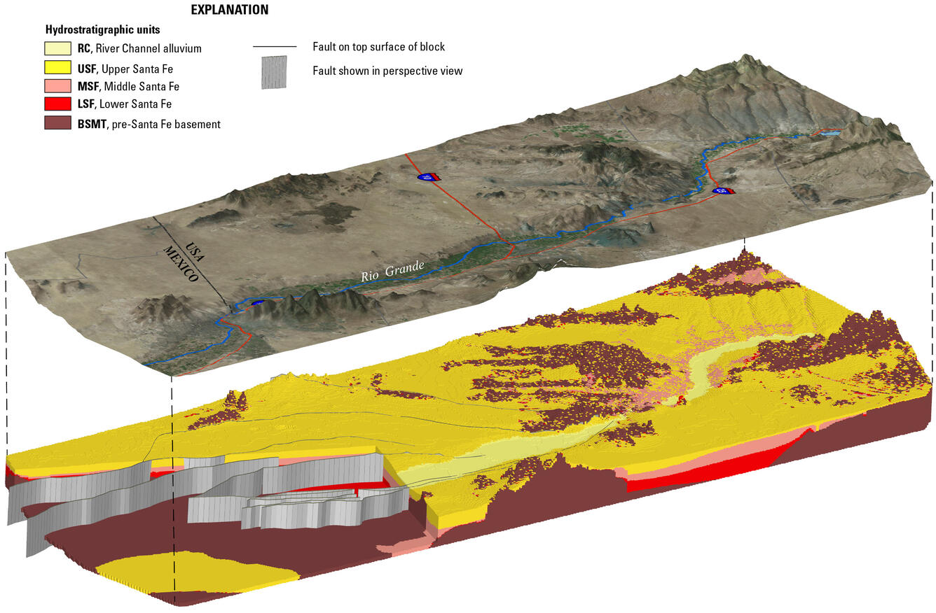
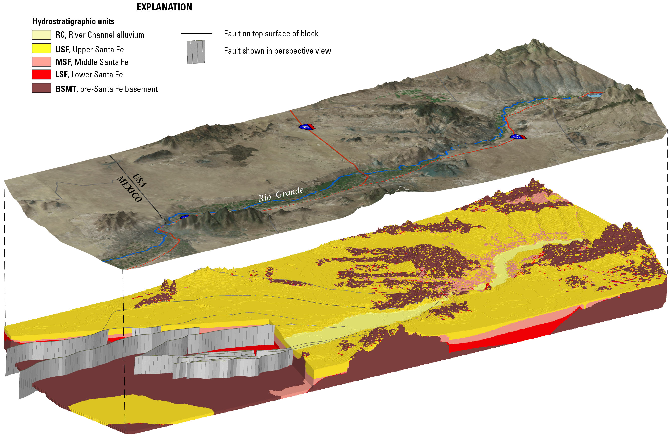
Perspective view, looking from above to the west, of the 3D hydrogeologic framework model of the Rio Grande transboundary region of New Mexico and Texas, USA, and northern Chihuahua, Mexico, including satellite imagery draped on a digital elevation model (upper image) and the three-dimensional hydrogeologic framework solid model (lower image), showing subsurface aquifer units and faults. Model published as U.S. Geological Survey Scientific Investigations Report 2017-5060.
Sources/Usage
Public Domain.
Three-dimensional hydrogeologic framework model of the Rio Grande transboundary region of New Mexico and Texas, USA, and northe
U.S. Geological Survey Scientific Investigations Report 2017-5060