
3D models derived from UAS-acquired data of the summit of the Kilauea Volcano during a period of the 2018 eruption
By Geosciences and Environmental Change Science Center
2018 (approx.)
Detailed Description
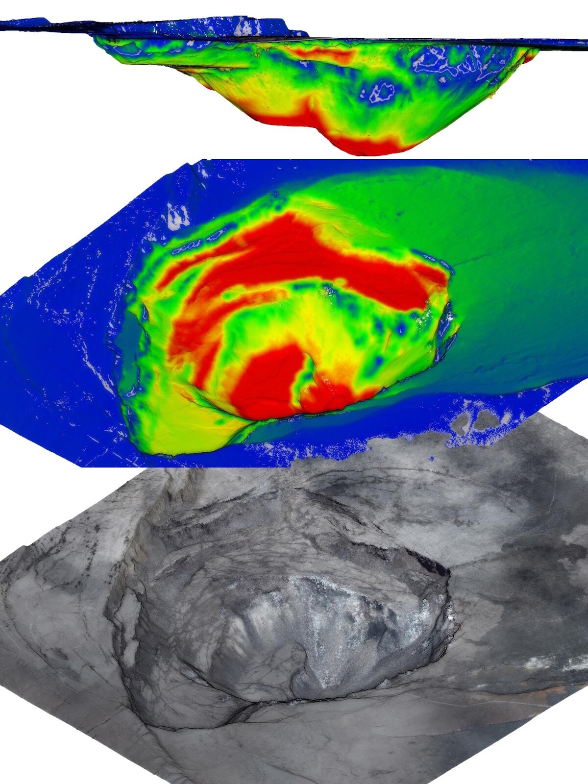
3D models derived from UAS-acquired data of the main caldera, the summit of the Kilauea Volcano, during a period of the 2018 eruption.
Side view (top) and top view (middle) of a 3D model that shows the depth of the crater on June 21st and highlights the drop in depth since June 13th (red indicates a drop of almost 100 meters).
3D textured surface model of the crater derived from imagery acquired from a UAS-mounted natural color sensor on June 21st (bottom).
Sources/Usage
Public Domain.